- Mawnan
-
Coordinates: 50°06′N 5°06′W / 50.1°N 5.1°W
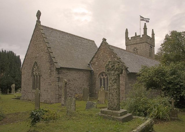
 Mawnan parish church
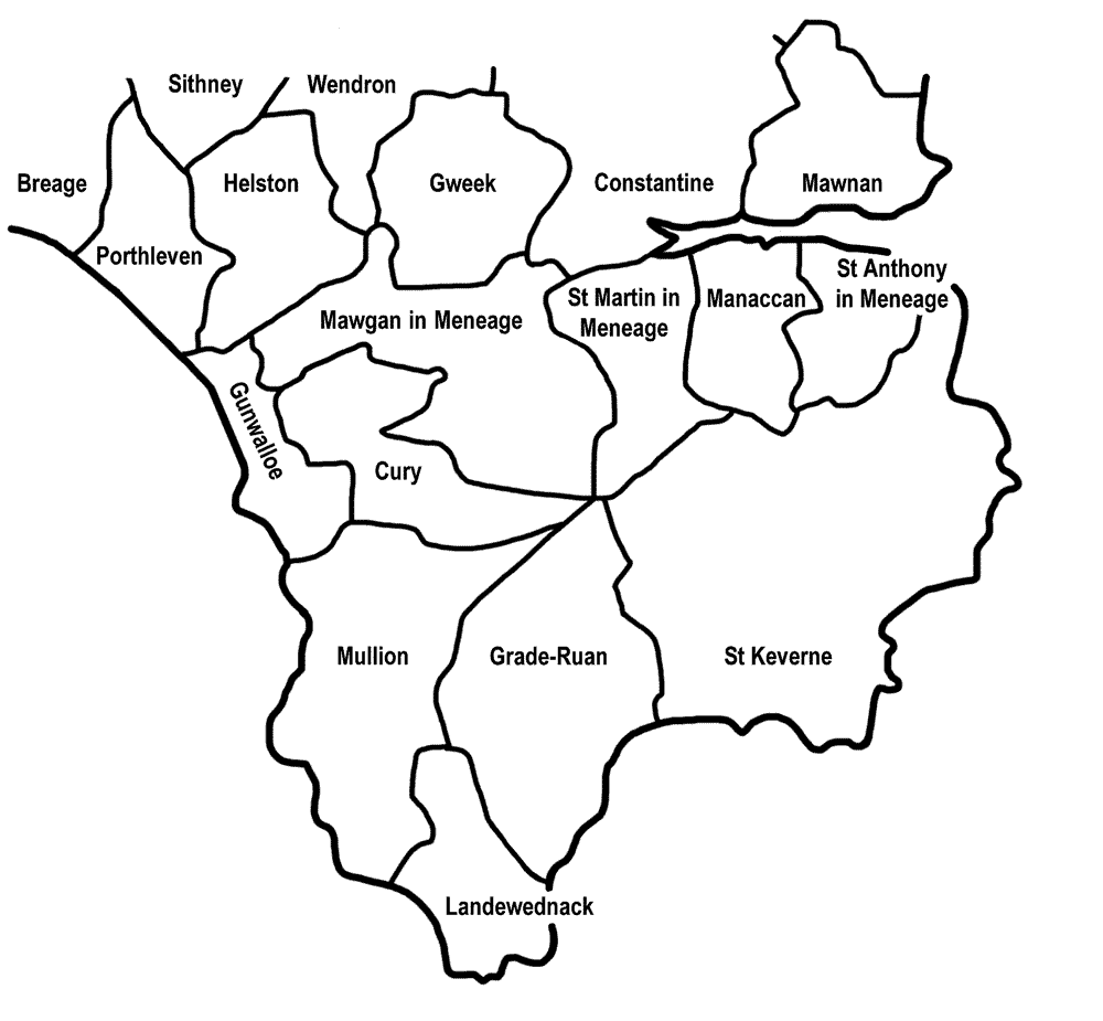
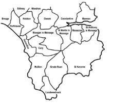 Mawnan (top right) in relation to surrounding parishes
Mawnan (Cornish: Sen Mownan) is a civil parish in south Cornwall, United Kingdom [1]. It is situated in the former administrative district of Kerrier and is bounded to the south by the Helford River, to the east by the sea, and to the west by Constantine parish. The population was 1,454 in the 2001 census[2].
The church town of the parish is Mawnan Church, also known simply as Mawnan, but the only large village in the parish is Mawnan Smith, situated approximately three miles south of Falmouth[3].
Contents
Geography
The parish is entirely rural and, as well as Mawnan Smith, it includes the hamlets of Carlinack, Bareppa, Penwarne, Helford Passage, Maenporth and Durgan. The parish also contains several Victorian gardens, now open to the public: Glendurgan, Trebah, Carwinion[4] and Penjerrick.
The coastline and cliffs south-east of the church town from Toll Point to Rosemullion Head forms the Rosemullion SSSI (Site of Special Scientific Interest), noted for its geological and biological interest. Marine species found here include Mytilus mussels, various seaweeds and sea sponges, such as Botryllus schlosseri.[5]
Etymology
It is suggested that Mawnan takes its name from a sixth century Saint Maunanus, who was probably a Breton monk who landed here about AD 520.[6]
Churches
There are two Anglican churches: the 13th Century Church of St Mawnan and St Stephen in Mawnan Church[6] and the 19th century Church of St Michael in Mawnan Smith village.
John Rogers was rector here in 1807.[7]
The land for St Michael's Church was given by the Rogers family of Carwinion and the building was completed in 1874.
The village of Mawnan Smith also has a Methodist chapel. There is a Catholic church dedicated to St Edward the Confessor in Old Church Road, which was completed in 1965.
References
- ^ Mawnan History Group (2002). The Book of Mawnan: celebrating a South Cornwall parish. Tiverton, Devon: Halsgrove. ISBN 1-84114-148-8.
- ^ GENUKI website; Mawnan; retrieved April 2010
- ^ Ordnance Survey: Landranger map sheet 204 Truro & Falmouth ISBN 9780319231494
- ^ Carwinion
- ^ "Rosemullion". Natural England. 1990. http://www.sssi.naturalengland.org.uk/citation/citation_photo/1005833.pdf. Retrieved 12 November 2011.
- ^ a b Church of England website: Notes on St Mawnan Church
- ^ Marchant, E. C. (1897). "Rogers, John (1778–1856), divine, by E. C. Marchant". Dictionary of National Biography Vol. IL. Smith, Elder & Co.. http://www.oxforddnb.com/templates/olddnb.jsp?articleid=23988. Retrieved 2007-12-13.
External links
Geography of Cornwall Cornwall Portal Unitary authorities Major settlements Bodmin • Bude • Callington • Camborne • Camelford • Falmouth • Fowey • Hayle • Helston • Launceston • Liskeard • Looe • Lostwithiel • Marazion • Newlyn • Newquay • Padstow • Par • Penryn • Penzance • Porthleven • Redruth • Saltash • St Austell • St Blazey • St Columb Major • St Ives • St Just-in-Penwith • St Mawes • Stratton • Torpoint • Truro • Wadebridge
See also: Civil parishes in CornwallRivers Topics History • Status debate • Flag • Culture • Places • People • The Duchy • Diocese • Politics • Hundreds/shires • Places of interest • full list...Civil parishes of Camborne and Redruth constituency 
Cornwall Portal Categories:- Civil parishes in Cornwall
- Sites of Special Scientific Interest in Cornwall
Wikimedia Foundation. 2010.