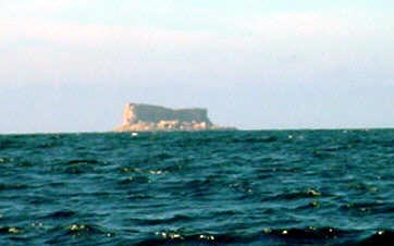
- Filfla
Infobox Settlement
name =Filfla
official_name =
other_name =
native_name =
nickname =
settlement_type =Uninhabited Island
total_type =
motto =
imagesize =
image_caption = Filfla in the horizon.
flag_size =
image_
seal_size =
image_shield =
shield_size =
image_blank_emblem =
blank_emblem_type =
blank_emblem_size =
mapsize =
map_caption =
mapsize1 =
map_caption1 =
image_dot_
dot_mapsize =
dot_map_caption =
dot_x = |dot_y =
pushpin_
pushpin_label_position = none
pushpin_map_caption =Location within Malta
pushpin_mapsize =
subdivision_type = Country
subdivision_name = flag|Malta
subdivision_type1 =
subdivision_name1 =
subdivision_type2 =
subdivision_name2 =
seat_type =
seat =
parts_type =
parts_style =
parts =
p1 =
p2 =
government_footnotes =
government_type =
leader_title =
leader_name =
leader_title1 =
leader_name1 =
established_title =
established_date =
area_magnitude =
unit_pref =
area_footnotes =
area_total_km2 =0.06
area_land_km2 =
area_water_km2 =
area_total_sq_mi =
area_land_sq_mi =
area_water_sq_mi =
area_water_percent =
elevation_footnotes =
elevation_m =
elevation_ft =
elevation_max_m =
elevation_max_ft =
elevation_min_m =
elevation_min_ft =
population_as_of =
population_footnotes =
population_note =
population_total =
population_density_km2 =
population_density_sq_mi =
population_blank1_title =
population_blank1 =
timezone =
utc_offset =
timezone_DST =
utc_offset_DST =
coor_type =
latd=35 |latm=47 |lats=15 |latNS=N
longd=14 |longm=24 |longs=37 |longEW=E
postal_code_type =
postal_code =
area_code =
website =
blank_name =
blank_info =
blank1_name =
blank1_info =
blank2_name =
blank2_info =
blank3_name =
blank3_info =
blank4_name =
blank4_info =
blank5_name =
blank5_info =
blank6_name =
blank6_info =
footnotes = Filfla is a small, barren, uninhabitedislet convert|5|km|mi south ofMalta , and is the most southerly point of the Maltese Archipelago. It belongs to the town ofŻurrieq [http://www.zurrieq.gov.mt/pages/tour.htm] .The name is believed to come from "filfel", the Arabic for a peppercorn.
It has an area of just convert|6|ha|acre|lk=on and is a crumbling flat-topped
limestone plateau surrounded by 60 metre high cliffs. The only known permanent structure on it was achapel built inside a cave in 1343, which was destroyed by anearthquake in 1856 that also sank part of the island. Until 1971 theRoyal Navy andRoyal Air Force used the island for target practice. It became a bird reserve in 1980. The "Filfla Natural Reserve Act", enacted in 1988, provided for further restrictions on access and use, including a prohibition on fishing within anautical mile (1.9 km) around due to the possibility of unexplodedordnance . Three species of sea birds breed on the islet: theEuropean Storm Petrel (c.5,000 pairs),Cory's Shearwater (c.200 pairs) andYellow-legged Gull (c.130pairs). A type ofwall lizard ("Podarcis filfolensis" ssp. "filfolensis") and door snail ("Lampedusa imitatrix gattoi") are endemic to Filfla. A large wild leek, growing up to 2 m high, also occurs.There is a small rocky islet next to Filfla, called Filfoletta.Access to Filfla is only possible for educational or scientific purposes and visitors must get prior permission from the Ministry responsible for the environment.
On the Maltese coast opposite Filfla are the archeological sites of
Hagar Qim andMnajdra , theHamrija Tower (one of 13watchtowers thatMartin de Redin built around the coast of Malta), and a memorial toWalter Norris Congreve , one of Malta's British governors-general.In popular culture
It is referred to in lyrics and cover art as the location of a fictitious radio station in the
Joe Demicoli album, "Radju Filfla".ee also
*
Endemic Maltese wildlife
Wikimedia Foundation. 2010.

