- Alfred and Plantagenet, Ontario
Infobox Settlement
official_name = Township of Alfred and Plantagenet
nickname =
motto =
image_
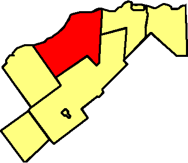
map_caption =Map of Prescott and Russell with Alfred and Plantagenet highlighted
subdivision_type = Country
subdivision_type1 = Provinces
subdivision_type2 = Census division
subdivision_name =Canada
subdivision_name1 =Ontario
subdivision_name2 = Prescott and Russell County
established_title = Founded
established_date =January 1 ,1997
established_title2 = Incorporation
established_date2 =January 1 ,1997
government_type =
leader_title =Mayor
leader_name =Jean-Yves Lalonde
area_magnitude =
area_total_sq_mi =
area_total_km2 =
area_land_sq_mi =
area_land_km2 = 391.68
area_water_sq_mi
area_water_km2 =
area_urban_sq_mi =
area_urban_km2 =
area_metro_km2 =
area_metro_sq_mi =
population_as_of=2006
population_footnotes = [cite web
url = http://www12.statcan.ca/english/census06/data/profiles/community/Details/Page.cfm?Lang=E&Geo1=CSD&Code1=3502023&Geo2=PR&Code2=35&Data=Count&SearchText=alfred%20and%20plantagenet&SearchType=Begins&SearchPR=35&B1=All&Custom=
title= 2006 Canadian Census]
population_total = 8624
population_urban =
population_metro =
population_density_sq_mi = 8.5
population_density_km2 = 22.1
timezone = EST
utc_offset = -5
timezone_DST = EDT
utc_offset_DST = -4
latd = | latm = | lats = | latNS = N
longd = | longm = | longs = | longEW = W
elevation_footnotes=cite web
url =Gnis3|
title=
accessdate= ]
elevation_ft =
elevation_m =
website = http://www.alfred-plantagenet.com/en/
footnotes =Alfred and Plantagenet (2006 population 8,654) is a township in eastern
Ontario ,Canada , in the United Counties of Prescott and Russell at the confluence of theOttawa River and theSouth Nation River .Communities
The township comprises the communities of Alfred, Alfred Station, Blue Corners, Centrefield, Coin Gratton, Curran, Glenburn, Jessups Falls, Lefaivre, Pendleton, Plantagenet, Plantagenet Station, Rockdale, Senecal, The Rollway, Treadwell, Wendover and Westminster.
Geographic Location (8-way)
Centre = Alfred and Plantagenet
North = "Ottawa River " / Plaisance, Papineauville, Montebello, Notre-Dame-de-Bonsecours,Fassett, Quebec
Northeast = "Ottawa River " /Grenville-sur-la-Rouge, Quebec
East = Champlain
Southeast =
South = The Nation
Southwest =
West = Clarence-Rockland
Northwest = "Ottawa River " /Lochaber, Quebec
References
Wikimedia Foundation. 2010.