- Gurabo, Puerto Rico
Infobox Settlement
settlement_type =
subdivision_type = Country
subdivision_name =United States
subdivision_type1 = Territory
subdivision_name1 =Puerto Rico
subdivision_type2 =
subdivision_name2 =
timezone=AST
utc_offset=-4
timezone_DST=
utc_offset_DST=
unit_pref=Imperial
map_caption =Location of Gurabo, Puerto Rico within Puerto Rico.
latNS=N
longEW=W| official_name = Gurabo, Puerto Rico | nickname = El Pueblo de las Escaleras", "Puerta del Turismo del Sureste | image_
| population_blank1 = Gurabeños|population_blank1_title=Gentilic| | population_blank1 = Gurabeños|population_blank1_title=Gentilic|
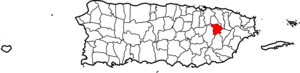
| map_caption = Location within the island ofPuerto Rico
established_date = 1815
leader_title|established_title=Founded| =Mayor | leader_title=Mayor
leader_name = Víctor Manuel Ortiz Díaz| political party = Partido Nuevo Progresista
leader_party = PNP
leader_title1=Senatorial dist.
leader_name1= 7 - Humacao
leader_title2=Representative dist.
leader_name2 = 31,32| area_magnitude = ?| area_total_km2 = 73.24
area_land_km2 = 72.11| area_water_km2 = 1.13| population_as_of = 2000 | population_note =
population_total = 36743|population_footnotes= | population_density_km2 = 509.6 | timezone = AST | utc_offset = -4 | timezone_DST = | utc_offset_DST = -4| latitude = ?
longitude = ? | website = http://www.gurabopr.com | footnotes = Anthem – "En un valle rodeado por montañas nace un" |Gurabo (goo-RAH-bo) is a municipality ("
municipio ") in easternPuerto Rico located in the central eastern region, north of San Lorenzo; south of Trujillo Alto; east of Caguas; and west of Carolina and Juncos. Gurabo is spread over 9 wards and Gurabo Pueblo (The downtown area and the administrative center of the city).History
Gurabo's history dates as far back as the 1600s, when Gurabo was actually part of Caguas. Then, the area was known as "Turabo". By 1700, transportation, medical and economic trouble were crippling the population of the "Turabo" area; traveling to Caguas' center for business and medical help was not easy and took hours. This led to many of "Turabo"s citizens to seek for the area to gain autonomy.
It would be long, however, before Gurabo was separated from Caguas. The separation movement was brought forward by an 1812 meeting of all 168 family leaders in Gurabo, who decided to have
Luis del Carmen Echevarría lead them in their quest for autonomic independence, based on the large number of residents in "Turabo".In 1815, Gurabo became a municipality. In 1822, the first
Catholic church in town was erected. In 1903, theFirst Baptist Church opened its doors in Gurabo town.Gurabo is also known as "La Ciudad de las Escaleras", or "city of the stairs", for which Gurabo is known today for. Located in the town center, the stairs are about twenty two floors high, and they are painted in bright colors. They cross an important business area of Gurabo. Gurabo's mayor is Victor M. Ortiz Diaz.
Flag
With eleven stripes, six green and five yellow, alternated, the yellow with the superior (top) edge indented forming a stairway.
Coat of Arms
In a green field resides a widened gold patriarcal cross. Below the bottom arm are two shields in silver. The one on the left has a fleur de lis and the one on the right three lilies with stems in a natural way. Three towers in gold crown the shield.
Demographics
Barrios (Districts/Wards) [http://welcome.topuertorico.org/maps/gurabo.pdf]
*Celada
*Gurabo Pueblo
*Hato Nuevo
*Jaguar
*Jaguas
*Mamey
*Masas
*Navarro
*Quebrada Infierno
*RincónGeo/Topography
*Loiza River
Anthem
By Miguel Monserrate
En un valle rodeado por montañas nace un
pueblo de entre el barro.
Con valor fue creado por hombre de fe
y constancia para honrar
y alabar al Creador.En Gurabo un pueblo con mucho orgullo
de costumbres de cultura y devoción
donde el tiempo se detiene ante el arrullo
de su gente de su historia y tradición.Gurabo es mi pueblo, es mi hogar,
es mi vida, es mi orgullo, es mi cantar,
es mi música, es mi sueño, es mi luchar...
mi instrumento de alegría y mi soñar.Gurabo es mi pueblo, es mi hogar,
escalera al paraíso terrenal
de las voces de su gente surge el himno
que se cantará por toda la eternidad.Economic
Agriculture
*Dairy Farms
Business
Industrial
Manufacturing (metal, paper, plastics, chemistries, phamaceuticals, textiles, electrical and electronic equipment, and electrical machinery)
Tourism
Landmarks and places of interest
*Centro de Exposición
*Cofresí Park
*Del Turabo University Museum
*Hacienda Mirador
*Loíza LagoonFestivals and events
*San José Patron Festivities - March
*Mapeyé Festival - OctoberEducation
*
Turabo University at Gurabo ports
Gurabo has a baseball academy named [Puerto Rico Baseball Academy and High School (PRBAHS)] [http://en.wikipedia.org/wiki/Puerto_Rico_Baseball_Academy_and_High_School] .
Notable "Gurabeños"
*
Rakim & Ken-Y , José Nieves (Rakim) and Kenny Vázquez (Ken-Y), reggaetón artistsReferences
* [http://factfinder.census.gov/servlet/GCTTable?_bm=y&-geo_id=05000US72063&-_box_head_nbr=GCT-PH1&-ds_name=DEC_2000_SF1_U&-redoLog=false&-format=CO-2&-mt_name=DEC_2000_SF1_U_GCTPH1_CO2 Gurabo and its barrios, United States Census Bureau]
External links
More information can be found at the Municipal Government website: http://www.gurabopr.com
* [http://www.puertohost.com/maps/gurabo-map.php Map of Gurabo Puerto Rico]
Wikimedia Foundation. 2010.