- Halfweg
Dutch town locator maps
mun_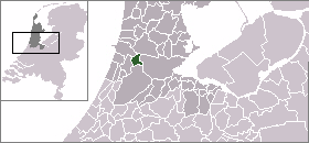
town_
caption = The village (dark red) and the statistical district (light green) of Halfweg in the municipality of Haarlemmerliede en Spaarnwoude.Halfweg (coord|52|23|N|4|45|E|type:city(2330)) is a town in the Dutch province of
North Holland . It is a part of the municipality ofHaarlemmerliede en Spaarnwoude , and lies about 8 km east ofHaarlem . Its name, which translates as "halfway," comes from its location approximately halfway between Haarlem and Amsterdam.The statistical area "Halfweg", which also can include the surrounding countryside, has a population of around 2330.Statistics Netherlands (CBS), [http://statline.cbs.nl/ "Statline: Kerncijfers wijken en buurten 2003-2005"] . As of
January 1 ,2005 .]History
In 1632, the
Haarlemmertrekvaart , acanal from Amsterdam to Haarlem, opened for passenger traffic bytrekschuit (towed barges). At the halfway point the passengers needed to disembark and change boats.A
towpath was laid along the canal, and this route has become theHaarlemmerweg (A200). From 1904 to 1957, Halfweg was a stop on the Amsterdam-Haarlem-Zandvoort electric tram line.A sugar factory was built in the 19th century and closed in the 1990s, although the building still dominates the city skyline.
Until 1876, Halfweg was right on the southern shores of the IJ Bay. With the construction of the
North Sea Canal , a channel was dug through the IJ and lined with dikes, after which the remaining portions of the IJ Bay were reclaimed and turned intopolder s. As a result, the village ofRuigoord , formerly an island of the same name, borders Halfweg, as does the town ofZwanenburg .References

Wikimedia Foundation. 2010.