Kerkbuurt — may refer to a number of Dutch villages:* Kerkbuurt (Harenkarspel) in North Holland * Kerkbuurt (Marken) in North Holland, on Marken * Kerkbuurt (Andijk) in North Holland, near Andijk * Kerkbuurt (South Holland), near Schiedam … Wikipedia
Harenkarspel — Héraldique … Wikipédia en Français
Harenkarspel — Gemeinde Harenkarspel Flagge Wappen Provinz Nordholland Bü … Deutsch Wikipedia
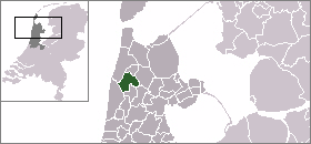
Harenkarspel — Infobox Settlement official name = Harenkarspel mapsize = 280px flag size = 150x75px image shield = Harenkarspel wapen.png shield size = 150x75px subdivision type = Country subdivision name = Netherlands subdivision type1 = Province subdivision… … Wikipedia
Sint Maarten (Hollande-Septentrionale) — 52°46′18″N 4°44′51″E / 52.77167, 4.7475 … Wikipédia en Français
Warmenhuizen — 52°43′21″N 4°44′23″E / 52.7225, 4.73972 … Wikipédia en Français
Dirkshorn — 52° 45′ 00″ N 4° 47′ 00″ E / 52.75, 4.78333 … Wikipédia en Français
Eenigenburg — 52°44′33″N 4°43′32″E / 52.7425, 4.72556 … Wikipédia en Français
Groenveld — 52° 46′ 00″ N 4° 47′ 00″ E / 52.7667, 4.78333 … Wikipédia en Français
Kalverdijk — 52° 44′ 00″ N 4° 46′ 00″ E / 52.7333, 4.76667 … Wikipédia en Français