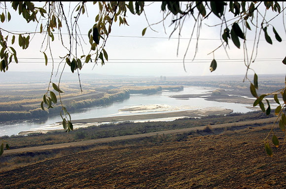
- Kızıl River
Infobox_River_TR
river_name = Kızılırmak

caption = Kızılırmak,İskilip - Taybi Ovasi
origin = Eastern Anatolia Region, Turkey
mouth = Black Sea
basin_countries =Turkey
length = 1,350 km
elevation = 2,000 m
mouth_elevation = 0
discharge = N/A
watershed = N/AThe Kızılırmak ( _tr. "Kızılırmak", "Red River"; _gr. Ἅλυς, "Halys River") is the longest
river inTurkey . It is a source ofhydroelectric power and it is not used for navigation.Geography
The Kızılırmak flows for a total of about 1,150 kilometers, rising in the eastern
Anatolia n highlands around coord|39.8|N|38.3|E, flowing first to the west and south-west until coord|38.7|N|34.8|E|, then forming a wide arch, the Halys bend, flowing first to the west, then to the north-west, passing to the north-east ofLake Tuz , then to the north and northeast where it is joined by its major tributary, theDelice River (also known by its Greek name Cappadox) at coord|40.47|N|34.14|E|, and after zig-zagging to the north-west to the confluence with theDevrez River at coord|41.10|N|34.42|E|, and back to the north-east finally empties into theBlack Sea at coord|41.72|N|35.95|E|.History
The
Hittites called it the Marassantiya River. It formed the boundary of the landHatti , the core land of the Hittite Empire. In theClassical Antiquity it was the boundary betweenAsia Minor and the rest ofAsia . As the site of theBattle of the Eclipse on May 28,585 BC , [Historically, from classical historians until recently, known as the Battle of Halys; since renamed by some as "Battle of the Eclipse", as the "very first" pre-modern battle which can be dated "with certainty" due to the eclipse which brought about its sudden end and the peace negotiations which followed.] it was the border betweenLydia and Media untilCroesus of Lydia crossed it to attackCyrus the Great in547 BC . He was defeated and Persia expanded to theAegean Sea .External links
* [http://www.livius.org/ha-hd/halys/halys.html Livius.org: Halys] - Photos
Notes
Wikimedia Foundation. 2010.
