- Connecticut Route 83
-
Route 83


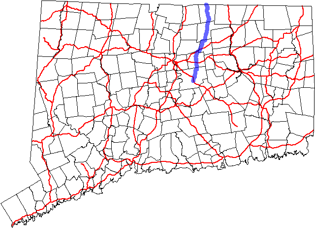
Route information Length: 35.65 mi (57.37 km)
Connecticut: 27.56 mi[1]
Massachusetts: 8.09 mi[2]Existed: 1932 – present Major junctions South end: New London Turnpike (near  Route 2) in Glastonbury
 I-384 in Manchester
 I-84 in Vernon
North end: 
 I-91 / US 5 in Springfield, MA
Highway system Routes in Connecticut
Special Service Roads • State Roads←  Route 82
I-84 →←  Route 81
MA I-84 →
Route 83 is a north–south state highway in the Greater Hartford and Greater Springfield areas of the U.S. states of Connecticut and Massachusetts. It serves as the main north–south artery for the towns of Manchester, Vernon, and Ellington and continues through East Longmeadow center into downtown Springfield. The route in Massachusetts is town-maintained, except for the ramps connecting to US 5 parallel to I-91.Contents
Route description


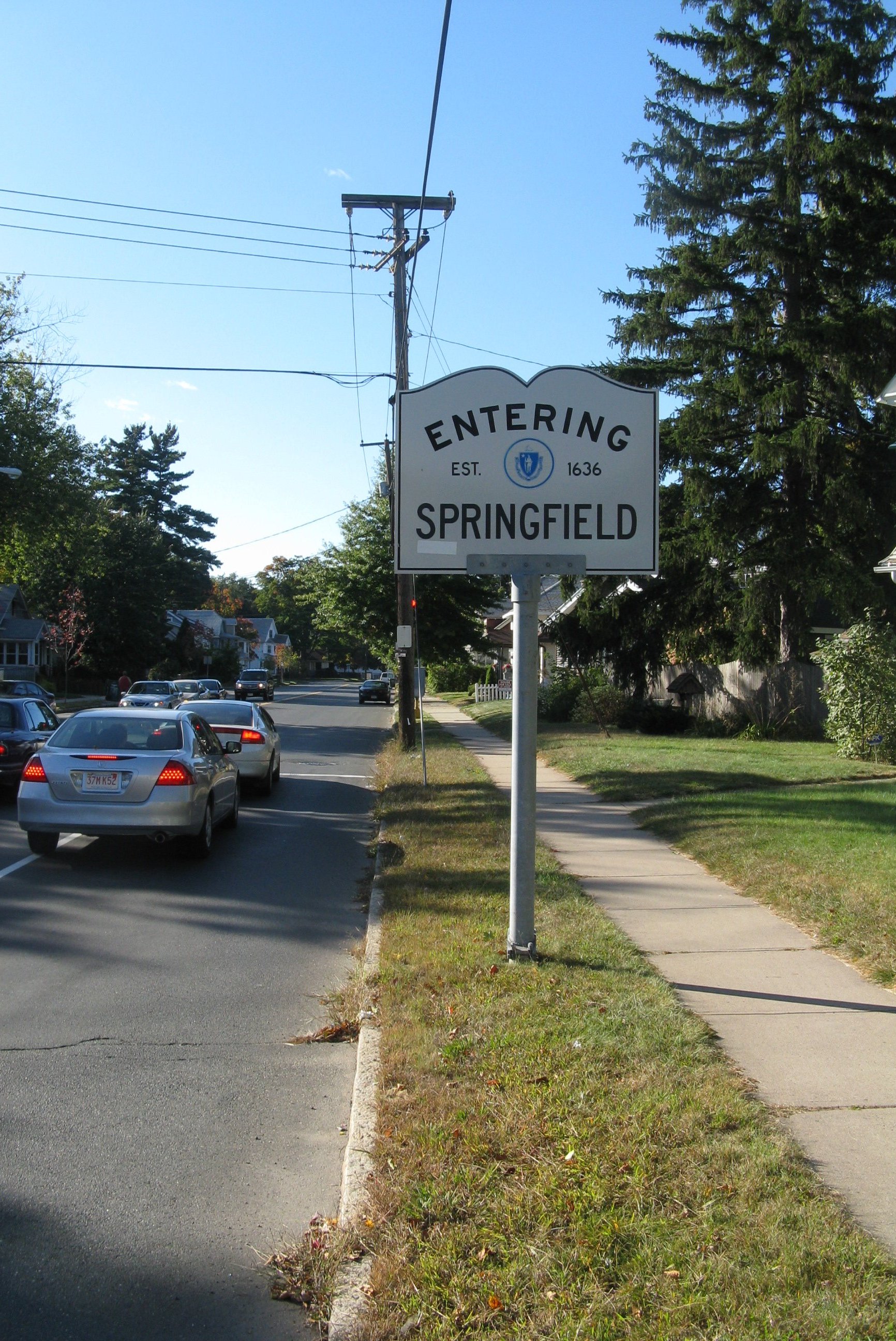
Northbound
entering Springfield, MassachusettsRoute 83 begins at the southern end of New London Turnpike in Glastonbury near its junction with Route 2. From Glastonbury, it then heads to Manchester, serving as the main thoroughfare of that city and intersecting I-384. Within the town center of Manchester, a 0.77-mile (1.24 km) segment is town maintained (between Hartford Road and Center St). It then continues north, overlapping Route 30 for 1.50 miles (2.41 km) in Manchester and Vernon, intersecting I-84 twice. It then continues north in Vernon, overlapping Route 74 for 0.81 miles (1.30 km), before continuing north through Ellington and Somers. In Somers, Route 83 briefly overlaps Route 190 before continuing into East Longmeadow, Massachusetts.[1] In East Longmeadow, it proceeds north as Somers Road until a complex seven-way intersection (the East Longmeadow Rotary) that involves Route 186 and Route 220 among other roads. Beyond the Rotary, Route 83 continues northwest through East Longmeadow along North Main Street. After enterin the city of Springfield, Route 83 shifts onto Belmont Avenue until it reaches a six-way intersection (known as "the X") where the route shifts again to Sumner Avenue. Route 83 follows Sumner Avenue to its end then turns south on Longhill Street, which provides access to the ramps leading to I-91 and US 5.
History
In the 1920s, the segment from Glastonbury to Manchester was called State Highway 164, while the segment from Manchester to Somers was called State Highway 108. The current Route 83 was established from these two state highways in the 1932 renumbering. At about the same time, Massachusetts extended the route through East Longmeadow and Springfield as a town-maintained road. In Connecticut, the only significant changes since then are have been the straightening of a few curves.[3] In Massachusetts, the construction of I-91 and relocation of US 5 led to the realignment of the northern end of Route 83 to its modern route along the I-91 ramps.
Junction list
Town Road names Major junctions Milepost Glastonbury
(4.99 miles)[1]Manchester Road New London Turnpike (Begin Route) 0.00 Route 20.09-0.22  Route 94
2.77 Manchester
(5.79 miles)South Main Street, Main Street, North Main Street, Oakland Street, Tolland Turnppike I-3846.48-6.69 
 US 6 / US 44
7.53  I-84 / Route 30 (Begin Multiplex with Route 30)
10.14 Vernon
(4.72 miles)Hartford Turnpike, Talcotville Road, Windsor Avenue, West Street Route 30 (End Multiplex)11.64 I-84 (Access from I-84 only; to access I-84 from Route 83 follow Route 30)11.79-11.90  Route 74 (Begin Multiplex)
14.58 Route 74 (End Multiplex)15.39 Ellington
(5.89 miles)West Road, Somers Road  Route 286
17.62-17.63  Route 140
18.36-18.40 Somers
(6.17 miles)South Road, Springfield Road  Route 190 (Begin Multiplex)
23.80 Route 190 (End Multiplex)23.82 E. Longmeadow, MA
(5.38 miles)Somers Road, North Main Street  Route 186
 Route 220
31.06 Springfield, MA
(2.71 miles)White Street, Belmont Avenue, Sumner Avenue, Longhill Street, I-91 ramps I-91 / US 535.65 References
- ^ a b c Connecticut State Highway Log
- ^ Executive Office of Transportation, Office of Transportation Planning - 2007 Road Inventory
- ^ Connecticut Routes, Route 83
Categories:- State highways in Connecticut
- Transportation in Hartford County, Connecticut
- Transportation in Tolland County, Connecticut
- Numbered routes in Massachusetts


Wikimedia Foundation. 2010.