- Partizánske
Geobox|Settlement
name = Partizánske
category = Town
etymology =
official_name =
motto =
nickname =
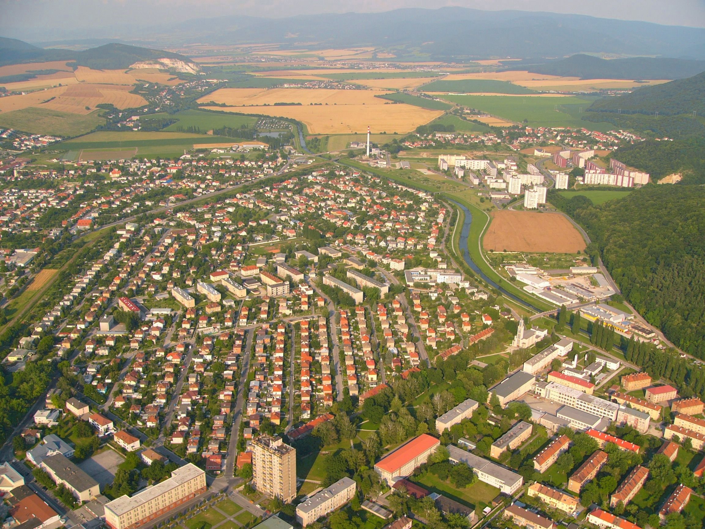
image_caption = Aerial view of the old part of Partizánske
symbol = Partizanske CoA SK.gif
symbol_type =
country = Slovakia
country_
state =
region = Trenčín
district = Partizánske
municipality =
parent = Horná Nitra
parent_type = Tourism region
river = Nitra
location =
elevation = 195
prominence =
lat_d =48 | lat_m =37 | lat_s =33 | lat_NS =N
long_d =18 | long_m =22 | long_s =22 | long_EW =E
highest =
highest_location = | highest_region = | highest_state =
highest_elevation =
highest_lat_d = | highest_lat_m = | highest_lat_s = | highest_lat_NS =
highest_long_d = | highest_long_m = | highest_long_s = | highest_long_EW =
lowest =
lowest_location = | lowest_region = | lowest_state =
lowest_elevation =
lowest_lat_d = | lowest_lat_m = | lowest_lat_s = | lowest_lat_NS =
lowest_long_d = | lowest_long_m = | lowest_long_s = | lowest_long_EW =
length = | length_orientation =
width = | width_orientation =
area = 22.375
area_land =
area_water =
area_urban =
area_metro =
population =24340 | population_date = 2006-12-31
population_urban =
population_metro =
population_density = auto
population_density_urban =
population_density_metro =
established =
established_type =
date =
government =
government_location = | government_region = | government_state =
government_elevation =
government_lat_d = | government_lat_m = | government_lat_s = | government_lat_NS =
government_long_d = | government_long_m = | government_long_s = | government_long_EW =
mayor = Ján Podmanický
leader =
timezone =
map_caption = Location in Slovakia
map_background = Slovakia - background map.png
map1 = Trenčín Region - outline map.svg
map1_caption = Location in the Trenčín Region
map1_background = Trenčín Region - background map.png
commons = Partizánske
statistics = [http://www.statistics.sk/mosmis/eng/prvav2.jsp?txtUroven420305&lstObec505315&Okruhzaklad MOŠ/MIS]
website = http://www.partizanske.sk
footnotes =Partizánske (Audio|Sk-Partizanske.ogg|pronunciation; meaning approximately "
partisan town" earlier:Šimonovany is a town inTrenčín Region ,Slovakia .Geography
It is located in the northern part of the
Danubian Hills around 55 km fromNitra , on theNitra River , near theTribeč mountains.History
Partizánske is a relatively young town. Its history starts in 1938–1939, when the
Bata Shoes company built a shoe factory in the cadastral area of Šimonovany municipality. The newly created settlement for workers carried the name of Baťovany and was part of Šimonovany. With the growth of the factory, so grew the settlement. The whole municipality was renamed to Baťovany in 1948 and given town status. As a sign of recognition of local inhabitants fighting in theSlovak National Uprising , the town was renamed Partizánske on9 February 1949 . [http://www.partizanske.sk/main.php?id_menu=1629&firmy_slovenska_] The factory was renamed by communists to "Závody 29. augusta" (29 August works) and it produced 30 million pairs of shoes and employed around 10,000 people. [cite news|url=http://www.slovakspectator.sk/clanok.asp?cl=28590 |title=Shoemaking: A troubled business|work=
The Slovak Spectator |date=2007-08-06|author=Michaela Stanková|accessdate=2008-02-23] However, after a failed privatisation in the 1990s, only fraction is left now.Demographics
According to the 2001
census , the town had 24,907 inhabitants. 97.71% of inhabitants wereSlovaks , 0.69% Czechs and 0.35% Roma.cite web | title = Municipal Statistics | publisher = Statistical Office of the Slovak republic | url = http://www.statistics.sk/mosmis/eng/run.html | accessdate = 2007-12-13] The religious makeup was 73.88%Roman Catholics , 18.07% people with no religious affiliation, and 2.95%Lutherans .References
External links
[http://www.partizanske.sk/ Website of town Partizánske]


Wikimedia Foundation. 2010.