- Yeongdeungpo-gu
Infobox Korean settlement
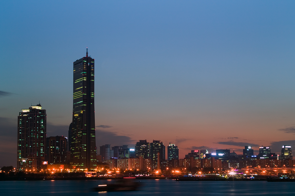
img_caption = Yeouido at dawn
hangul=영등포구
hanja=永登浦區
rr=Yeongdeungpo-gu
mr=Yŏngdŭngp'o-ku
area_km2=24.56
divs=22 administrative "dong"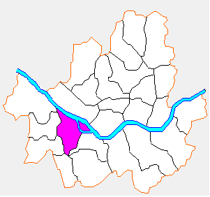
Yeongdeungpo-gu is an administrative district in southwest
Seoul ,Korea . Although the origin of the name is uncertain, the first two syllables are thought to be from "yeongdeung" (靈登) or "divine ascent", a shamanic rite. [cite web|url=http://tour.ydp.go.kr/culture/culture_03_01.asp?cul_type=1&cul_id=10058|title=동 명칭 및 주요 옛지명 유래|work=Yeongdeungpo-gu government Korean-language tourism website|accessdate=2006-04-07] The third syllable is "po", representing water (浦), referring to the district's position on the Han River. The 2006 population was 408,819. The current magistrate isKim Hyung-Su .There are 22 administrative "dong" and 34 legal "dong".
Yeouido Dong is the largest in area and takes about 34% of the land. The total area is 24.56 km² (2004), making up 4% of Seoul's land. The annual budget is approximately 2 billion won.Yeongdeungpo Gu has been heavily developed as an office, commercial, and residential district. Yeouido Dong is home to the famous
DLI 63 Building , the highest office building inSouth Korea and currently the 3rd tallest building in the country.The
National Assembly Building is located in Yeouido-dong, in Yeongdeungpo Gu. In addition, there are many kinds of organisations like Financial Union of Korea. There are mass-media corporations like Newspaper Corporations; Kookmin Newspaper Corporation, and Broadcasting Corporations and their partitions;Munhwa Broadcasting Corporation andKorean Broadcasting System . Sometimes in both Broadcasting Buildings, Many kinds of live-concerts, programs, and TV-shows are held and broadcasted.For those reasons, Yeouido-dong is the centre of culture and politics of South Korea.History
January 1 1963, Some areas of Bucheon-gun were combined to Yeongdeungpo-gu as below.
Administrative Divisions
Yeongdeungpo Gu is divided into the following "dong"s.
*Dangsan-dong (Hangul : 당산동) (divided in turn into Dangsan 1 and 2 Dong)
*Daerim-dong (Hangul : 대림동) (divided in turn into Daerim 1, 2, and 3 Dong)
*Dorim-dong (Hangul : 도림동) (divided in turn into Dorim 1 and 2 Dong)
*Mullae-dong (Hangul : 문래동) (divided in turn into Mullae 1 and 2 Dong)
*Singil-dong (Hangul : 신길동) (divided in turn into Singil 1 to 7 Dong)
*Yangpyeong-dong (Hangul : 양평동) (divided in turn into Yangpyeong 1 and 2 Dong)
**Yanghwa-dong
*Yeongdeungpo-dong (Hangul : 영등포동) (divided in turn into Yeongdeungpo 1, 2, and 3 Dong)
*Yeouido-dong (Hangul : 여의동)Transportation
Railroad
*
Korail ;*Seoul Subway Line 1 ;;;(Dongjak-gu ) ← Daebang — Singil — Yeongdeungpo → (Guro-gu )
*Seoul Metro ;*Seoul Subway Line 2 Euljiro Circle Line;;;(Guro-gu ) ← Mullae — Yeongdeungpo-gu Office — Dangsan → (Mapo-gu )
*Seoul Metropolitan Rapid Transit Corporation ;*Seoul Subway Line 5 ;;;(Yangcheon-gu ) ← Yangpyeong — Yeongdeungpo-gu Office — Yeongdeungpo Market — Singil — Yeouido — Yeouinaru → (Mapo-gu );*Seoul Subway Line 7 ;;;(Dongjak-gu ) ← Boramae — Sinpung — Daerim → (Guro-gu )ister Cities
*flagicon|South Korea
Cheongyang ,South Korea
*flagicon|ChinaDezhou ,China
*flagicon|South Korea Goseong,South Korea
*flagicon|Japan Kishiwada,Japan
*flagicon|China Mentougou,China
*flagicon|South KoreaYeongam ,South Korea ee also
*
Geography of South Korea
*Subdivisions of South Korea
*Administrative divisions of SeoulReferences
External links
* [http://english.ydp.go.kr/ Official website]
Wikimedia Foundation. 2010.