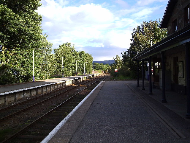
- Ardgay railway station
Infobox UK station
name = Ardgay
other_name =
code = ARD
caption =
manager =First ScotRail
locale =Ardgay
borough = Highland
platforms = 2
lowusage0405 = 2,297
lowusage0506 = 3,067
lowusage0607 = 3,964
latitude = 57.8809
longitude = -4.3613
original =Inverness and Ross-shire Railway /Sutherland Railway
pregroup =Highland Railway
postgroup = LMSR
years =28 July 1874
events = Opened as Bonar Bridge
years1 =2 May 1977
events1 = Renamed as Ardgay|Ardgay railway station is a
railway station serving the village ofArdgay in the Highland council area ofScotland . The station is on theFar North Line 93 km (57¾ miles) north of Inverness, nearBonar Bridge .History
Opened in 1874, and becoming the meeting point of the
Sutherland Railway and theInverness and Ross-shire Railway , the station joined theHighland Railway . Becoming part of theLondon, Midland and Scottish Railway during the Grouping of 1923, it then passed on to theScottish Region of British Railways onnationalisation in 1948.When Sectorisation was introduced in the 1980's, the station was served by
ScotRail until the Privatisation of British Railways.ervice
2008
On Mondays to Saturdays, there are 6 trains a day southbound to Inverness and 3 a day northbound to Wick. On Sundays there is 1 train in each direction.
rail line
previous = Tain
next = Culrain
route =First ScotRail Far North Line
col = FF80C0rail line
next = Culrain
"Line and Station open"
previous = "Line continues south"
route =Sutherland Railway Highland Railway
col = HR colourrail line
next = "Line continues north"
previous = Mid Fearn Halt
"Line open; Station closed"
route =Inverness and Ross-shire Railway Highland Railway
col = HR colour
###@@@KEYEND@@@###ources
*
*
* [http://www.railscot.co.uk/Sutherland_Railway/frame.htm RAILSCOT on Sutherland Railway]
* [http://railscot.co.uk/Inverness_and_Ross-shire_Railway/frame.htm RAILSCOT on Inverness and Ross-shire Railway]
Wikimedia Foundation. 2010.
