- New-Juaben Municipal District
-
New-Juaben Municipal District Region Eastern Region District type Municipal District Chief Executive Kwasi Adjei-Boateng Capital Koforidua Area 216 km² Population (2002) 136,753 ISO 3166 GH-EP-NJ The New-Juaben Municipal District is a district of Ghana in the Eastern Region. The capital lies at Koforidua.
Geography

 Left:Boti Falls. Right:Akan Falls.
The New Juaben Municipality falls within the Eastern Region of Ghana. The municipality covers an estimated area of 110 square kilometers constituting 0.57 % of the total land area of the Eastern Region.[1] The municipality has 48 electoral areas. It has an annual rainfall ranging from 50 – 120 inches and 20 – 32 celsius mean annual temperatures.
The municipality shares boundaries with East-Akim Municipality to the northeast, Akwapim North District to the east and south and Suhum Kraboa Coaltar District to the west. Koforidua City (New Juaben) is made up of several towns and neighborhoods, including Effiduase, Asokore, Oyoko, Jumapo , Suhyen, Dansuagya, Betom, Srodae, etc.
A predominant natural feature in Koforidua is the 'Obuo Tabri' Mountain, which is considered sacred. Nearby is Akosombo Dam which holds Lake Volta, the world's largest man-made lake. Waterfalls in the area such as Akan Falls and Boti Falls and the Umbrella Rock attract tourists to the region.
References
- ^ "New-Juaben Municipal". New Juaben Ghana Districts. http://www.newjuaben.ghanadistricts.gov.gh/. Retrieved January 25, 2009.
- Districts of Ghana at statoids.com
- GhanaDistricts.com
Districts of the Eastern Region of Ghana 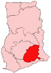 Akuapim North · Akuapim South Municipal · Akyemansa · Asuogyaman · Atiwa · Birim Central Municipal · Birim North · Birim South · East Akim Municipal · Fanteakwa · Kwaebibirem · Kwahu East · Kwahu North · Kwahu South · Kwahu West Municipal · Lower Manya Krobo · New-Juaben Municipal · Suhum/Kraboa/Coaltar · Upper Manya Krobo · West Akim · Yilo Krobo
 Categories:
- Districts of Eastern Region, Ghana
- Ghana geography stubs


Wikimedia Foundation. 2010.