- Macroom
Infobox Irish Place
name = Macroom
gaeilge = Maigh Chromtha
crest
motto =
map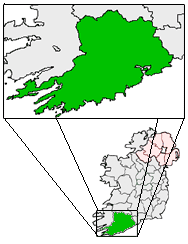
pin coords = left: 94px; top: 61px
north coord = 51.904354
west coord = 8.956947
irish grid = W337729
area =
county =County Cork
population = 2,985
census yr = 2002
province =Munster
web = www.macroom.ie
|Macroom ( _ga. Maigh Chromtha) is a small
market town lying in a valley on theRiver Sullane , a tributary of the River Lee, between Cork andKillarney . The town recorded a population on 2,985 in the 2002 national census. The name in Irish Gaelic may mean 'meeting place of followers of the god Crom' or 'crooked plain'.The area is thought to once have been the meeting place for the
Druid s ofMunster . It is said that Macroom is "the town that never reared a fool." [O'Brien, Barry. " [http://www.brierygap.com/pages/macroom.html Macroom] ". brierygap.com. Retrieved on 10 June, 2007.]History
s of Munster. [" [http://www.apieceofireland.com/ History of Macroom] ". "apieceofireland.com". Retrieved on 19 March, 2007.]
The first recorded historical reference to Macroom dates back to the sixth century when the townland was known as Achad Dorbchon, and held within the kingdom of Muscraighe Mitine. [Ring (1995), p.31] The dominate clan within Munster during this period was the Eoghanach dynasty, and they held kingdoms from Muscraighe Mitine to the midlands town of
Birr . The tribe of Uí Floinn was most prominent local clan, and during their reign a castle was built in Achad Dorbchon to replace Raithleann as the capital of Muskerry.In 978 a major battle was fought at Bealick between
Brian Boru and the King of Carbery. The battle was the climax of a power-struggle between the Lords of Carbery and the Dál gCais of North Munster. Boru sought to avenge the slaughter of his brother Mahon, as well as to acede to the throne of Munster. Mahon had been killed by the Viking chieftain Molloy in Aghina parish a year earlier. The battle lasted a full day, during which time the battle line shifted west to Sliabh Caoin (Sleveen). It has been described as one of the "Fiercest engagements ever fought in Muskerry". [Ring (1995), pp.47-50]Muscraighe Mitine underwent three invasions during the thirteenth century; from the Murcheatach Uí Briain and Richard de Cogan in 1201 and 1207 respectively, and finally from the McCarthy family who had become the dominant and most powerful family in what was then known as Muscraighe Uí Fhloinn. The McCarthy family occupied the castle from this time up until the middle of the seventeenth century. By the fourteenth century Achad Dorbchon was accepted to be the capital of the Barony of Muskerry, and was seen as growing center for trade, burial and religious worship. [Ring (1995), p.80]
Macroom was one of the earliest centres in Ireland where milling was carried out. By the end of the sixteenth century, the town began to grow from a village settlement to a functionally diverse urban centre. The locality grew outwards from the castle. The McCarthys established the town as a centre for markets and fairs, and in 1620 a market house was built to the east of and facing the castle. The family introduced a plantation scheme which aimed to attract new agriculture and industrial techniques and methods to the area. By the mid-seventeenth century English families owned approximately one-third of the town in value terms. [Ring (1995), p.105] The Protestant families introduced butter making to the town, and industry that was labor intensive and had a positive effect on local dairy farming.
The
battle of Macroom took place near the town in 1650, during theCromwellian conquest of Ireland . Bishop Boetius McEgan, fighting on behalf of the McCarthys failed to hold the Castle, and he was taken prisoner by the Cromwellian forces and hanged atCarrigadrohid . [" [http://www.corkkerry.ie/individual_results.asp?sID=48800 Macroom Castle] ". "Failte Ireland", 2004. Retrieved on 19 March, 2007.]A 1750
tenement list shows the town at that time to comprised 134 buildings and 300 families, with a population ratio of 6 to 1 between Catholic and Protestants. By now the town had developed from a locality of mud cabins in the early 1660s to a linear shaped urban settlement comprised mainly ofthatch ed cabins, replaced in due course by solid cottages through efforts of theIrish Land and Labour Association (ILLA) founded in 1894.During the
Irish War of Independence (1919-1921), Macroom was the base in Cork for the BritishAuxiliary Division . At theKilmichael Ambush , 17 Auxiliaries were killed on the road between Macroom and Dunmanway by the localIrish Republican Army underTom Barry . Macroom castle was burned out on five separate occasions; the last occasion was on 18 August, 1922 following the evacuation of British Auxiliaries from the town. The anti-treaty forces, includingErskine Childers andFrank O'Connor , had retreated from Cork City to Macroom. They burned the castle before retreating west. In 1924 the Castle and estate was gifted to the town by Lady Ardilaun. Michael Collins was killed in 1922 in an ambush nearBéal na mBláth .Geography
1.5km south of Macroom is the Gearagh, a national nature reserve which comprises an inland delta, made up of a series of small islands, separated by anastomosing river channels. [" [http://www.ucc.ie/staff/memmers/Gearagh.htm The Gearagh] ". ucc.ie. Retrieved on 19 March, 2007.] The area is thought to have been wooded since the end of the last Ice Age (c. 10,000 years ago)." [http://www.npws.ie/Conservationsites/SpecialAreasofConservationSACs/SiteSynopsis/Cork/Name,907,en.html The Gearagh] ". "National Parks & Wildlife Service", 1997. Retrieved on 19 March, 2007.] The alluvial woodland had extended as far as the Lee Bridge, however in 1954 the Lee
hydro-electric scheme was undertaken which led to extensive tree-felling and flooding in the area. The scheme resulted in the loss of sixty per-cent of the former oak woodland. Today, the Gearagh is of great natural importance due to its rich and rare diversity of wildlife, and represents the only extant extensive alluvial woodland in Western Europe. [" [http://www.corkkerry.ie/individual_results.asp?sID=44631 The Gearagh ] ". "Failte Ireland", 2004. Retrieved on 19 March, 2007.]Tourism
Tourist attractions include a colourful town centre, an 18-hole golf course and scenic surroundings. A few kilometres to the north of Macroom is Mushera Mountain, with the family attraction of Millstreet Country Park, a 1.5 km walk to the summit of the mountain, and the ancient Saint John's Well. There are many holy wells, churches and other sites in the area associated with ancient visionaries and healers. 6km west lies the historic
Carrigaphooca Castle . In the town itself, the Castle Arch, a remainder of the demolished Macroom Castle, admits walkers to the Castledemesne parklands, held in trust as a gift to, and possession of, the people of Macroom. This large park contains riverside walks among matureoak andbeech trees.Education
Macroom town contains two primary schools and three secondary schools; a De La Salle for boys, St. Mary's Secondary School Convent of Mercy for girls, and McEgan College, a mixed technical college located in the castle grounds.
Coláiste De La Salle was opened in 1933 was originally located in the town hall, until the permanent building was completed three years later. By the late 1970s the school was experiencing sever capacity issues and a re-structure and extension of the school was undertaken in 1982. [" [http://www.geocities.com/macroomdelasalle/home.html Coláiste De La Salle] ". Retrieved on 19 March, 2007.] Since its opening the ratio of puplis has remained relatively stable with 40% from coming the town and 60% from the surrounding parishes. The Convent of Mercy Secondary School is contained within the Sisters of Mercy's complex attached to St. Colmans church, which also included a convent, a primary school a graveyard and a grotto. The technical college is named after Bishop McEgan.
Aghina National School is a rurally based, two teacher, primary school within the parish of Macroom. Located 5 km from the town, it is the only co-educational primary school within the parish.
Currently a new school is being built for St Colmans Boys National School after years of appealing and applications. The new school will consist of two stories, will have wheelchair accessibility, and will have in indoor gym. The old school is planned to be knocked down during the summer holidays and the new school is planned to be opened in November 2008.
Transport
The town is situated the national primary route N22, approximately 38km from
Cork city and 48km from Killarney. There is an hourly bus service to a from Cork city. Macroom's nearest airport isCork Airport . Between 1866 and 1953, a railway ran between the town and Cork city, terminating in the mart grounds. In 1890 there were five services each way on week days and two on Sundays, and the running time was just over an hour. Macroom railway station opened on 12 May 1866, closed for passenger traffic on 1 July 1935, closed for goods traffic on 10 March 1947 and finally closed altogether on 1 December 1953. [cite web | title=Macroom station | work=Railscot - Irish Railways | url=http://www.railscot.co.uk/Ireland/Irish_railways.pdf | accessdate=2007-11-03]Youth Organizations
couting
28th Cork Macroom Scout Group is the scout troop for the Macroom region. They are part of the Lee Valley Scout County which is Part of the Southern Province of
Scouting Ireland . There are currently three sections of four active in Macroom Scout Group. They are the
*Cubs/Macaoimh (8 to 10 and a half year olds) (currently has approx. 20 members)
*Scouts (10 and a half to 16 year olds) (currently has approx. 6 to 8 members )
*Venture Scouts (16-21 year olds) (currently has approx. 9 members)The Beaver Scouts (6 to 8 year olds) are currently not active.Fact|date=September 2008port
Macroom golf club is located within the castle grounds and runs parlell with the river Sullane. Rugby was popular in the town in the early part of the 20C, and Hockey was played in the Castle grounds during the 1930s. Soccer was introduced to the town in the mid 1960s. Judo is also practiced in the town with members of the Macroom Judo Club winning many national and international medals down through the years.
ources
* Ring, Denis Paul (1995). "A Historical Geography of Macroom C.500-1995". Castle House Publications.
References
ee also
*
List of towns in the Republic of Ireland
*Market Houses in the Republic of Ireland External links
* [http://www.macroom.ie Official Town Website]
* [http://www.npws.ie/Conservationsites/SpecialAreasofConservationSACs/SiteSynopsis/Cork/Name,907,en.html The Gearagh] - National Parks & Wildlife Service.
* [http://www.aghinans.ie Aghina National School] - Aghina National School's website.
Wikimedia Foundation. 2010.