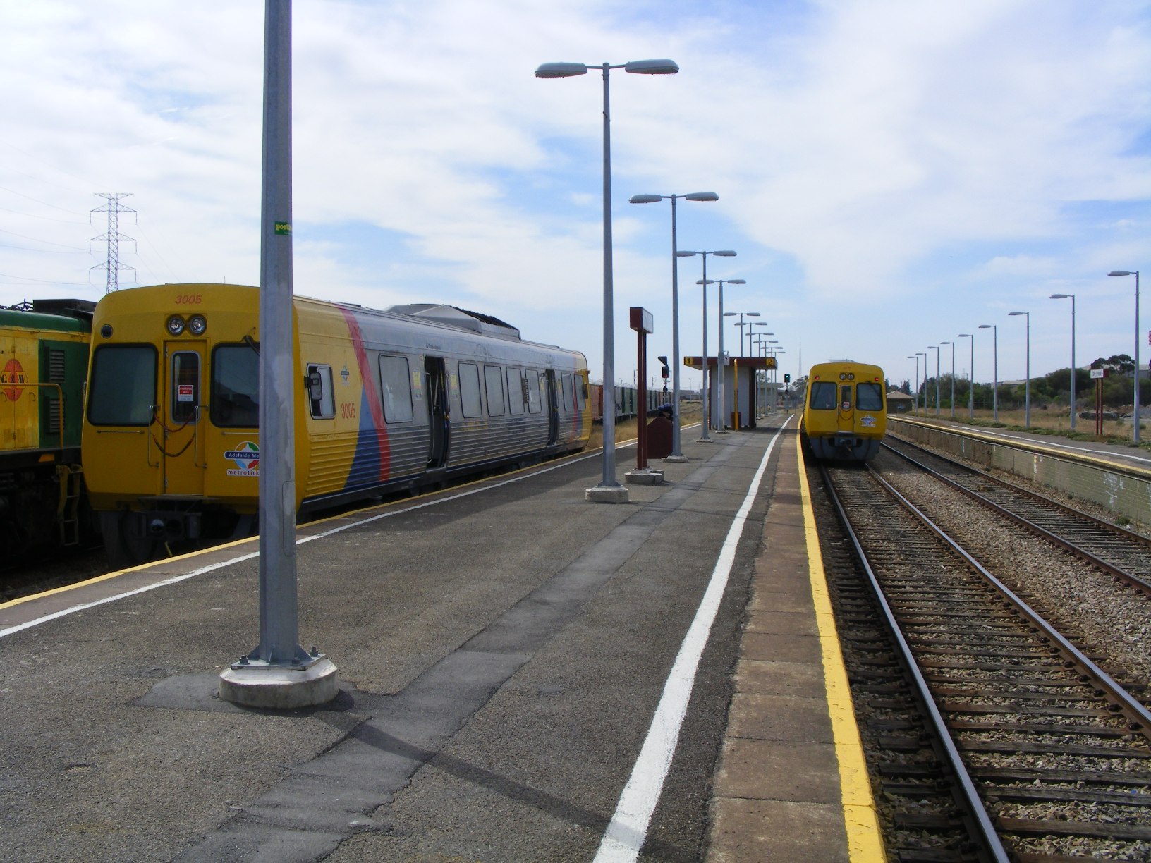
Dry Creek railway station, Adelaide
- Dry Creek railway station, Adelaide
TransAdelaide
colour=#9c2727
station_name=Dry Creek
line=Gawler Central
street=Railway Terrace
suburb=Dry Creek
distance=10.6
access=Level Pedestrian Crossing
HFS=No
peakfreq=Every 30 Mins
wdfreq=Every 30 Mins
wefreq=Every 30 Mins
nightfreq=Every 60 Mins
rrtd=No
rrts=Yes
platforms=3 (one disused)
platform_arch=1 Side Platform
1 Centre Platform
toilets=No
parking=No
bike=No
lounge=No
kiosk=No
disability=Yes
facilities=None
opened=Late 1800's
trainconnect=None
busconnect=None
previous=Kilburn
next=Mawson Lakes
Dry Creek railway station is a railway station on the Gawler Central railway line which is located in the inner northern Adelaide suburbs of Dry Creek. It is located 10.6km by railway from the Adelaide Railway Station. It was the easternmost station of the Dry Creek to Port Adelaide railway line and also the northernmost station on the Gawler Central line before the Northfield branch. Some trains previously used the station as a terminus for local services and an interchange with Gawler Central services (usually for people who live between the Adelaide and Dry Creek stations), but from April 28 2008 these services were discontinued, with all services operating to Gawler or Gawler Central stations.
Freight
Dry Creek is also the location of a major freight terminal and marshalling yard. A Bogie exchange facility was located here between 1980 and 1995.
See also
* List of Adelaide railway stations
* List of closed Adelaide railway stations
* TransAdelaide
* List of suburban and commuter rail systems
* Railways in Adelaide
* Rail transport in South Australia
References
Wikimedia Foundation.
2010.
Look at other dictionaries:
Dry Creek railway station — Dry Creek Railways in Adelaide List of Railway Stations … Wikipedia
Port Dock railway station, Adelaide — Port Dock railway station was located in the commercial centre of Port Adelaide, South Australia at the corner of St. Vincent Street and Lipson Street. This station was the original terminus of the railway between Adelaide and Port Adelaide,… … Wikipedia
Dry Creek, South Australia — Dry Creek Adelaide, South Australia Barker Inlet wetlands at Dry Creek Populat … Wikipedia
Rosewater railway station, Adelaide — Rosewater railway station was a railway station located in the northwestern Adelaide suburb of Rosewater. The station was right next to the Eric Sutton Oval, and was located about 7km from Dry Creek on the Dry Creek to Port Adelaide line. History … Wikipedia
Woodville railway station, Adelaide — TransAdelaide colour=#a100ff station name=Woodville line=Grange, Outer Harbor street=Woodville Road suburb=Woodville distance=7.5 access=Level Pedestrian Crossing HFS=No peakfreq=Every 10 30 Mins wdfreq=Every 30 Mins wefreq=Every 15 45 Mins… … Wikipedia
Dry Creek — may refer to: Communities Australia Dry Creek, South Australia, a suburb of Adelaide United States Dry Creek, Alaska in the Southeast Fairbanks Census Area Dry Creek, Louisiana in Beauregard Parish Dry Creek, Oklahoma in Cherokee County Dry Creek … Wikipedia
Dry Creek (South Australia) — Dry Creek or Dry Creek Drain (34°47′40″S 138°34′39″E / 34.79444°S 138.5775°E / 34.79444; 138.5775) is a seasonal stream in South Australia … Wikipedia
Port Adelaide railway station, Adelaide — TransAdelaide colour=#a100ff station name=Port Adelaide line=Outer Harbor street=Commercial Road Portland Place Baynes Place suburb=Port Adelaide distance=11.7 access=Ramp rrtd=No rrts=Yes platforms=2 platform arch=2 Side Platforms toilets=No… … Wikipedia
Tube Mills railway station, Adelaide — Tube Mills railway station was a railway station on the Gawler railway line located in the inner northern Adelaide, Australia suburb of Kilburn. It was located approximately 8.4km by railway from the Adelaide Railway Station, and was demolished… … Wikipedia
Smithfield railway station, Adelaide — TransAdelaide colour=#9c2727 station name=Smithfield Interchange line=Gawler, Gawler Central street=Anderson Walk Station Road Graeber Road suburb=Smithfield distance=30.2 access=Level Pedestrian Crossing HFS=Yes peakfreq=Every 5 10 Mins… … Wikipedia