- Region of Murcia
-
Region of Murcia
Región de Murcia (Spanish)— Autonomous Community — 
Flag
Coat of armsMap of the Region of Murcia
Coordinates: 38°00′N 1°00′W / 38°N 1°WCoordinates: 38°00′N 1°00′W / 38°N 1°W Capital Murcia Government – President Ramón Luis Valcárcel Siso (PP) Area(2.2% of Spain; Ranked 9th) – Total 11,313 km2 (4,368 sq mi) Population (2008) – Total 1,424,063 – Density 125.9/km2 (326/sq mi) – Pop. rank 10th – Percent 3.0% of Spain ISO 3166-2 MU Official languages Spanish; Statute of Autonomy June 9, 1982 Parliament Cortes Generales Congress seats 10 (of 350) Senate seats 4 (of 264) Website Comunidad Autónoma de la Región de Murcia The Region of Murcia (Spanish: Región de Murcia, IPA: [reˈxjon de ˈmurθja]; Valencian: Regió de Múrcia, IPA: [redʒiˈo ðe ˈmuɾsia])[1] is an autonomous community of Spain located in the southeast of the country, between Andalusia and Valencian Community, on the Mediterranean coast.
The autonomous community consists of a single province, unlike most autonomous communities, which have several provinces within the same territory. Because of this, the autonomous community and the province are operated as one unit of government. The city of Murcia is the capital of the region and seat of government organs, except for the parliament (Regional Assembly), which is located in Cartagena. The autonomous community and province is subdivided in municipalities.
The Region of Murcia is bordered by Andalusia (the provinces of Almería and Granada); Castile-La Mancha (the province of Albacete, which was historically connected to Murcia until 1980); the Valencian Community (province of Alicante); and the Mediterranean Sea. The community measures 11,313 km² and has a population of 1.4 million, of whom one-third live in the capital. The highest mountain is Los Obispos (2,015 m).
The region is a major producer of fruits, vegetables, and flowers for Spain and the rest of Europe. Wineries have developed near the towns of Bullas, Yecla, and Jumilla, as well as olive oil near Moratalla. Murcia is mainly a warm region which has made it very suitable for agriculture. However the precipitation level is low and water supply is a hot subject today since, in addition to the traditional water demand for crops, there is now also a demand of water for the booming tourist developments which take advantage of the mild weather and beaches. Water is supplied by the Segura River and, ever since the 70's, by the Tajo transvasement, a major civil engineering which, under some environmental and sustainability restraints, brings water from the Tajo into the Segura.
Contents
Geography
Relief
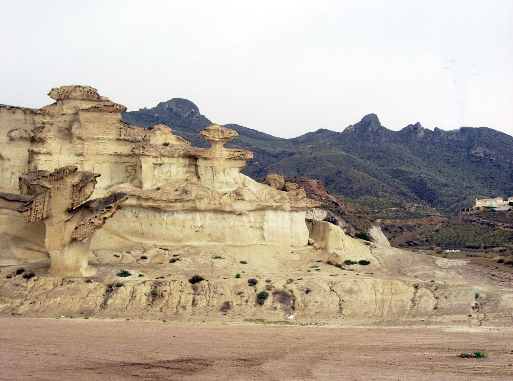
The region is located in the eastern part of the Cordilleras Béticas mountains and it is influenced by their orography. These mountain ranges are divided as well in the Prebética, Subbética and Penibética mountain ranges (from north to the south).
 Sierra de las Moreras
Traditionally it has been considered that the peak of Revolcadores, pertaining to the bulk of the same name, was the highest point in the Region of Murcia, with a height of 2,027 meters; but in measurements of the most recent maps of the SNIG (National Service of Geographic Information of Spain), Revolcadores appears with a height of 1,999 m, and there is a mountain, Los Obispos ("The Bishops"), located slightly further north, which is more elevated (2,015 m).
Approximately 27% of the Murcian territory can be described as mountainous, 38% as intramountainous depressions and running valleys, and the remaining 35% as flat lands and plateaux.
Climatology
The Region of Murcia enjoys a Mediterranean climate of semi-arid type, with mild winters (an average of 11C in December and January) and warm summers (where the daily maximum regularly exceeds 40°C). The average annual temperature is 18°C.
With little precipitation of about 300 to 350 mm per year, the region has between 120 and 150 days in the year where the sky is totally clear. April and October are the months with the most precipitation, there being frequent heavy downpours in a single day.
The distance to the sea and the relief causes a thermal difference between the coast and the interior, specially in winter, when the temperature rarely descends below 10º on the coast, while in the interior regions the minimum does not usually rise above 6º and the precipitation level is higher (up to 600 mm).
The city of Murcia holds the record temperature of the 20th century in Spain. It reached 46.1° Celsius (115 degrees Fahrenheit) on July 4, 1994. The winter of 2005 was the coldest in a long time, with snow even falling on the Murcian coast. [1]
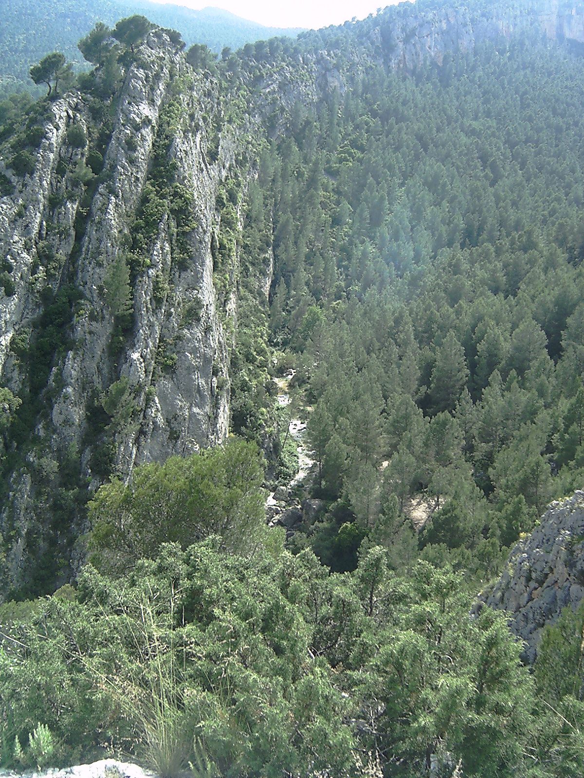
 Lands around Moratalla and river Alharabe.
Hydrography
Rivers
The hydrographic network of the region is made up of the Segura river and its affluents:
- Mundo (which is born in Albacete), it is the one that contributes to the Segura with the greatest volume.
- Alhárabe and its affluent, the Benamor.
- Mula river.
- Guadalentín, Sangonera or Reguerón (which is born upper before Lorca).
Due to the water supplying incapacity of the Segura river basin, contributions to this river basin are made, originated from the basin of the Tajo river, by means of the Tajo-Segura trasvasement.
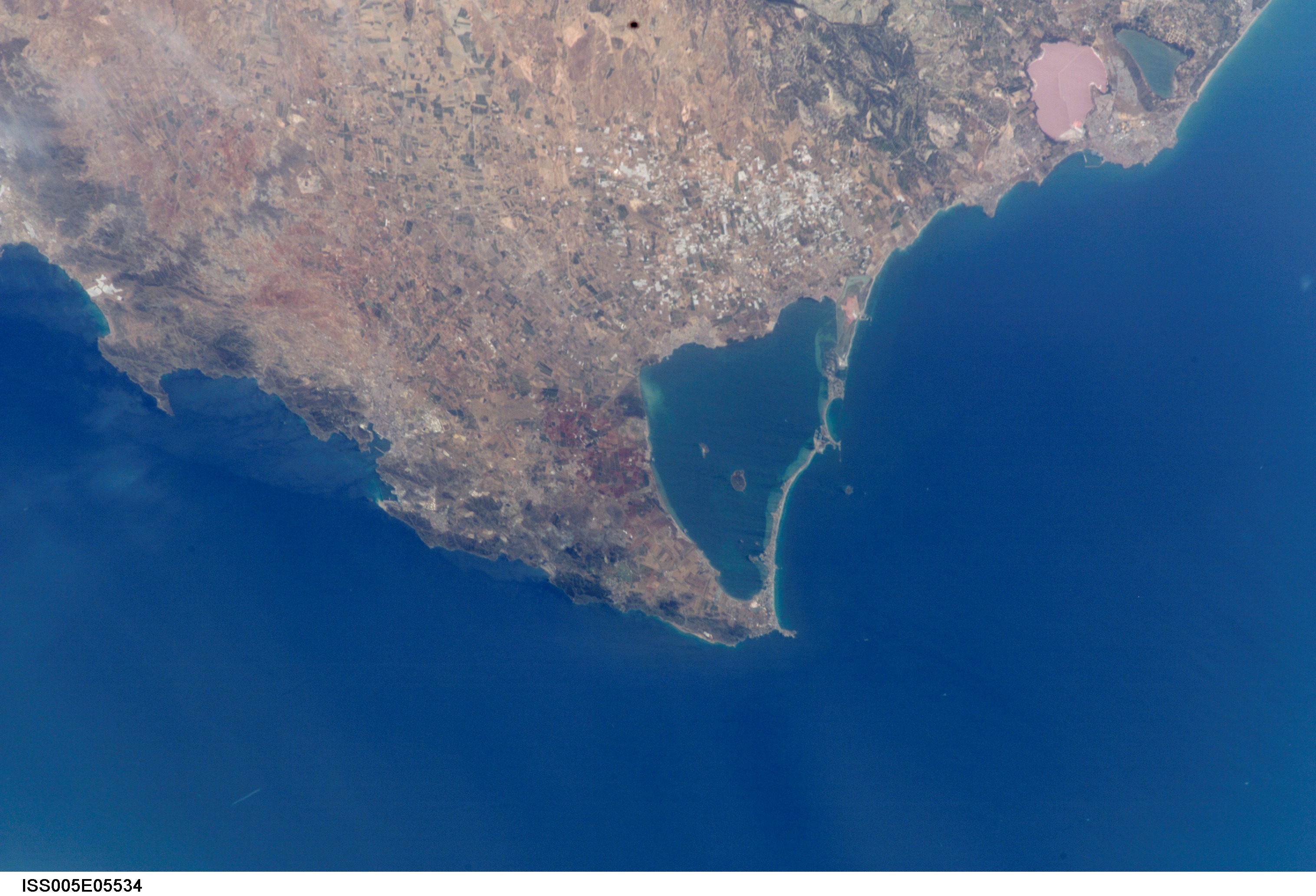
Seas
 Satellite view of the Mar Menor
The greatest natural lake of Spain can be found in the region: the Mar Menor (Small Sea) lagoon. It is a salt water lagoon, adjacent to the Mediterranean Sea. Its special ecological and natural characteristics make the Mar Menor a unique natural place and the largest saltwater lake in Europe. With a semicircular shape, it is separated from the Mediterranean Sea by a sand strip 22 km in length and between 100 and 1200 m wide, known as La Manga del Mar Menor (the Minor Sea's Sandbar). The lagoon has been designated by the United Nations as a Specially Protected Zone of Importance for the Mediterranean. Its coastal perimeter accounts for 73 km of coast in which beaches follow one another with crystal clear shallow water (the maximum depth does not exceed 7m). The lake has an area of 170 square kilometers.
History
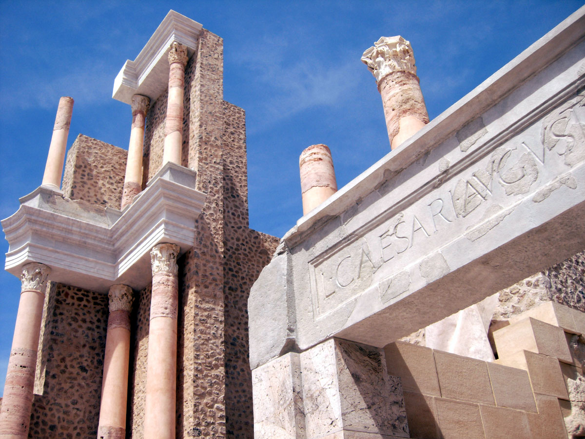
 Roman Theatre, Cartagena.
The Carthaginians established a permanent trading port on the coast at Cartagena, which the Romans called Carthago Nova. For the Carthaginian traders, the mountainous territory was merely the Iberian hinterland of their seacoast empire. During The Roman period Murcia did not exist but its actual borders could have been inside of the province of Hispania Carthaginensis. Under the Moors, who introduced the large-scale irrigation on which Murcian agriculture depends, the province was known as Todmir; it included, according to Idrisi, the 11th century Arab cartographer based in Sicily, the cities of Orihuela, Lorca, Mula and Chinchilla, Spain.
The Kingdom of Murcia became independent as a taifa centered on the Moorish city of Murcia after the fall of the Umayyad Caliphate of Córdoba (11th century). Moorish Taifa of Murcia included Albacete and part of Almería as well. After the battle of Sagrajas in 1086 the Almoravid dynasty swallowed up the taifas and reunited Islamic Spain. Ferdinand III of Castile received the submission of the Moorish king of Murcia in 1243.
In the usual way, the Muslims were evicted from the cities, and Ferdinand's heir Alfonso X of Castile, who benefited from rule over a largely depopulated Murcia, divided the border kingdom in three regions for administrative purposes, entrusted respectively to the concejos de realengo, to the ecclesiastical señores seculares, as a reward for their contributions to the Reconquista and to the Military Orders founded in the 11th century. Alfonso annexed the Taifa of Murcia as King of Murcia and Señorio de Cartagena outright in 1266, and it remained technically a vassal kingdom of Spain until the reforms in the liberal constitution of 1812. Murcia became an autonomous region in 1982.
The Castilian conquest of Murcia was significant because it gave the former access to the Mediterranean for the first time and ended the expansion of the Kingdom of Aragon which had been moving south along the coast.
Demography
The Region of Murcia has a population of 1,424,063 inhabitants (INE 2008, National Statistic Institute of Spain), of which almost a third (30.7%) live in the municipality of Murcia. It makes up 3.0% of the Spanish population. In addition, after Ceuta and Melilla, Murcia has the highest vegetative growth (5.52 by thousand inhabitants) and also the highest birth rate of the country.
- Birth rate (2004): 13.00 per 1,000
- Mortality rate (2004): 7.48 per 1,000
- Life expectancy (2002):
- Men: 76.01 years
- Women: 82.00 years
In the 1991-2005 period the Murcian population grew at by 26.06%, as opposed to the national average of 11.85%. 12.35% of the inhabitants are of foreign origin, according to the INE 2005 census, which is 4% more than the Spanish average. The most notable groups of immigrants are Ecuadorians (33.71% of the total of foreigners), Moroccans (27.13%), Britons (5.95%), Bolivians (4.57%) and Colombians (3.95%).
Municipalities
 Municipalities in Region of MurciaMain article: List of municipalities in Murcia
The Region of Murcia comprises 46 municipalities, the most populated being Murcia, Cartagena, Lorca, and Molina de Segura.
Language
The Spanish spoken in the region has its own accent and local words. The Murcian dialect tends to eliminate many syllable-final consonants and to emphasize regional vocabulary, much of which is derived from Aragonese and old Arabic words. The general intonation and some of the distinctive vocabulary of the Spanish dialect spoken in Murcia share several traits with the one spoken in the neighboring province of Almería, in Andalusia, and the Vega Baja del Segura in the Alicante province.
Valencian (Catalan) is spoken in a small area of the region known as El Carche.
Tourism
 El Mojón. Cartagena municipality, near Mazarrón.
Despite the famous seaside resorts, the overall region keeps being notably unknown even within Spain, so it continues to be relatively unspoilt compared to other more overcrowded areas of the Spanish Mediterranean coast. Nevertheless its more than 300 sunny days a year with an average temperature of 21 degrees, and the 250 km of beaches of the so-called Costa Cálida (Warm Coast) have attracted tourists for decades.
The region is also being promoted as a cultural destination with a lot of highlits for visitors: monuments, gastronomy, cultural events, museums, historic remains, festivals etc. The Region of Murcia is one of the Spanish autonomous communities that has grown the most in the last years, and it has conferred it the character of an ideal destination of services, shopping and for the organization of cultural events and conventions.
Cultural tourism
Major tourist destinations
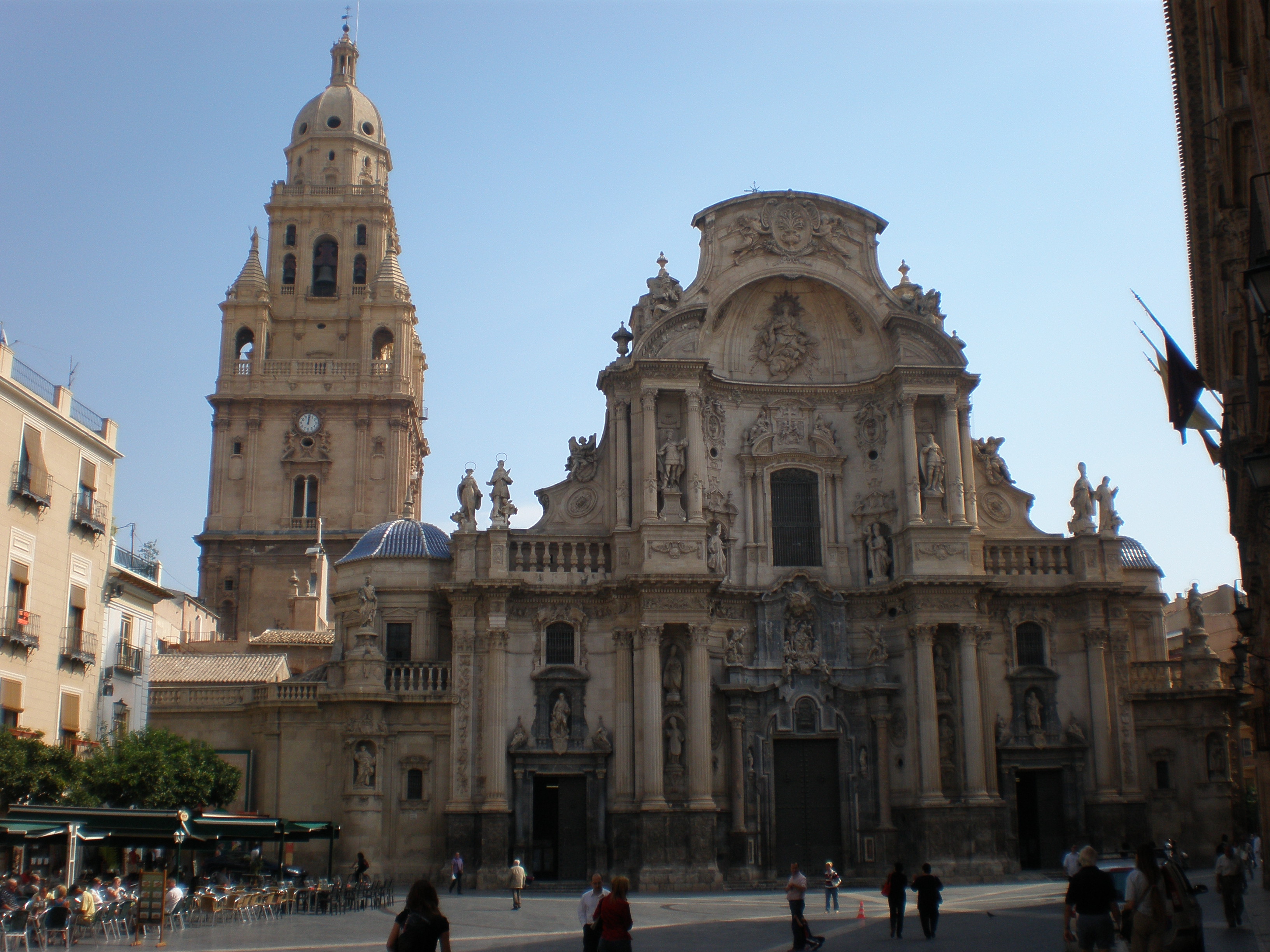
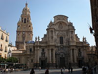 Murcia Cathedral.
- Murcia, the capital city offers the facilities, equipment and services of a large city. It is the seventh largest Spanish city by population with approximately 440,000 inhabitants in 2009. Murcia's sights include a very tall belfry and its famous Cathedral. Murcia is also a large University town with more than 30,000 students per year. It has more than 2 million km2 of parks and gardens. Murcia has a rich history tied to the Jewish community.
- Cartagena, is the region's second largest city and one of the main Spanish naval bases. Sights include its recently restored Roman Theatre (among its numerous other Roman remains), a number of modernist buildings made for its military fortifications
- Lorca is a large medieval town at the foothills of where its famous castle stands. It is the second largest municipality of Spain by area.
- Caravaca de la Cruz, or simply Caravaca, is one of the five official Holy cities for Catholicism since it is claimed to house of part of the Lignum Crucis, the Holy Cross.
The castles itinerary
 Castle of Lorca
the interior of the region of Murcia has plenty of castles and fortifications showing the importance of these frontier lands between the Christian Castile and the Muslim Andalusia. They include:
- Castle of Jumilla, a former Roman fortification turned by the Moors into an Alcazaba. The Castilian Kings and the marquis of Villena gave it its appearance of Gothic royal residence.
- Castle of Moratalla, one of the largest castles of the province, built to defend the town of Moratalla from the invaders from the nearby Muslim Kingdom of Granada.
- Castle of Mula, of Muslim origin, but as many castles, eventually restored and renovated.
- Real Alcázar of Caravaca de la Cruz, where the Holy sanctuary was built, also of Moorish origin, conquered by the Christians and finally home of several noble families.
- Concepción Castle, in Cartagena, built on one of the five hills of the old Carthagena, following the Roman taste. Now is home of the Centre for the Interpretation of Cartagena's History.
- The Castle of Lorca, also known as the Fortress of the Sun.
Festivities
Cartagena’s and Lorca’s Holy Week’s processions have been declared of International Tourist Interest, together the Murcia's "Bando de la Huerta" and "Burial of the Sardine", included in its Spring Festivities. Murcia’s Holy Week is also interesting since its processions include Murcian sculptor Francisco Salzillo's statues.
Cartagena’s main festivities are the Carthagineses y Romanos, re-enacting the Punic Wars. They have been declared of National Tourist Interest.
The Águila’s Carnival is one of the most important and colourful of Spain.
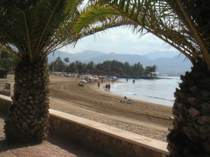
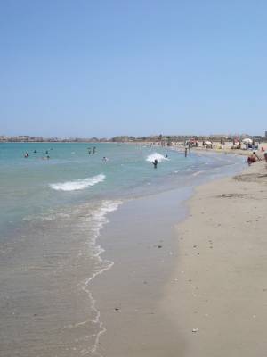
Beaches and golf
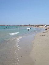 La Manga del Mar Menor
This is the most developed tourist resource in Murcia. The Costa Cálida has 250 km of beaches, from el Mojón at the North near Alicante to Águilas, South West Murcia, near Almería. One of the major destinations of Murcia is the Mar Menor or Small Sea, the largest natural lake of Spain and the largest salty lagoon in Europe, located by the Mediterranean. It is separated from the mediterranean by a 22 km narrow sandy strip known as La Manga del Mar Menor or simply La Manga. It is probably the most developed and overcrowded holiday area of Murcia, despite being declared a Specially Protected Area of Mediterranean Importance (SPAMIs) by the United Nations.
Mar Menor's muds are famous for its therapeutic properties. Apart from Mar Menor, the Murcian coast from the historical city of Cartagena to the frontier with Andalusia, that corresponds to the Mediterranean Sea alternates wild and unspoilt rocky areas with large sandy beaches, with the towns of Mazarrón and Águilas standing out.
The tourism needs have forced the area to add all kinds of facilities and services. The construction boom shows the huge amount of estates, including the controversial holiday resorts of Polaris World and second residences, as well as numerous malls. Thanks to the orography and climate of the region of Murcia, these lands are suitable for golf courses, a fact that has been very controversial because of the need for water, which Murcia lacks being a very dry region.
Other services includes charter nautical, yacht facilities, golf courses, adventure tourism companies, sports federations, tourist routes, guided visits, excursions by sea.
Natural resources and rural tourism
The region of Murcia has 19 areas under different statutes of protection, representing 6% of its territory.
 San Pedro’s marsh
- The Sierra Espuña, a protected natural space, has an area of 17,804 ha. It is located on the Baetic Cordillera within the basin of the Segura. It is also declared as Special Protected Area for the Birds.
- Salinas y Arenales de San Pedro del Pinatar, a salt marsh by the Mar Menor.
- Cabo Cope-Puntas del Calnegre, between Águilas and Lorca, by the Mediterranean sea. The government of Murcia has amended Law 1/2001 of 24 April on Land in the Region of Murcia, declassifying a total of 1600 hectares of the land protected by the Regional Park of Cabo Cope and Puntas de Calnegre. Rares species of animals (Bonelli's eagle, Greek tortoise) and plants are threatened.
- Calblanque, Monte de las Cenizas y Peña del Aguila, between La Manga and Cartagena, Calblanque is also one of the top-favourite beaches for the Murcians although it is an undeveloped area.
- Carrascoy y el Valle is a Special Protection Area (SPA) and Site of Community Importance (SCI).
- Sierra de la Pila, also a Special Protection Area (SPA).
- Sierra del Carche, also part of the Baetic Cordillera.
- Cañón de Almadenes
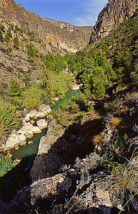 Cañón de Almadenes
- Humedal del Ajuaque y Rambla Salada, another wetland and also a Special Protection Area (SPA).
- Cerro de Cabezo Gordo, in which there is the archaeological site of Sima de las Palomas, a cave where the second oldest human remains in the Iberian Peninsula were found.
- La Muela y Cabo Tiñoso
- A group of islands and islets on the Murcian Mediterranean has a high ecological importance.
- Espacios Abiertos e Islas del Mar Menor, in which the five volcanic islands of the Mar Menor are included.
- Sierra de las Moreras
- Cañaverosa
- Sierra de Salinas
- Barrancos de Gebas
- Saladares del Guadalentín
- Cuatro Calas
Inner lands of the region, near the historical towns of Caravaca de la Cruz and Moratalla, offer a number of rural accommodations and facilities: cottages, farmhouses, country houses and camp sites. Visitors can engage in activities related to excursions, day trips, sports, sightseeing.
Transport
- San Javier–Murcia Airport.
- Alicante Airport, although outside Murcia, it is also used to arrive.
- Cartagena Seaport.
See also
- List of municipalities in Murcia
- The City of Murcia, which is the capital of the Autonomous Community of Murcia.
References
External links
- (English) MURCIAREGION.COM - Independent Site of Murcia, Spain. Thousands of pictures and movies
- "In Spain, Water Is a New Battleground" article by Elisabeth Rosenthal in The New York Times June 3, 2008
- (Spanish) Comunidad Autónoma de la Región de Murcia (the Autonomous Community of Murcia)
- (Spanish) Portal de la Región de Murcia Digital (Official Cultural Site of Autonomous Community of Murcia)
- (Spanish) Official Tourism Site of Murcia, Spain
- (Spanish) La Opinión - local newspaper
- (Spanish) La Verdad - local newspaper
- (Spanish) Murcia.com - local newspaper
Municipalities in the Region of Murcia Abanilla · Abarán · Águilas · Albudeite · Alcantarilla · Los Alcázares · Aledo · Alguazas · Alhama de Murcia · Archena · Beniel · Blanca · Bullas · Calasparra · Campos del Río · Caravaca de la Cruz · Cartagena · Cehegín · Ceutí · Cieza · Fortuna · Fuente Álamo de Murcia · Jumilla · Librilla · Lorca · Lorquí · Mazarrón · Molina de Segura · Moratalla · Mula · Murcia · Ojós · Pliego · Puerto Lumbreras · Ricote · San Javier · San Pedro del Pinatar · Santomera · Torre-Pacheco · Las Torres de Cotillas · Totana · Ulea · La Unión · Villanueva del Río Segura · Yecla
Autonomies of Spain Autonomous communities 
Autonomous cities Plazas de soberanía Provinces of Spain A Coruña · Álava · Albacete · Alicante · Almería · Asturias · Ávila · Badajoz · Balearic Islands · Barcelona · Biscay · Burgos · Cáceres · Cádiz · Cantabria · Castellón · Ciudad Real · Córdoba · Cuenca · Girona · Granada · Guadalajara · Gipuzkoa · Huelva · Huesca · Jaén · Las Palmas · León · Lleida · Lugo · Madrid · Málaga · Murcia · Navarre · Ourense · Palencia · Pontevedra · La Rioja · Salamanca · Segovia · Seville · Soria · Tarragona · Santa Cruz de Tenerife · Teruel · Toledo · Valencia · Valladolid · Zamora · Zaragoza
Categories:- Region of Murcia
- Provinces of Spain
- Autonomous communities of Spain
- NUTS 2 statistical regions of the European Union
- States and territories established in 1982


Wikimedia Foundation. 2010.