Cove, Argyll and Bute

Cove, Argyll and Bute
Cove and the Rosneath peninsula seen from Blairmore, across Loch Long in Cowal

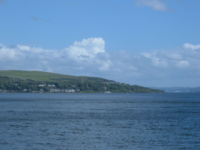
Cove is a village in Argyll and Bute, Scotland.

It is on the south-west of the Rosneath peninsula, on the east shore of Loch Long.

Before the local government reorganisation in Scotland in 1975 it formed part of the small Joint Burgh of Cove and Kilcreggan, in the County of Dumbarton.

In common with many villages in the area, it was home to wealthy Glasgow merchants and shipowners in the 19th and early 20th centuries. Several of the large houses have either been converted or have gone. Survivors include over a dozen houses by Alexander "Greek" Thomson: Craigrownie Castle, Glen Eden, Craig Ailey, Ferndean and Seymour Lodge, all dating from the 1850s. Of those not by Thomson, Hartfield was the summer residence of Lord Inverclyde became a YMCA hostel before its dereliction and demolition in the 1960s.

External links

Coordinates: 56°0′0″N 4°51′5″W / 56°N 4.85139°W / 56; -4.85139


Wikimedia Foundation. 2010.

Игры ⚽ Поможем решить контрольную работу

Look at other dictionaries:

  • Argyll and Bute — This article is about the council area. For the constituencies, see either Argyll and Bute (UK Parliament constituency) or Argyll and Bute (Scottish Parliament constituency) infobox Scotland council area Council= Argyll and Bute Council Earra… …   Wikipedia

  • List of places in Argyll and Bute — This List of places in Argyll and Bute is a list of links for any town, village, hamlet, castle, golf course, historic house, lighthouse, nature reserve, reservoir, river, canal, and other place of interest in Argyll and Bute, Scotland,… …   Wikipedia

  • Loch Long (Argyll and Bute) — 56°4′19,2″N 4°52′4,8″O / <span class= geo dec geo title= Cartes, vues aériennes et autres données pour Erreur d’expression : caractère de ponctuation « , » non reconnu. Erreur d’expression : caractère de ponctuation «  …   Wikipédia en Français

  • Argyll y Bute — Saltar a navegación, búsqueda Argyll and Bute Earra Ghaidheal agus Bòd Información Capital: Lochgilphead Población   Total   Densidad de población 90.870 h …   Wikipedia Español

  • Cove (disambiguation) — Cove may refer to: Cove, geographic feature on a body of water Covè, a city in Benin Cove (Appalachian Mountains), a type of valley found in the Appalachian Mountains Cove (standing stones), a megalithic feature Cove, Argyll and Bute, a village… …   Wikipedia

  • Loch Lomond and the Trossachs National Park — Infobox protected area | name = Loch Lomond and The Trossachs National Park iucn category = II caption = Looking eastwards along Loch Katrine in the Loch Lomond and the Trossachs National Park locator x = locator y = location = Scotland, Argyll… …   Wikipedia

  • List of community council areas in Scotland — This is a list of community council areas established in each of the council areas of Scotland.Aberdeen CityThere are 31 community council areas in the council area. Those marked with an asterisk have a community council. [… …   Wikipedia

  • Kilcreggan — infobox UK place country = Scotland official name= Kilcreggan gaelic name= scots name= population= os grid reference= NS238805 latitude= 55.98502 longitude= 4.82601 unitary scotland= Argyll and Bute lieutenancy scotland= Dunbartonshire… …   Wikipedia

  • Islands of the Clyde — The Islands of the Firth of Clyde are the fifth of the major Scottish island groups after the Inner and Outer Hebrides, Orkney and Shetland. The islands are situated in the Firth of Clyde between Ayrshire and Argyll. There are about forty islands …   Wikipedia

  • West Dunbartonshire (UK Parliament constituency) — Coordinates: 55°57′58″N 4°30′22″W / 55.966°N 4.506°W / 55.966; 4.506 …   Wikipedia

Share the article and excerpts

Direct link
Do a right-click on the link above
and select “Copy Link”