- Santa Ana, El Salvador
Infobox Settlement
official_name = Santa Ana
other_name =
native_name =
nickname = La Ciudad Heróica "Heroic City"
settlement_type =
motto =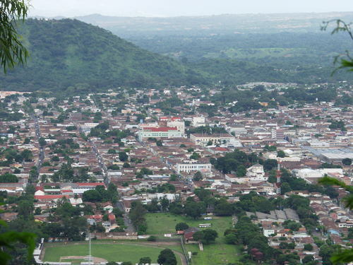
imagesize = 250px
image_caption = Panoramic of Santa Ana city_flag.png)
flag_size = 100px
image_.png)
seal_size = 75px
image_shield =
shield_size =
image_blank_emblem =
blank_emblem_size =.png)
mapsize = 180px
map_caption =
mapsize1 = 180px
map_caption1 =
image_dot_
dot_mapsize =
dot_map_caption =
dot_x = |dot_y =
pushpin_
pushpin_label_position =
pushpin_map_caption =
pushpin_mapsize =
subdivision_type =Country
subdivision_name = SLV
subdivision_type1 =
subdivision_name1 =
subdivision_type2 = Department
subdivision_name2 = Santa Ana
government_footnotes =
government_type =
leader_title =Mayor
leader_name =Orlando Mena
leader_title1 =
leader_name1 =
leader_title2 =
leader_name2 =
leader_title3 =
leader_name3 =
leader_title4 =
leader_name4 =
established_title =
established_date =
established_title2 =
established_date2 =
established_title3 =
established_date3 =
area_magnitude = 1 E8
unit_pref =
area_footnotes =
area_total_km2 =408.01
area_land_km2 =
area_water_km2 =
area_total_sq_mi =157.5
area_land_sq_mi =
area_water_sq_mi =
area_water_percent =
area_urban_km2 =
area_urban_sq_mi =
area_metro_km2 =
area_metro_sq_mi =
area_blank1_title =
area_blank1_km2 =
area_blank1_sq_mi =
population_as_of =2007
population_footnotes = [ [] ] [ [] ]
population_note =
population_total =245,421
population_density_km2 =
population_density_sq_mi =
population_metro =290000
population_density_metro_km2 =
population_density_metro_sq_mi =
population_urban =280000
population_density_urban_km2 =
population_density_urban_sq_mi =
population_blank1_title =
population_blank1 =
population_density_blank1_km2 = 601.51
population_density_blank1_sq_mi =
timezone =
utc_offset =
timezone_DST =
utc_offset_DST =
latd=14 |latm=0 |lats=0 |latNS=N
longd=89|longm=33|longs=0|longEW=W
elevation_footnotes =
elevation_m = 665
elevation_ft = 2182
postal_code_type = ISO 3166-2
postal_code = SV-SA
area_code =
blank_name =
blank_info =
blank1_name =
blank1_info =
website = http://www.santaana.gob.sv
footnotes =Santa Ana is the second largest city in
El Salvador , located 64 kilometers west of San Salvador, the capital city. Santa Ana has approximately 274,830 (2006) inhabitants and serves both as the capital of the department of Santa Ana and as the municipal seat for the surroundingmunicipality of the same name. For its administration the municipality is divided into 35 colonias (neighborhoods) and 318 small villages.A major processing center for El Salvador's sizable
coffee industry is located near Santa Ana.Currently, the mayor of Santa Ana is Orlando Mena, from the PDC (Christian Democratic Party), a right-wing political party. Mena was reelected in local elections in March 2003.
Geography
The city of Santa Ana is located on a
meseta about 665 meters above sea level. The city has year-round warm climate with an average temperature of around 25 °C. The main river is the Guajoyo river which is a major tributary of the much largerLempa River . There is a major Hydroelectric Power station at the Guajoyo river that provides electricity to most of the western sector of the country.The city is situated among many beautiful green hills such as Técana hill and Hills of Santa Lucia, among others. In the southern part of the municipality is the
Ilamatepec volcano, the highest volcano in the country, which made a moderate eruption in 2005 that killed two people. Close to it is another famous volcano, Izalco, known to sailors throughout the mid 1800s and early 1900s as "The lighthouse of the Pacific" due to its constant lava eruptions.History
The city of Santa Ana has pre-Columbian origins, whose founders were the Pocomame tribes, later the
pipiles entered and conquered the zone in 1200 AD. The indigenous name of the region in nahaut is Sihuatehuacán, that means "place of priestesses". There are some archeological traces of Sihuatehuacán in the present day district of Santa Barbara west of the Apanteos and Apanchacal rivers.On July 26, 1569 the Guatemalan bishop Bernardino Villalpando changed the name from Sihuatehuacán to that of Santa Ana. The new town at the time was part of the Greater Mayorship of San Salvador. In June 1812 Santa Ana was designated with the title of "town" and in 1824 it was given the title of "city".In 1894 the
revolution of the 44 overthrew presidentCarlos Ezeta , who had governed the country as a dictator. The revolt began in Santa Ana then spread throughout the country, which is why the city from then on was known as the "heroic city".At the time of the golden era of coffee in El Salvador, Santa Ana was the most prosperous city in the country. Many industrialists who cultivated it lived in Santa Ana, and coffee haciendas sprouted all around the city generating a surplus of income when coffee prices sky-rocketed in the latter part of the 19th century. This led to the construction of architectural jewels such as the gothic Catedral de Santa Ana and the Teatro de Santa Ana.
Notable Salvadoran personalities born in Santa Ana are the writer
David Escobar Galindo , the poet Jose Váldez and ex- presidentsTomás Regalado andPedro Jose Escalón , together with several members of the influential Pacas family.Education
The city of Santa Ana has 183 schools according to statistics from the Salvadoran Ministry of Education, out of those 53 are private. Some of the best known schools are:
#
Colegio Bautista
#Liceo San Luis
#Escuela Interamericana
#Colegio Latinoamericano
#Colegio Salesiano San José
#Colegio Santa María
#CE INSA Santa Ana has a few universities, some of the major ones are:
Universidad Católica de Occiente ,Universidad de El Salvador Facultad Multidiciplinaria de Occidente andUniversidad Autónoma de Santa Ana .Economy
Santa Ana today is the second largest city in population and importance in El Salvador, the main economic drivers of the city are in retail and manufacturing. In the north and west of the city are factories and assembly plants most of foreign nationality. The southern part of the city is more commercially developed, you will find many restaurants, commercial banks, hotels and shopping malls. The largest commercial center in the city is metrocentro.Santa Ana has two main markets: the Columbus and the Central Market, only a few streets from one another, offering a great variety of produce.
In respect to tourism, the city has old architectural jewels such as:
Catedral de Santa Ana (Santa Ana's Cathedral), Alcaldía Municipal de Santa Ana (Santa Ana'sCity Hall ) and theTeatro de Santa Ana (Santa Ana's Theatre).The only museum in the city registered by Concultura is the
Occidental Regional Museum , also known as the Museum of the West. There are also the Apanteos and Sihuatehuacán aquatic parks.Sport
Santa Ana is home to C.D FAS, one of the most famous football (soccer) clubs in El Salvador. Their home stadium is "Estadio Oscar Quiteño", with an approximate capacity of 15,000 fans.
Religion
Like the rest of the country, Christianity is the major faith with the majority of the population of Santa Ana professing Roman Catholicism, but there is a fast growing Protestant Evangelical population mainly congregating in churches such as Mission Cristinana ELIM.
References
External links
* [http://www.santaana.gob.sv Municipality of Santa Ana]
* [http://www.4elsalvador.com/Teatro%20nacional%20de%20santa%20ana.htm Teatro de Santa Ana]
* [http://www.4elsalvador.com/catedral%20de%20santa%20ana.htm Catedral de Santa Ana]

Wikimedia Foundation. 2010.