- Akersloot
Dutch town locator maps
mun_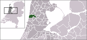
town_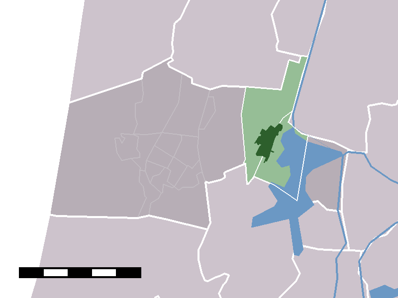
caption = The town centre (darkgreen) and the statistical district (lightgreen) of Akersloot in the municipality of Castricum.Akersloot (coord|52|34|N|4|44|E|type:city(4347)) is a town in the Dutch province of
North Holland . It is a part of the municipality ofCastricum , and lies about 9 km south ofAlkmaar . UntilJanuary 1 ,2002 , Akersloot was a separate municipality.In 2001, the town of Akersloot had 4347 inhabitants. The built-up area of the town was 0.81 km², and contained 1657 residences.Statistics Netherlands (CBS), "Bevolkingskernen in Nederland 2001" [http://www.cbs.nl/nl-NL/menu/themas/milieu-natuur-ruimte/ruimte/publicaties/cartografie-geografie/geografische-data/2001-bevolkingskernen-in-nederland.htm] . Statistics are for the continuous built-up area.] The wider statistical area of Akersloot has a population of around 5080.Statistics Netherlands (CBS), "Gemeente Op Maat 2004: Castricum" [http://www.cbs.nl/nl-NL/menu/themas/nederland-regionaal/nederland-regionaal/publicaties/gemeente-op-maat/2004/alfabet/C/2004-castricum.htm] .] This includes the hamlets
Starting andKlein Dorregeest south of Akersloot, and Boekel to the north.External links
* [http://www.kuijsten.de/atlas/nh/kuyper_nh_akersloot.html Map of the municipality in 1868]
The oldest name for Akersloot was Axmericota, meaning "Oak Forest at the Sea".
In the years between 1250 and 1400, Akersloot gained the title "capital village of Kennemerland". Limmen was the second village in Kennermerland in prestige. In 1276 the people of Akersloot regained their rights and priviliges from Count Floris V due to their bravery in the stuggle against the Frisians. These privileges were removed by their former lord, the count of Holland, in the early 13th century because they rebelled against him.
Akersloot was razed in October of 1573 by retreating Spaniards after the siege of Alkmaar. Several residences and other buildings were burnt to ashes.
After the 80-year war trade bloomed. Even sea-faring and fishery was part of the Akersloot economy.
The Akersloot of today was isolated for a long time. Communication with the outer world was maintained through salon boats of the Alkmaar Packet. After the liberation good bus connections gradually emerged. Akersloot gained a yachting harbor, which now is one of the major ones on the Alkmaardermeer.
References
Wikimedia Foundation. 2010.