- Menstrie Glen
-
Coordinates: 56°09′29″N 3°51′25″W / 56.158°N 3.857°W
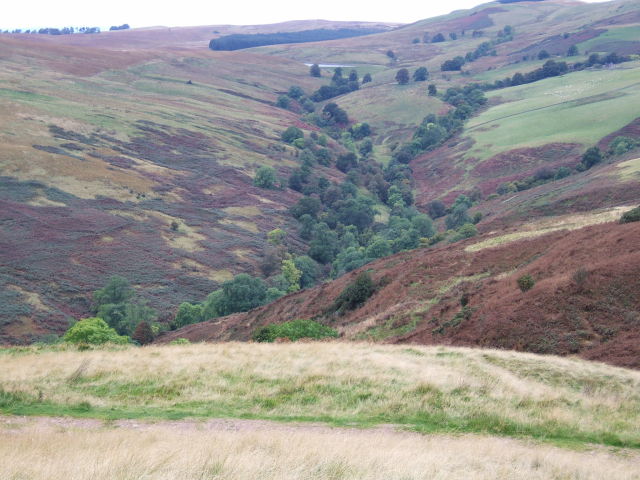
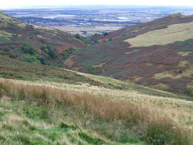
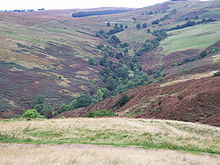 Upper Menstrie Glen from NS853981 looking WNW
Menstrie Glen is the valley which separates Dumyat from Myreton Hill and the main body of the Ochil Hills in Scotland. Once farmed but no longer inhabited, it is now used for sheep pasture, a public water supply and recreation in the form of fishing and walking.
Contents
Vegetation and topography
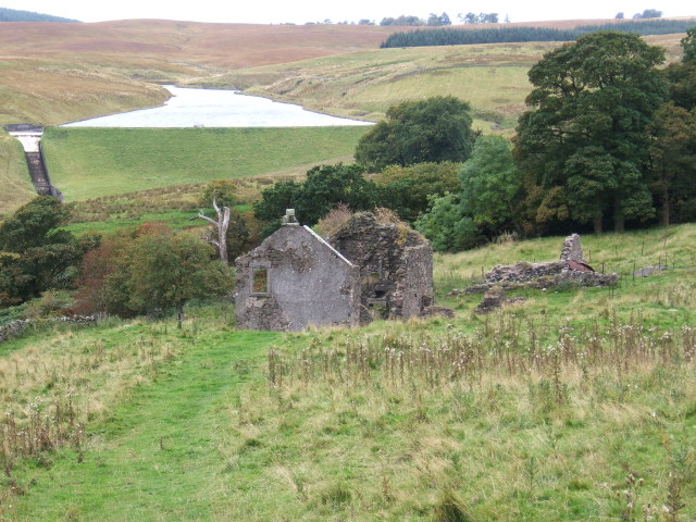
 Jerah and the Lossburn Reservoir looking west
Much of the area of the glen is rough pasture where sheep graze. Bracken is also abundant while broad-leaved trees grow in the deeply cut burnsides and in the vicinity of abandoned settlements.
The bed of the glen ranges in altitude from 228m, at the saddle at UK Grid reference NN819002, to about 20m where it emerges onto the flood plain in Menstrie at NS849970.
Near its upper (west) end, the glen contains the Lossburn Reservoir which holds drinking water and is used for recreational fishing. The reservoir accepts water from the north-western slopes of Dumyat and from the south-western slopes of Loss Hill. An earth embankment seemingly designed to divert compensation water around the north side of the reservoir has been breached so the Menstrie Burn relies for its flow mainly on the streams entering the watercourse below the dam.
Below the reservoir, the Loss Burn is joined by the Crunie Burn to form the Menstrie Burn. This, in turn, is augmented by the Third, Second and First Inchna Burns (in the order in which they join) and which drain the southwestern slopes of Colsnaur Hill. The Second Inchna Burn and part of the Menstrie Burn downstream lie along the boundary between Stirlingshire (to the west) and Clackmannanshire.
History
The history of settlement and land-use from 1450 to the mid-20th century has been published.[1]
In medieval times, much of Menstrie Glen was Crown land and used mainly to pasture sheep.
The Campbells of Argyll had come into possession of the land east of the Menstrie Burn by the early 14th century and, up to at least 1530, the lands of Jerah were controlled by the Cistercians of Culross.
In the 18th century ownership of the glen passed to local lairds. Farmsteads, of which there were then more than a dozen, were operated by the lairds' tenants. In the mid-18th Century James Wright, laird of Loss, owned about half of the glen. He left voluminous notes and paperwork describing his practices and improvements.
In the early 19th century arable farming and pasture were still carried on at the remaining farmsteads of Ashentrool, Loss and Jerah.
The remnant of Loss farmstead is described in detail by The Royal Commission on the Ancient and Historical Monuments of Scotland (RCAHMS).[2]
RCAMHS have also published a description and aerial photographs of the remains of Ashentrool, also known as Loss Hill.[3]
Jerah, at NS838991 near the top of the glen and once accessible by road from the Sheriffmuir (western) side, was finally abandoned in the 1960s and fell into ruin. The glen is now uninhabited.
Access
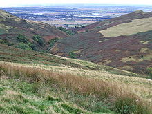 Lower Menstrie Glen from NS842993 looking South
The lower (southern) parts of the glen, reached by footpaths from Menstrie, give access to routes to the summits of Dumyat and Myreton Hill.
A gated farm track leads from Menstrie around the eastern and northern flanks of the glen to the ruin of Red Brae (NS842992), near Jerah.
Another gated farm track goes from the Sherrifmuir Road (at NS819994) past the Lossburn Reservoir, around the southern and western flanks of Menstrie Glen, finally descending past Dumyat Farm (once named Foreside of Lipney) to Cotkerse, a kilometre west of Menstrie at NS834968.
In October 2008, Menstrie Community Council announced a proposal to make access to the glen easier and to install visitor attractions.[4]
References
- ^ "'WELL SHELTERD & WATERED' Menstrie Glen, a farming landscape near Stirling", Royal Commission on the Ancient Historical Monuments of Scotland, ISBN 1-902419-25-1 Crown Copyright: RCAHMS 2001
- ^ http://www.scotlandsplaces.gov.uk/search_item/index.php?service=RCAHMS&id=47146 Loss Burn archaeological record
- ^ http://www.scotlandsplaces.gov.uk/search_item/index.php?service=RCAHMS&id=144994 Ashentrool archaeological record
- ^ http://www.menstrie.org/gb.html Proposal to the Local Landscape Partnership for Upgrading Menstrie Glen and Burn
External links
Categories:- Glens of Scotland
- Geography of Stirling (council area)
- Geography of Clackmannanshire
- Protected areas of Stirling
- Protected areas of Clackmannanshire
Wikimedia Foundation. 2010.