- Deal Timeball
-
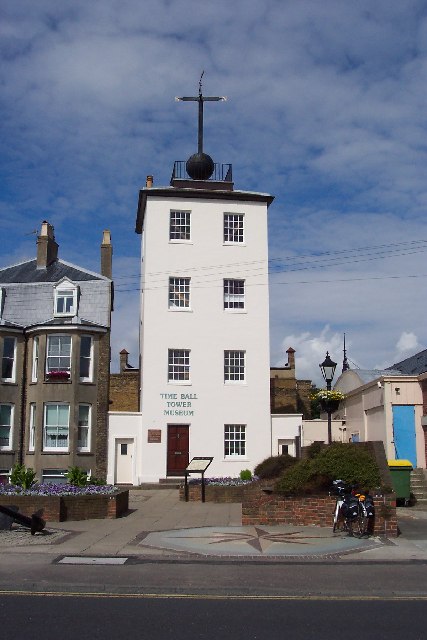
 Deal Timeball Tower.
Deal Timeball is a Victorian maritime Greenwich Mean Time signal located on the roof of a waterfront four-storey tower in the coastal town of Deal, in Kent, England. It was established in 1855 by the Astronomer Royal George Biddell Airy in collaboration with Charles V. Walker, superintendent of telegraphs for the South Eastern Railway Company. It was built by the Lambeth firm of engineers Maudslay and Field. The timeball, which, like the Greenwich timeball, fell at 1 pm precisely, was triggered by an electric signal directly from the Royal Observatory.
Before it became a timeball tower, the tower was a semaphore tower used to signal to the ships at anchor in the Dover channel.
From 1821 to 1831, the Tower carried a semaphore mast, which was used by the Coast Blockade for the Suppression of Smuggling to pass information along the coast. The Blockade was under the auspices of the Navy, and was manned by their personnel.
The Timeball Tower stands on the site of an earlier Shutter Telegraph. Ths was one of a chain of telegraph stations between the Admiralty in London and the Naval Yard at Deal. The telegraph line opened in 1796 and closed in 1814. Its purpose was to allow rapid communication between London and Deal, the latter being an important Naval anchorage during the Napoleonic Wars.
The Deal Timeball Tower Museum features exhibits about the history of the tower and its use for navigation aid, fight against smuggling, signaling, and the mechanics of the timeball.
See also
- Shepherd gate clock
- Timeball
- Time signal
References
Categories:- Navigational equipment
- Timekeeping
- Museums in Kent
- Technology museums in the United Kingdom
- Maritime museums in England
Wikimedia Foundation. 2010.