Xgħajra

Xgħajra

Towns (Malta)
name = Xgħajra(Ix-Xgħajra)
coa = XghajraHTML.gif
official_name = Ix-Xgħajra
inhabitants_name = Xgħajri (m), Xgħajrija (f), Xgħajrin (pl)


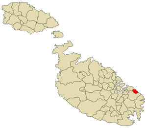
latitude = 35°53 '11"
longitude = 14°32 '50"
area = 1.0
population_total = 1,243
population_density = 1,287
borders = Kalkara, Żabbar
saint = Our Lady of Grace
feast = Sunday after 8th September
mayor = Anthony Valvo (MLP)
website = [http://www.xghajra.gov.mt/home.asp xghajra.gov.mt]

Xgħajra (English: Sh'ayra) [ [http://www.geody.com/geolook.php?world=terra&
]
] is a small village in Malta on the coast, about halfway between Valletta and Marsaskala. The population of Xgħajra is 1,234 people (Nov 2005).

Its local football club is known as: Xgħajra Tornadoes F.C.

Zones in Xgħajra

*Ta' Alessi
*Ta' Maġġi
*Tal-Qassisin
*Tan-Nisa
*Tumbrell
*Wied Glavan

Xgħajra Main Roads

*Dawret ix-Xatt (Strand By-Pass)
*Triq Ħaż-Żabbar (Zabbar Road)
*Triq il-Fortizza tal-Grazzja (Grazzia Fort Street)
*Triq il-Knisja (Church Street)
*Triq it-Torri ta' Alof de Wignacourt (Alof de Wignacourt Tower Street); This road refers to the Santa Maria delle Grazie Tower that Knights of Malta erected in 1620 during the reign of Grand Master Fra Alof de Wignacourt, and is one of the set of Wignacourt towers. The British demolished the tower to clear a field of fire for the Della Grazie Battery that they constructed in 1888.

External links

* [http://www.xghajra.gov.mt/home.asp Xgħajra Local Council]


Coordinates: coor dms|35|53|11|N|14|32|50|E|type:city


Wikimedia Foundation. 2010.

Игры ⚽ Поможем написать реферат

Look at other dictionaries:

  • Ajra — Infobox Indian Jurisdiction native name = Ajara | type = Town | latd = 16.12 | longd = 74.2 locator position = right | state name = Maharashtra district = Kolhapur leader title = leader name = altitude = 660 population as of = 2001 population… …   Wikipedia

  • Ajra — Original name in latin Ajra Name in other language Ajra State code IN Continent/City Asia/Kolkata longitude 16.11601 latitude 74.21097 altitude 661 Population 15864 Date 2013 02 08 …   Cities with a population over 1000 database

  • ájra — अज्र …   Indonesian dictionary

  • Xgħajra — Flagge Karte Basisdaten Fläche …   Deutsch Wikipedia

  • Xgħajra — Drapeau …   Wikipédia en Français

  • Xgħajra — Entidad Consejo local de Malta  • País …   Wikipedia Español

  • ghāsé-ajra — घासेअज्र …   Indonesian dictionary

  • urv-ájra — उर्वज्र …   Indonesian dictionary

  • Coastline of Malta — North western coastline of Malta. The coastline of Malta consists of bays, sandy beaches, creeks, harbours, small villages, cities, cliffs, vallies, and other interesting sites. Here, there is a list of these different natural features that found …   Wikipedia

  • MT-63 — Lage von Xgħajra in Malta Xgħajra (sprich: Schaajra , auch Ix Xgħajra genannt) ist ein Dorf an der Nordost Küste der Insel Malta, etwa in der Mitte zwischen Valletta und Marsaskala. Es hat 1234 Einwohner (Stand: November 2005). Der örtliche… …   Deutsch Wikipedia

Share the article and excerpts

Direct link
Do a right-click on the link above
and select “Copy Link”