Slawston

Slawston
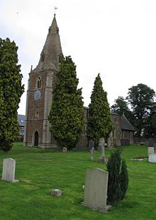
All Saints church, Slawston

Slawston is a village and civil parish in the Harborough district of Leicestershire, England, north-east of Market Harborough. According to the 2001 census the parish had a population of 143. The parish includes the deserted Othorpe village at grid reference SP770956.

The village is characterised by Slawston Hill at SP782941, 131 metres (430 ft) in height.

External links

Coordinates: 52°32′N 0°51′W / 52.533°N 0.85°W / 52.533; -0.85


Wikimedia Foundation. 2010.

Игры ⚽ Нужен реферат?

Look at other dictionaries:

  • Harborough — This is about the district of Harborough; there is also the Harborough constituency. Infobox UK district name = Harborough District status = District region = East Midlands admincounty = Leicestershire area = Ranked 79th 592.70 km² adminhq =… …   Wikipedia

  • List of places in Leicestershire — Location map+|Leicestershire caption = Some of the larger settlements of Leicestershire. float = right width = 350 places = Location map |Leicestershire label = Melton Mowbray long = 0.886 lat = 52.7661 background = white Location map… …   Wikipedia

  • Slade Green — infobox UK place country = England map type = Greater London region= London population= official name= Slade Green latitude= 51.4668 longitude= 0.1964 london borough= Bexley constituency westminster= Bexleyheath and Crayford post town= ERITH… …   Wikipedia

  • List of civil parishes in Leicestershire — Blaby= *Aston Flamville 1 *Blaby 1 *Town of Braunstone 1 *Cosby 1 *Countesthorpe 1 *Croft 1 *Elmesthorpe 1 *Enderby 1 *Glenfield (Glenfields) 1 *Glen Parva 1 *Huncote 1 *Kilby 1 *Kirby Muxloe 1 *Leicester Forest East 1 *Leicester Forest West 1… …   Wikipedia

Share the article and excerpts

Direct link
Do a right-click on the link above
and select “Copy Link”