- Stupava, Malacky District
Geobox | settlement
name = Stupava
category = Town
etymology =
official_name =
motto =
nickname =
image_caption =
symbol =
country = Slovakia
country_
state =
region = Bratislava
district = Malacky
municipality =
part =
river =
location =
elevation = 182
lat_d = 48
lat_m = 16
lat_s = 16
lat_NS = N
long_d = 17
long_m = 01
long_s = 54
long_EW = E
coordinates_type = region:SK_type:city
highest =
highest_lat_d =
highest_long_d =
lowest =
lowest_lat_d =
lowest_long_d =
area = 67.178
area_round = 3
population = 8433
population_date = 2005
population_density = auto
established =1158
established_type = First mentioned
date =
mayor = Ján Beleš
timezone =
map_background = Slovakia - background map.png
map_locator = Slovakia
map1 = Bratislava Region - outline map.svg
map1_background = Bratislava Region - background map.png
map1_locator = Bratislava Region
map1_size = 128
commons = Stupava
statistics = [http://www.statistics.sk/mosmis/eng/prvav2.jsp?txtUroven410106&lstObec508233&Okruhzaklad MOŠ/MIS]
website = [http://www.stupava.sk/ www.stupava.sk]
footnotes =Stupava ( _de. Stampfen; _hu. Stomfa) is a small
town in westernSlovakia . It is situated in theMalacky District ,Bratislava Region .Geography
The town is located in the
Záhorie lowland, under theLittle Carpathians , around 15 km north ofBratislava at an altitude of 182 metres. It has 8,400 inhabitants as of 2005 and has a land area of 67.17 km². Except the main part Stupava, it also has part Mást (German: "Maaßt"; Hungarian: "Mászt") located south of the town.History
However, traces of habitation go back to the Bronze Age, and the first known inhabitants were
Celts . The Romans built a military station as a part of the nearLimes Romanus on theDanube . The first written mention about the town was in 1269 in a document of the KingBéla IV of Hungary under name "Ztumpa". In the second half of the 13th century the now-ruinedPajštún Castle in the Little Carpathians was built. It was developing mainly as an agricultural and trading settlement. The name of the town comes from the pressing mills called "stupa" on the "Stupavský potok" brook, which were used for extracting oil from flax and hemp.Landmarks
*
Stupava Castle , originally built as awater castle , rebuilt in the 17th century to the Renaissance château, now serving as a retirement home
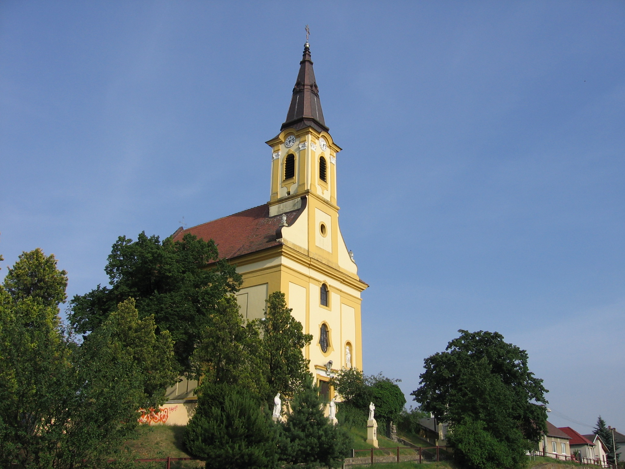
*Roman Catholic church in Baroque style from the first half of the 17th century
*Baroque-style Calvary chapel from the beginning of the 18th centuryDemographics
According to the 2001
census , the town had 8,063 inhabitants. 96.7% of inhabitants wereSlovaks , 1% Czechs and 0.5% Hungarians.cite web | title = Municipal Statistics | publisher = Statistical Office of the Slovak republic | url = http://www.statistics.sk/mosmis/eng/run.html | accessdate = 2007-11-06] The religious makeup was 70.4%Roman Catholics , 19.5% people with no religious affiliation and 2%Lutherans .References
External links
* [http://www.stupava.sk Official website]


Wikimedia Foundation. 2010.