- Bondoukou
Infobox Settlement
official_name = Bondoukou
other_name =
native_name =
nickname =
settlement_type =
motto =
imagesize =
image_caption =
flag_size =
image_
seal_size =
image_shield =
shield_size =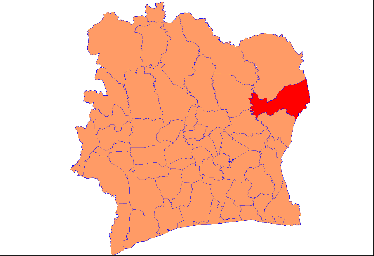
mapsize = 300px
map_caption = Bondoukou Department
mapsize1 =
map_caption1 =
image_dot_
dot_mapsize =
dot_map_caption =
dot_x = |dot_y =
pushpin_
pushpin_label_position =
pushpin_map_caption =Location within Côte d'Ivoire
pushpin_mapsize =
subdivision_type = Country
subdivision_name =Côte d'Ivoire
subdivision_type1 = Region
subdivision_name1 =Zanzan
subdivision_type2 = Department
subdivision_name2 = Bondoukou
subdivision_type3 = "Commune de plein exercice"
subdivision_name3 = Bondoukou
subdivision_type4 =
subdivision_name4 =
government_footnotes =
government_type =
leader_title = Dept. Prefect
leader_name = Goun François [ [http://www.rezoivoire.net/news/article/3306/ APA 8/9/2008] ]
leader_title1 = City Mayor
leader_name1 = Félix Kouakou Dapa
leader_title2 =
leader_name2 =
leader_title3 =
leader_name3 =
leader_title4 =
leader_name4 =
established_title =
established_date =
established_title2 =
established_date2 =
established_title3 =
established_date3 =
area_magnitude =
unit_pref =Imperial
area_footnotes =
area_total_km2 =
area_land_km2 =
area_water_km2 =
area_total_sq_mi =
area_land_sq_mi =
area_water_sq_mi =
area_water_percent =
area_urban_km2 =
area_urban_sq_mi =
area_metro_km2 =
area_metro_sq_mi =
population_as_of =2005
population_footnotes =
population_note =estimate
population_total =45,000
population_density_km2 =
population_density_sq_mi =
population_metro =
population_density_metro_km2 =
population_density_metro_sq_mi =
population_urban =
population_density_urban_km2 =
population_density_urban_sq_mi =
population_blank1_title =
population_blank1 =
population_density_blank1_km2 =
population_density_blank1_sq_mi =
timezone =GMT
utc_offset = +0
timezone_DST =
utc_offset_DST =
latd=8|latm=02 |lats=24 |latNS=N
longd=2 |longm=48 |longs=06 |longEW=W
elevation_footnotes =
elevation_m =343
elevation_ft =
postal_code_type =
postal_code =
area_code =
blank_name =
blank_info =
blank1_name =
blank1_info =
website =
footnotes =Bondoukou (var. Bonduku, Bontuku) is one of the fifty-eight departments of
Côte d'Ivoire , located in theZanzan Region, 420 km Northeast ofAbidjan . [ [http://www.rezoivoire.net/news/article/3306/ Conflit foncier dans le nord ivoirien : 8 morts et 21 blessés] . Places Bondoukou 424 km NE of capitol. APA : 8/9/2008 ] The administrative center and largest town of the Department is Bondoukou, while other towns includeBandolé ,Boudouye andTanbi .Bondoukou Department
Located at the northeast corner of the nation, Bondoukou Department borders
Ghana its neighbor to the north (Bouna Department) also bordersBurkina Faso . The area has long been in the path of trade routes, primarily for the transport of kola nut and gold from the forested south to the empires of theSahel . This importance has continued since the demarcation of borders under colonialism.Bondoukou town
Its central town, also named Bondoukou, is the Departmental capitol and capitol of
Zanzan Region. It in the southeast section of the Department, near the Ghana border and the Department of Tanda. Just across the border is the Ghanian town ofSampa . The town lies at the junction of the main A1 highway with roads toSorobango to the north andGhana to the east.History
Originally a Dyula trading center, the capital was conquered by the
Abron , anAkan people , in the early seventeenth century; it soon became the economic hub of theGyaaman kingdom. [ [http://www.rezoivoire.net/cotedivoire/patrimoine/131/le-royaume-abron-de-bondoukou.html Le royaume Abron de Bondoukou] , retrieved 2008-09-10] On 13 November 1888, the French officer Treich-Laplène signed a Protectorate treaty with the Abron king of Bondoukou, but the city fell toSamori between September 1895 and July 1897, and unlike nearby centers, he did not destroy the old city, but deposed the Abron in favour of the Muslim Dyula. The French incorporated the town intoFrench West Africa in 1899. At the end of the colonial period, the town had shrunk to large village, eclipsed by the nearby administrative center of Loti. In 1964 it was made administrative center for its region, and as since regained its status as the largest town, and is the seat of the Prefect governing Bouna, Tanda, and Bondoukou Departments. In 1980, the town came to prominence as the home of the first secondary school strikes by students opposed to thePDCI-RDA government. On the deviding line between government and rebel zones of control during theIvorian Civil War , Bondoukou became the main northeastern base of theUnited Nations Operation in Côte d'Ivoire (ONUCI). [ [http://arpanonair.blogspot.com/2008/04/bondoukou-cote-divoire-ii.html Bondoukou, Cote d'Ivoire] , reflections of UN Worker, 2008.]Population
The city had an estimated population of roughly 45,000 in 2005, [ [http://www.geocities.com/bondoukou2000/ bondoukou2000 website] , retrieved 2008-09-10.] and 60,000 in 2007. The town's role as a trade center has made it home to a diverse population. The walled old city ("Medina") includes ethnic neighbourhoods from far flung groups who originally came to the area as part of long distance trade networks. These include the Donzoso of the Donzo-Ouattara Dyula (related to the warrior Ouattara clans of the
Kong Empire ), the Jiminiso/Limamso of the Timité Dyula (which is home to the most prominent Muslim schools), theHausa merchant town quarter of Malagaso, as well as the mostly Christian Bambaraso quarter. Other traditional Muslim neighbourhoods, each with their own clan leader and identity, include the Karidyulaso, Kamagaya, Koko, Hwelaso, Neneya, and Koumalaso quarters. Neighborhoods, like the Abron "Mont Zanzan" area, lie outside the old city, which is bounded by theWamo river on the southwest. TheBaya river also borders the suburbs to the west. [As these neighbourhoods are important for the traditional parades, they are detailed in Arnut, pp. 121-150.] Often Muslim, each group centered around their ownMosque , earning the town the nickname "the city of a thousand mosques." [ "la ville aux mille mosquées" [http://www.geocities.com/bondoukou2000/ bondoukou2000 website] ] Because of the influence of populations from the north, many Bondoukou mosques are of the Sudanic architectural style, more common northern cities likeTimbuktu orDjenne . [ [http://www.aodl.org/bondoukou.php "Mosques of Bondoukou" photo collection] : Ray Silverman (1987), African Online Digital Library] This further led to the town's importance as a center of religious learning. [Drinking the Word of God, 2002] The French introduced Christianity, and the town is also the seat of theRoman Catholic Diocese of Bondoukou . Prominent buildings include the house used by French explorerBinger ,Samori 's headquarters, the old market building which houses the "Bondoukou Museum of Art and Traditions" ("Musée des Arts et des Traditions"), and the Limamisso and Kamagaya mosques. Outside the old town, major neighbourhoods include "Mont Zanzan", "Lycée" , "TP", and "Camp Militaire." Outside the town, historic sites include anAkan ceremonial center atSoko (just east), pottery works atMontiamo , the treasure house of theAbron war-leader atWéletchéi (just north), and the French colonial era plantations atGoli (just west). The town is also know for cultural events, including theyam harvest festival, and theSakaraboutou (warriors' parade) andKourouby womens' parade (both celebrated at the end ofRamadan ). [Karel Arnaut, [http://www.africana.ugent.be/index.php?id=9&type=file Performing displacements and rephrasing attachments.Ethnographic explorations of mobility in art, ritual, media, and politics] . Chapter II: ‘Sakaraboutou is a Bondoukou custom’: an investigation into ritual spaces and performative positions. pp.115-202, Doctoral Dissertation, University of Ghet (2004).
"la ville aux mille mosquées" [http://www.geocities.com/bondoukou2000/tourisme.htm bondoukou2000 website] & [http://www.geocities.com/bondoukou2000/tradition.htm "Traditons"] on the same site.] Apart from Diola, Mande, and Akan peoples, the Department is home to a patchwork of ethinc groups including the Nafaanra,Koulango , andLobi .Administration
In
1978 [Loi no 78-07 du 9 janvier 1978] Bondoukou was made one of the 27 "Communes de plein exercice" or self-governing towns in the nation.ervices
The town is home to several schools (from primary to post-secondary), a regional hospital and an Ivorian second division Football club,
Scaraboutou sports de Bondoukou . Bondoukou has an airport withAITA code "BDK".Rural ethnic conflict
The 1990s and 2000s saw periodic ethnic conflict between the Bondoukou
Kulango farmers (aGur people who form theNkurang ofGhana ) [ [http://www.ethnologue.com/show_language.asp?code=kzc Ethnologue code "kzc"] ] and theLobi people , recently migrated from Bouna Department. Conflicts between the two ethnic groups date from at least 1993, when clashes erupted over attempts by Lobi pastoralists to resettle in the area. [ [http://www.int.iol.co.za/index.php?set_id=1&click_id=86&art_id=nw20080908151726585C250460 Ethnic violence flares up in Ivory Coast] , IOL News, September 08 2008.] Clashes and counter clashes have killed several dozen people in the villages of Abouabou, Gonzaqueville, and Marahui with escalations taking place during theIvorian Civil War in 2002 and in 2008. [ [http://www.apanews.net/apa.php?page=show_article_eng&id_article=74712 Côte d’Ivoire – Land dispute. Land dispute leaves 8 dead, 21 injured in northern Côte d’Ivoire] , APA news 8 September 2008 ] The informal ceasefire line of the Civil War ran through Bondoukou Department, leaving most of Zazan (excluding Bouna Department) under central government control.References
* [http://www.fallingrain.com/world/IV/38/Bondoukou.html Bondoukou (town), fallingrain.com] .
*Muhammad, Akbar. The Samorian Occupation of Bondoukou: An Indigenous View. The International Journal of African Historical Studies, Vol. 10, No. 2 (1977), pp. 242-258.
* [http://museum.msu.edu/exhibitions/Virtual/DrinkingtheWordofGod/Bondoukou.html Drinking the Word of God. Expressions of Faith and the Search for Well-Being in Two West African Communities. March 18, 2001 - January 20, 2002] . Short history and photo gallery, Michigan State University, retrieved 2008-09-10.
*Portions of this article were translated from the French language Wikipedia article , 2008-09-10.External links
* [http://www.geocities.com/bondoukou2000/ Bondoukou 2000 site (French language)]
* [http://www.lib.utexas.edu/maps/ams/west_africa/txu-oclc-6595921-nc30-15.jpg1955 US Military Map of Bondoukou region] .

Wikimedia Foundation. 2010.