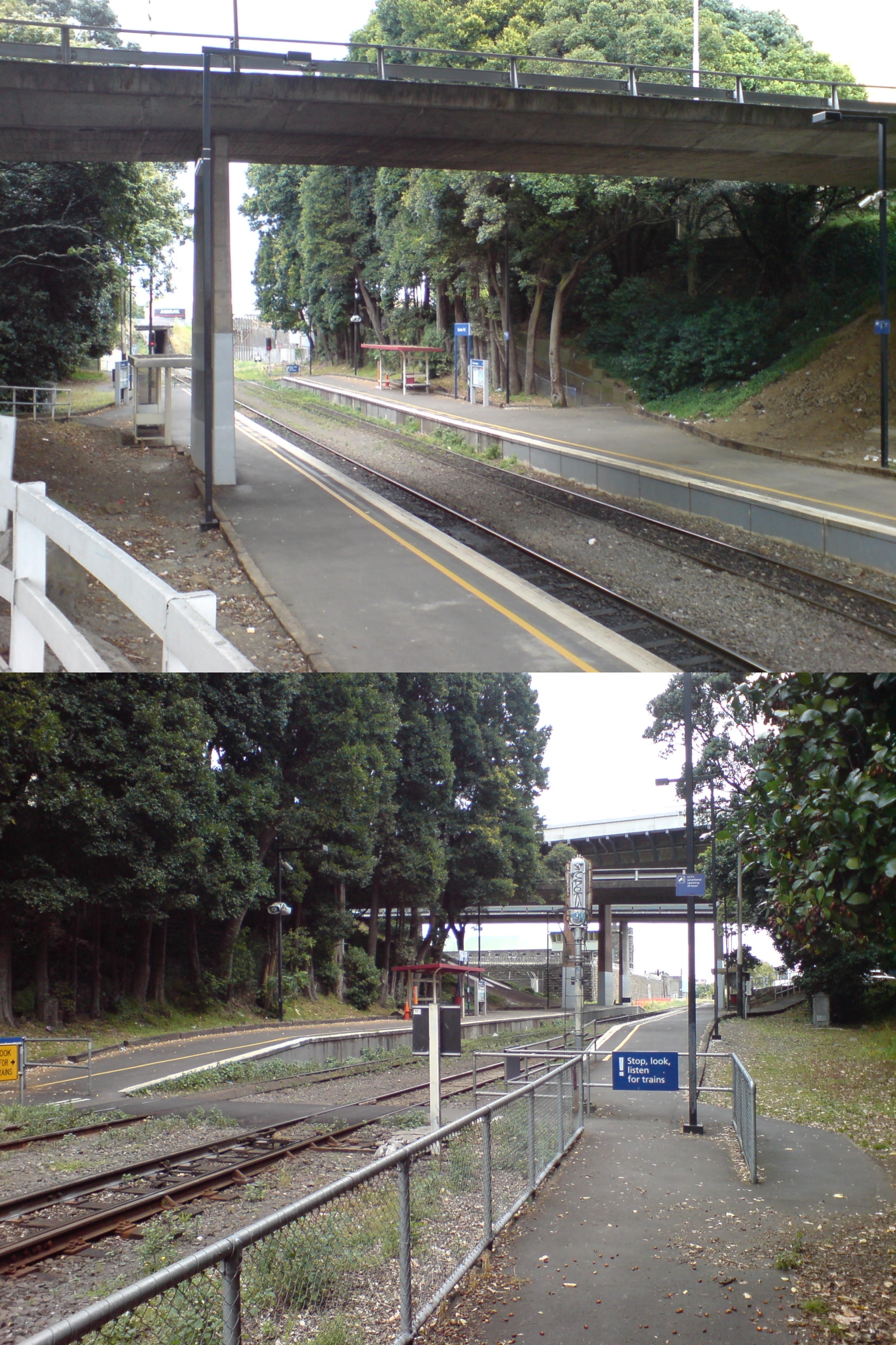
Boston Road Train Station
- Boston Road Train Station
Infobox Station
name=Boston Road Train Station
type=MAXX Urban rail

image_size=
image_caption=The station in 2007. Above: looking east. Below: looking west.
address=Auckland City
coordinates=coord|36|52.0|S|174|46.1|E|region:NZ-AKL_type:railwaystation
line=Western Line
other=
structure
platform=Side platform
levels=1
tracks=Mainline (2)
as of 2008 still singletracked to the east
parking=No
bicycle=
baggage_check=
passengers=
pass_year=
pass_percent=
pass_system=
opened=1964
closed=
rebuilt=1993
electrified=No
ADA=
code=
owned=ONTRACK and ARTA
zone=
former=
services=s-note|text=ONTRACK
mpassengers=
Boston Road Railway Station is on the Western Line of the Auckland Suburban Railway Network, near Mt Eden Prison, St Peter's College [See article on St Peter's College for an account of the origin of the Boston Road Train Station.] [Rick Maxwell, "St Peter's College, Auckland", Simerlocy Press, Auckland, 2008, pp. 7, 8, and 29.] and Auckland Grammar School. The station is directly under State Highway 1, one of the busiest motorways in New Zealand.
Until double-tracked to Mt Eden in 2005, morning trains ran on the right through the loop and afternoon trains on the left, avoiding the need for St Peter's and Grammar pupils to cross the line.
History
* 1964: The station was created as a stopping place with only one daily service each way on school days. This stopping place was provided for students who travelled to St Peter's College and Auckland Grammar School by train ["Railway Stations of Auckland's Western Line" (2004) by Sean Millar] .]
* 1993: The station became a full station, with all trains stopping here. This occurred because the new ex-Perth trains required new platforms, so unless the station was upgraded it would have to close. The council decided to upgrade the platforms and open the station to all passengers. References
Wikimedia Foundation.
2010.
Look at other dictionaries:
Mt Eden Train Station — Infobox Station name=Mt Eden Train Station type=MAXX Urban rail image size= image caption= address= coordinates= line=Western Line other= structure= platform=1 levels=1 tracks=2 parking=No bicycle=No baggage check=No passengers= pass year= pass… … Wikipedia
Mount Eden Train Station — Mt Eden Railway Station MAXX urban rail Station statistics Coordinates … Wikipedia
Train station — Rail transport Operations Track Maintenance High speed Gauge Stations … Wikipedia
Chiswick Road (MBTA station) — CHISWICK ROAD Station statistics Address Commonwealth Avenue and Chiswick Road Brighton, Massachusetts Coordinates … Wikipedia
Dean Road (MBTA station) — DEAN ROAD Station statistics Address Intersection of Beacon Street and Dean Road, Brookline Coordinates … Wikipedia
Boston — This article is about the capital of Massachusetts. For other uses, see Boston (disambiguation). Boston City Clockwise: Skyline of Back Bay seen from the … Wikipedia
Boston Garden — Infobox Stadium stadium name = Boston Garden| nickname = The Garden location = 150 Causeway Street Boston, Massachusetts, 02114 broke ground = opened = 1928 closed = September 28, 1995 demolished = November, 1997 owner = Stephen Schmitz operator … Wikipedia
Road Rules: South Pacific — Format Reality Created by Bunim/Murray Productions Country of origin United States Production Running time … Wikipedia
Boston transportation — The Boston transportation system includes roadway, rail, air, and sea options for passenger and freight transit. The Massachusetts Port Authority (Massport) operates the Port of Boston, which includes a container shipping facility in South Boston … Wikipedia
Boston and Lowell Railroad — Infobox SG rail railroad name=Boston and Lowell Railroad system map size=300 map caption=Map of the Southern Division as it was in 1887, just before it was leased by the Boston and Maine Railroad, including the original Boston to Lowell mainline … Wikipedia

