- Rumia
Infobox Settlement
name = Rumia
imagesize = 250px
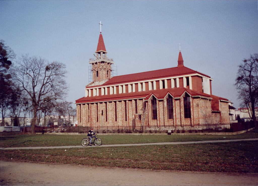
image_caption = Janowo church

image_shield = POL Rumia COA.svg
pushpin_
pushpin_label_position = bottom
subdivision_type = Country
subdivision_name = POL
subdivision_type1 = Voivodeship
subdivision_name1 = Pomeranian
subdivision_type2 = County
subdivision_name2 = Wejherowo
subdivision_type3 =Gmina
subdivision_name3 = Rumia (urban gmina)
leader_title = Mayor
leader_name = Elżbieta Jolanta Rogala-Kończak
established_title = Established
established_date =13th century
established_title3 = Town rights
established_date3 = 1954
area_total_km2 = 32.86
population_as_of = 2006
population_total = 44497
population_density_km2 = auto
population_metro = 130000
timezone = CET
utc_offset = +1
timezone_DST = CEST
utc_offset_DST = +2
latd = 54 | latm = 34 | lats = 0 | latNS = N | longd = 18 | longm = 24 | longs = 0 | longEW = E
postal_code_type = Postal code
postal_code = 84-230
area_code = +48 58
blank_name = Car plates
blank_info = GWE
website = http://www.rumia.eu Rumia [IPA-pl|'|r|u|m|j|a] (Kashubian/Pomeranian: "Rëmiô", _de. Rahmel) is a town in theEastern Pomerania region of north-westernPoland , with some 43,000 inhabitants. It is a part of theKashubian Tricity (Rumia,Reda ,Wejherowo ) and a suburb part of the metropolitan area of theTricity . It has been situated in theWejherowo County inPomeranian Voivodeship since 1999; previously it was inGdańsk Voivodeship (1975-1998). Traditionally, Rumia is related toKashubia . It is connected by well-developed railway and highway connections to theTricity , an urban agglomeration of over 1 million inhabitants on the coast ofGdańsk Bay .History
The village of Rumia was first mentioned in
1224 when it was awarded by Świetopełk II, later duke ofEastern Pomerania to theCistercian convent inOliwa (today part ofGdańsk ). At the time it was populated byKashubian s.Fact|date=February 2007 The name of Rumia was applied also to the neighbourhoods of Janowo (=John's Place) and Biała Rzeka (=White River). In1285 Mestwin II , duke of Pomerania stopped here to issue official documents. Rumia was owned by theRoman Catholic Church until the first partition of Poland in1772 , when it was annexed by the Prussian government. It belonged toWest Prussia until1871 when it became part ofImperial Germany .At the end of
World War I , it became a part of thePomeranian Voivodeship of the newly re-established Polish state. In the late1920s , the nearby village ofGdynia was turned into a city and one of the biggest seaports in the region. The city grew very fast and so did the price of land. Because of that, many people settled in the village of Rumia and its vicinity. Zagórze, Kazimierz and Łężyce, which are today parts of Rumia, were originally separate villages, and were joined with Rumia in1934 to form Rumia Rural Commune. By1934 , Rumia had become an importantsuburb ofGdynia (population of 12,000 in1939 ), located approximately 10 km from the city centre and well-connected with it through a railway link. A small military airfield, home of two squadrons of the Coast Defence Escadrille (based in Puck) was opened to civilian planes on 1 May 1936. The airport serviced international routeGdynia -Copenhagen and domestic routeGdynia -Warszawa and by 1 January 1939, the number of passengers using it rose to over 3000 a year. The airfield was also the main base of theGdynia -basedglider club.During the Invasion of Poland, Rumia was a site of heavy fighting. It was a flanking position of the main Polish defence line at Kępa Oksywska. Two military cemeteries are located in the area. During
World War II , the town was occupied byNazi Germany , which annexed it to its province ofDanzig-West Prussia and renamed to its German name (Rahmel). Soon after taking the town, in September and October 1939,SS and SD units started a terror campaign.Fact|date=February 2007 The first of a series ofwar crime s happened on9 September , 1939 when theWehrmacht shot 21 Polish POWs from the local self-defence units.Fact|date=February 2007 Total number of victims of the following crimes is unknown, although various historians place the death toll at approximately 3000.Fact|date=February 2007 Most of the victims were either executed at a nearby mass execution site inPiaśnica or sent toStutthof concentration camp . Approximately half of the pre-war inhabitants of the town were expelled in1940 and1941 , mostly to theGeneral Government . The town was also a place of internment for several thousandPOW s, mostly from theUnited Kingdom ,France andItaly . Aforced labour camp and an aircraft assembly plant were located in the town's vicinity. In1945 , shortly before liberation by theRed Army , the local airfield was destroyed by an RAF bombing raid.In
1945 , the town was transferred back to thePomeranian Voivodeship . It became a city in1954 when a few other villages (Zagórze, Biała Rzeka, Szmelta and Janowo) were joined with Rumia. In2001 , the village of Kazimierz was also included.Transportation
Rumia is well connected through a 2-lane highway that leads from
Wejherowo toGdynia and from there by Circular Highway toGdańsk . There is a plan to extend the Circular from Gdynia to beyond Wejherowo.The Szybka Kolej Miejska (Urban Fast Train) makes two stops in the city, connecting it to Wejherowo, Gdynia, and beyond. The stops are Rumia and Rumia Janowo. There is also network of city buses that also offers connections to
Wejherowo andGdynia .Population
*1960: 15,100 inhabitants
*1970: 23,300 inhabitants
*1975: 26,000 inhabitants
*1980: 26,700 inhabitants
*1990: 37,500 inhabitants
*1995: 40,000 inhabitants
*1998: 40,200 inhabitants
*2003: 43,000 inhabitants
*2004: 43,700 inhabitants
*2005: 44,900 inhabitantsPeople from Rumia
Erika Steinbach , politicianExternal links
* [http://susi.e-technik.uni-ulm.de:8080/Meyers2/hiresBilder/werk/meyers/band/12/seite/0541a/meyers_b12_s0541a.jpg1896 Map Rahmel West-East Prussia Meyers Lexikon]
* [http://www.rumia.pl/ Official Rumia page] pl icon
* [http://mapa.szukacz.pl/?x=460936&y=746475&t=WYBRANY%20PUNKT&z=3 Street maps of Rumia, from mapa.szukacz.pl]


Wikimedia Foundation. 2010.