- Gütersloh (district)
Infobox German district
name=Gütersloh
state=North Rhine-Westphalia
capital=Gütersloh
regierungsbezirk=Detmold
area=967.18
population=354,057
population_as_of=31/12/2006
density=366
carsign=GT
url=http://www.kreis-guetersloh.de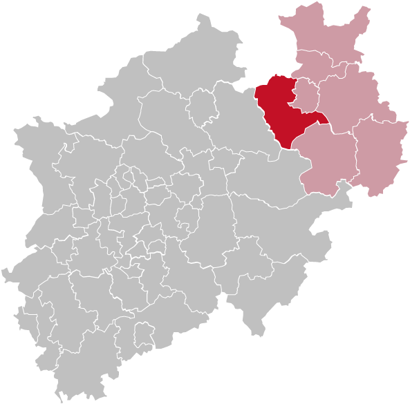
Gütersloh (IPA2|ˈgyːtɐsloː) is a Kreis (
district ) in the north-east ofNorth Rhine-Westphalia ,Germany . Neighboring districts are Osnabrück, Herford, district-freeBielefeld ,Lippe , Paderborn, Soest and Warendorf.History
It was created in
1973 in the reorganization of the districts inNorth Rhine-Westphalia , when the previous districts of Halle and Wiedenbrück were merged. Also the districts Bielefeld, Paderborn, Beckum und Warendorf had to cede parts of their area to the newly formed district. The precursor districts were created in1816 after the newPrussia n province ofWestphalia was established.Today, the district Gütersloh has one of Germanys largest exile communities of
Assyrians (also known asSyriacs ,Arameans andChaldeans ).Geography
The east of the district is covered by the
Teutoburg Forest , which also contains the highest elevation of the district, the "Hengeberg" (316m). In the west there is the source of the Ems river. The Ems valley also contains the lowest point of the district, nearHarsewinkel with 56m.Coat of arms
Towns and municipalities
Economy
Some important companies are located in the district of Guetersloh:
*Beckhoff Automation Technology
*Bertelsmann Media
*Claas Combine harvesters
* Gerry Weber Fashion
*Miele Consumer electronic goods
* [http://www.nobilia.de Nobilia International] Kitchens
*Storck Candies
*Telefonica Internet ServicesExternal links
* [http://www.kreis-guetersloh.de Official website] (German)
Wikimedia Foundation. 2010.