- South Fremantle, Western Australia
Infobox Australian Place | type = suburb
name = South Fremantle
city =City of Fremantle
state = Western Australia

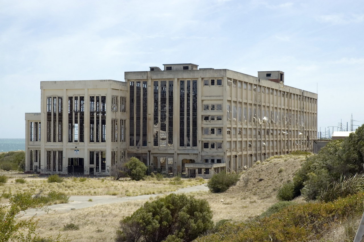
caption = South Fremantle Power Station
lga =City of Fremantle
postcode = 6162
est =
pop = 2,794 (2006 Census)
area =
propval =
stategov =
fedgov =Division of Fremantle
near-nw =
near-n = Fremantle
near-ne = Fremantle
near-w =
near-e = Beaconsfield
near-sw =
near-s = North Coogee
near-se = Hamilton Hill
dist1 =
location1=South Fremantle is a suburb of
Perth, Western Australia , located within theCity of Fremantle . Its postcode is 6162.History
The first development in the area may have been when Richard Goldsmith Meares who established a lime burning kiln in 1831. Meares had arrived at the
Swan River Colony withThomas Peel in the previous year. [cite web|url=http://register.heritage.wa.gov.au/PDF_Files/10180%20Lime%20Kilns(I-AD).PDF|title=Assesment documentation - Three Lime Kilns, Cockburn|work=Heritage Council of Western Australia|accessdate-2007-02-02]As the area was adjacent to the relatively safe harbour of Owen's Anchorage in
Cockburn Sound , the area began to be used as an alternative destination point for ship arrivals.In the late 1890s, a railway was built from Fremantle to Robb Jetty. At that time, an abattoir was built for slaughter of livestock arriving from the north-west of the state including the Kimberley Region. Livestock were unloaded from from the ships onto a jetty. Extensive pasturing for the animals as well as small market gardens were established in the region around the abattoir. The Coogee Hotel was built in 1901 and in 1903 the railway was extended to
Woodman Point . Commercial lime kilns were established during this period to provide for the construction boom and population growth which had been brought about by gold discoveries.The area steadily became the centre of much of Perth's heavy industry and comprised the coal fired power station, railway marshalling yards, abattoir as well as numerous skin drying sheds. From the 1980s however, pressures brought on by demands for residential housing began a process of removal of the various facilities.
;Railway marshalling yardsA large WAGR
marshalling yard withsignal box tower built in the 1960s during thestandard gauge railway line project from Kalgoorlie to LeightonThe yard was decommissioned in the
Westrail era in the 1990s.South Fremantle is also referred to as the Dirty South by local gang members.;Robb Jetty AbattoirClosed in 1994 with the jetty itself dismantled in the 1960s. The chimney is the only remaining part of the large complex of buildings which included offices, holding yards, freezer and chiller facilities. The chimney is listed in the State Register of Heritage Places. [cite web|url=http://register.heritage.wa.gov.au/PDF_Files/R%20-%20A-D/Robb%20Jetty%20Chimney%20(I-AD).PDF|title=Assesment documentation - Robb's Jetty chimney|work=Heritage Council of Western Australia|accessdate-2007-02-02]
;Power stationIn September 1985, the South Fremantle Power Station closed after 34 years service and its four chimney stacks were demolished.
References
Wikimedia Foundation. 2010.
