- Minera Limeworks
-
Minera Lime Company 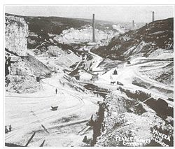
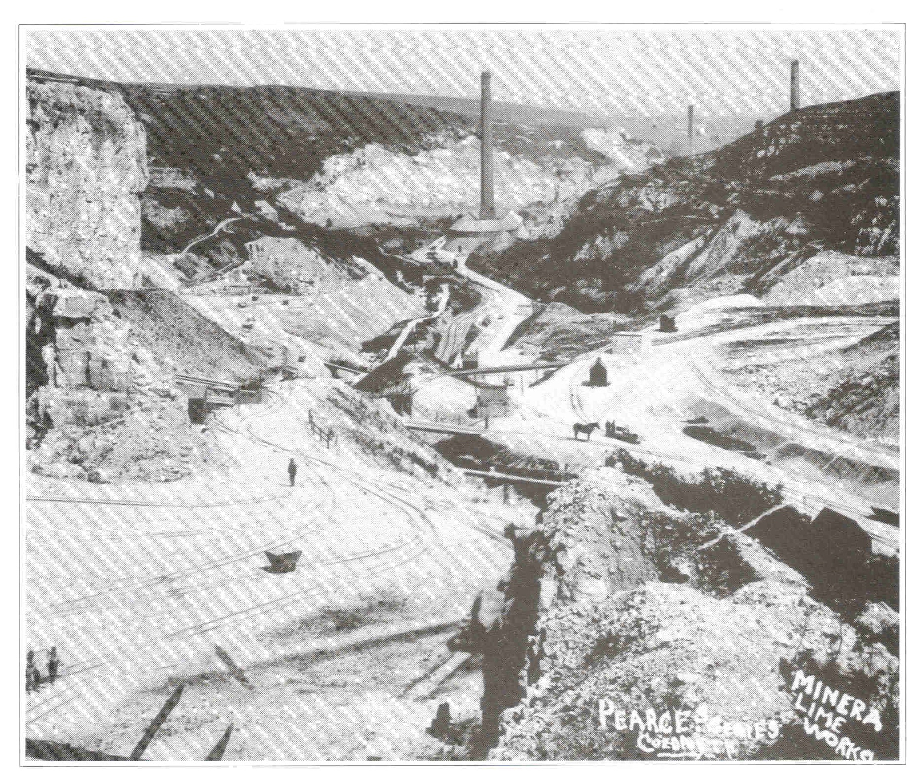
The Minera Limeworks, 1910Location Country Wales Owner Company Lafarge Aggregates Production Products Lime History Opened 1852 Active 1852-1972 Closed 1993 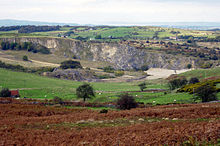 Abandoned quarry workings
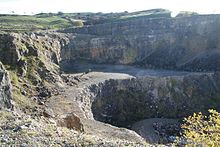 The last worked face at the works.
The Minera Limeworks were extensive lime quarries and kilns at Minera in Wrexham, Wales. It was located at grid reference SJ253520, near the villages of Gwynfryn, Minera, and Coedpoeth and was locally referred to as The Calch[1].
Contents
History
The Minera Limeworks were once the largest lime workings in the north of Wales. Limeburning at Minera is recorded from as early as 1620[2] but the Minera Lime Company was established in 1852. The total output from the Minera area quarries was estimated, in 1859, to be around 300,000 tons, with 200,000 tons of this converted to lime.
The Minera Lime Company became a limited company in 1865, and this prompted some heavy cash injection into the works. Using this money, the company erected a "Hoffmann kiln". Originally destined for brickmaking, it was soon converted to limeburning. This kiln still exists and is one of three that were purpose-built for lime burning left in the UK: another is located at Langcliffe in Yorkshire, another is located at Llanymynech Limeworks.
The quarries had their own steam locomotive and hundred of open coal wagons and closed lime wagons at its peak. Hornby Railways and Dapol both have model wagons detailing the Minera Lime Co. It also had extensive kilns, still there to this day. The works closed in 1972 and the Wrexham and Minera Branch railway lines were pulled up at around the same time.
Current usage
Blasting and quarrying of limestone, used for road building materials, continued at the site until 1993.
For many years since closure, the quarry has served as storage for road building materials, and a tipple for them was built, but was soon abandoned. In 2004-05 the quarry was subject to a clean up operation, where all the materials were taken and the whole area flattened. Tarmac (a supplier of materials to the building trade) who have taken interest in the site have been taking several core samples and have apparently found the quarry to still be a viable source of lime.
Lafarge Aggregates currently own the site, following their take over of Redland plc and have erected large amounts of fencing around most of the site as well as signage advising to stick to signed footpaths, restricting movement around the quarry for health and safety purposes. Lafarge have no interest in resuming quarrying operations at the site here.
The Minera Quarry Trust[3] is currently in negotiation with Lafarge about the future of the site. Minera Quarry Trust was established in 2005 with the explicit aim of conserving the former quarry site for the benefit of the public. Since then the trust has made significant progress in developing a plan of action for the site that encompasses both short term improvements and long term sustainability for the site. The Trust is working in partnership[4] with North Wales Wildlife Trust to develop the project and has received political endorsement from Wrexham County Borough Council.
The quarry is also popular with local potholers, as there is a cave system[5] starting in the quarry linked to many underground rivers.
See also
References
- ^ Minera History.com. "'The Calch' - Minera Limeworks". http://www.minerahistory.com/the_calch.html. Retrieved 19 October 2010.
- ^ "Minera Limeworks". http://www.brocross.com/industrial%20history/welsh%20limekilns/flintshire/minera%20limeworks.htm. Retrieved 19 October 2010.
- ^ "Minera Quarry Trust". http://mineraquarry.org.uk/. Retrieved 19 October 2010.
- ^ BBC News (9 March 2010). "Quarry caves near Wrexham may open to tourists". http://news.bbc.co.uk/1/hi/wales/8556265.stm. Retrieved 19 October 2010.
- ^ Geological Conservation Review. "Minera Caves". http://www.thegcr.org.uk/Sites/GCR_v12_C06_Site0568.htm. Retrieved 19 October 2010.
External links
Categories:- Wrexham County Borough
- Defunct mining companies


Wikimedia Foundation. 2010.