- Unga, Alaska
-
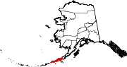
Coordinates: 55°11′03″N 160°30′18″W / 55.18417°N 160.505°W Unga is a ghost town on Unga Island in the Aleutians East Borough of the U.S. state of Alaska,[1] about 2 miles west of Sand Point. The total length of the island is 15 miles (24 km).[2] Unga's altitude is 59 feet (18 m).[1]
History
It was settled by Aleuts in 1833 and was named Delarov, referring to Evstratii Ivanovich Delarov of the Shelikhov-Golikov Company,[3][4] with a population of 116. The village was reported as Ougnagok by F. P. Lutke in 1836. Its first post office was established in 1888 and in 1890 Apollo Mining Co. was established. In 1894, its name was changed to Unga. The post office was closed in 1958. In 1969, the last family left Unga. Most of the people who left Unga moved to Sand Point.[1]
The population was 116 in 1833; 185 in 1880; 159 in 1890; 108 in 1910; 313 in 1920; 150 in 1930; 152 in 1939; and 107 in 1950. The Ounga post office, established in 1888; changed its name to Unga in 1894; discontinued in 1958.[1]
References
- ^ a b c d U.S. Geological Survey Geographic Names Information System: Unga, Alaska
- ^ U.S. Geological Survey Geographic Names Information System: Unga Island
- ^ U.S. Geological Survey Geographic Names Information System: Delarof Harbor
- ^ Long-Forgotten Greek Alaskan, Preservation of American Hellenic History
External links
Municipalities and communities of Aleutians East Borough, Alaska Cities Akutan | Cold Bay | False Pass | King Cove | Sand Point
CDP Unincorporated
communitiesBelkofski | Ikatan | Morzhovoi
Ghost towns Pauloff Harbor | Pirate Cove | Sanak | Squaw Harbor | Unga
Categories:- Geography of Aleutians East Borough, Alaska
- Ghost towns in Alaska
- 1833 establishments
- 1958 disestablishments
- Southwest Alaska geography stubs

Wikimedia Foundation. 2010.