- Östermalm (borough)
-
Coordinates: 59°20′17″N 18°05′12″E / 59.33814°N 18.08672°E
Östermalm 
Country:  Sweden
Municipality:  Stockholm
Municipal part: Innerstaden Area: 18.000 km² Population: 61,253 (2004) Established: 2007 Website: Östermalm on
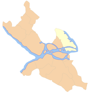
Stockholm siteMap 
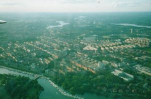
Östermalm is a so called borough (stadsdelsområde) in central Stockholm, named after the dominating district.
Overview
Except Östermalm (proper) there are four districts in the borough: Djurgården, Hjorthagen, Ladugårdsgärdet (popularly known as Gärdet), and Norra Djurgården. Note that a portion of northern Östermalm is organized in Norrmalm borough. The population as of 2004[update] is 61,253 on an area of 18.00 km², which gives a density of 3,402.94/km².
See also
External links
 Media related to Östermalm at Wikimedia Commons
Boroughs of Stockholm 
- Älvsjö
- Bromma
- Enskede-Årsta-Vantör
- Farsta
- Hägersten-Liljeholmen
- Hässelby-Vällingby
- Kungsholmen
- Norrmalm
- Östermalm
- Rinkeby-Kista
- Skärholmen
- Skarpnäck
- Södermalm
- Spånga-Tensta

- Stockholm Municipality
- (Innerstaden
- Söderort
- Västerort)
- Stockholm Urban Area
- Metropolitan Stockholm
Coordinates: 59°20′30″N 18°05′20″E / 59.34167°N 18.08889°E
Categories:- Boroughs of Stockholm
- Stockholm County geography stubs
Wikimedia Foundation. 2010.
