Osenberge

Osenberge
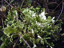
The lichen Cladonia foliacea in the Osenberge

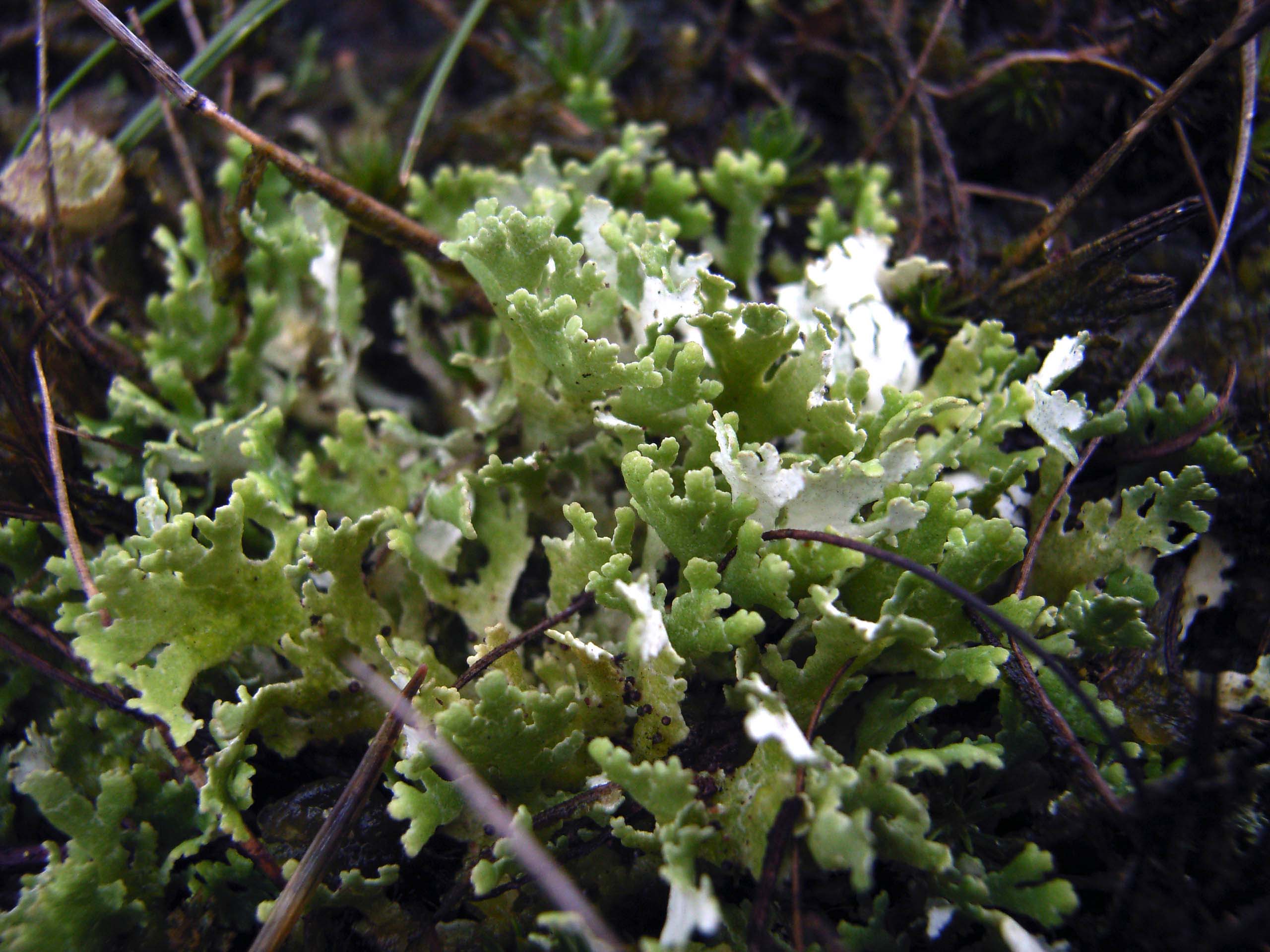
The Osenberge is a dune region up to 23 m above sea level high in the district of Oldenburg, Lower Saxony (Germany).

Geographical location

The rolling dunes of the Osenberge are located in the northwest of the Wildeshausen Geest Nature Park, on average about 14 km (as the crow flies) south of Oldenburg, directly south of Sandkrug and immediately northwest of Sandhatten, both of which lie within the municipality of Hatten. To the west the Osenberge are passed by a section of the River Hunte in a south-north direction; to the northwest lies Wardenburg.

The Osenberge are the highest elevations in the region, for example the town of Oldenburg is only about 5 to 7 m above sea level. Its two highest peaks, both 23 m above NN high, are the Kistenberg south of Sandkrug and the Gierenberg northwest of Sandhatten. From the latter so-called hill there is a good view of the valley of the Hunte. Within the forested or wooded area of Barneführerholz the Osenberge are mainly covered by old pines.

History

The sand-rich landscape of the Osenberge was formed by the glaciers of the last ice age (Weichselian glaciation) through glacial bursts and outwash.

Legend has it that dwarves used to live in the Osenberge. In addition the legend of Oldenburger Wunderhorn, a medieval drinking horn from Oldenburg, now in Copenhagen, is set in the Osenberge.

Access

The Osenberge can be reached on town bus line no. 315 operated by the Oldenburg Transport and Water Company (Oldenburger Verkehr und Wasser GmbH); alight in Sandkrug at the Mühlenweg bus stop.


Coordinates: 53°1′34.3″N 8°17′3.1″E / 53.026194°N 8.284194°E / 53.026194; 8.284194


Wikimedia Foundation. 2010.

Игры ⚽ Поможем решить контрольную работу

Look at other dictionaries:

  • Osenberge — Die Flechte Cladonia foliacea in den Osenbergen Die Osenberge sind eine bis 23 m ü. NN hohe Dünenlandschaft im Landkreis Oldenburg, Niedersachsen (Deutschland) …   Deutsch Wikipedia

  • Liste der Berge und Erhebungen in Niedersachsen — Die Liste der Berge und Erhebungen in Niedersachsen zeigt eine Auswahl hoher bzw. bekannter Berge und Erhebungen im deutschen Bundesland Niedersachsen (nach Höhe geordnet): Name, Höhe in Metern über NN, Lage (Landkreis/Landschaft); drei ???… …   Deutsch Wikipedia

  • List of mountains and hills of Lower Saxony — Wurmberg, highest mountain in Lower Saxony; View from the Brocken Railway line This List of mountains and hills in Lower Saxony shows a selection of high or well known mountains and hills in the German state of Lower Saxony (in order of height).… …   Wikipedia

  • Liste von Bergen und Erhebungen in Niedersachsen — Wurmberg, höchster Berg von Niedersachsen; Blick von Brockenbahntrasse Die Liste von Bergen und Erhebungen in Niedersachsen zeigt eine Auswahl von Bergen, Erhebungen und Bergausläufern im deutschen Bundesland Niedersachsen − nach Höhe in Meter… …   Deutsch Wikipedia

  • Charlottendorf West — Wappen Deutschlandkarte …   Deutsch Wikipedia

  • Hatten-Sandkrug — Ortseingang von Sandkrug Sandkrug (I, II und III) ist ein Ortsteil der Gemeinde Hatten im Landkreis Oldenburg, Niedersachsen. Inhaltsverzeichnis 1 Geografie und Verkehrsanbindung 2 …   Deutsch Wikipedia

  • Westerholt (Wardenburg) — Wappen Deutschlandkarte …   Deutsch Wikipedia

  • Hatten — Infobox German Location Art = Gemeinde Name = Hatten Wappen = Hatten.png lat deg = 53 | lat min = 00 | lat sec = 30 lon deg = 08 | lon min = 19 | lon sec = 00 Bundesland = Niedersachsen Landkreis = Oldenburg Höhe = 34 Fläche = 103.44 Einwohner =… …   Wikipedia

  • Hatten — Wappen Deutschlandkarte …   Deutsch Wikipedia

  • Hunte — Die Hunte in der Wildeshauser GeestVorlage:Infobox Fluss/KARTE fehlt Daten …   Deutsch Wikipedia

Share the article and excerpts

Direct link
Do a right-click on the link above
and select “Copy Link”