Ohio Falls Station

Ohio Falls Station
Ohio Falls Station
Ohio Falls Station is located in Kentucky
{{{alt}}}
Location of Ohio Falls Station
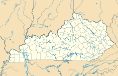
Country United States
Location Louisville, Kentucky
Coordinates 38°12′N 85°52′W / 38.20°N 85.87°W / 38.20; -85.87Coordinates: 38°12′N 85°52′W / 38.20°N 85.87°W / 38.20; -85.87
Commission date 1926
Owner(s) Louisville Gas and Electric
Power station information
Generation units 8
Power generation information
Installed capacity 101 MW

Ohio Falls Station is a hydroelectric power station operated by Louisville Gas and Electric and located 3 miles west of Downtown Louisville, Kentucky. In 2005 its megawatt capacity was expanded from 80 to 101.


See also

External links

Official website


Wikimedia Foundation. 2010.

Игры ⚽ Поможем решить контрольную работу

Look at other dictionaries:

  • Ohio Statehouse — U.S. National Register of Historic Places U.S. National Historic Landmark …   Wikipedia

  • Ohio high school athletic conferences — This is a list of high school athletic conferences in Ohio.[1] Because the names of localities and their corresponding high schools do not always match and because there is often a possibility of ambiguity with respect to either the name of a… …   Wikipedia

  • Ohio River Islands National Wildlife Refuge — The Ohio River Islands National Wildlife Refuge (ORINWR) is a National Wildlife Refuge (NWR) in non contiguous sites consisting of islands along 362 miles (583 km) of the Ohio River, primarily (85% of acreage)[1] in the U.S. state of West… …   Wikipedia

  • Ohio State Route 55 — State Route 55 Route information Maintained by ODOT Length: 38.98 mi[1 …   Wikipedia

  • Ohio Country — The Ohio Country with battles and massacres between 1775 and 1794 The Ohio Country (sometimes called the Ohio Territory or Ohio Valley by the French) was the name used in the 18th century for the regions of North America west of the Appalachian… …   Wikipedia

  • Fourteenth Street Bridge (Ohio River) — Fourteenth Street Bridge The Fourteenth Street Bridge, as viewed from the Clarksville waterfront Other name(s) Ohio Falls Bridge Carries CSX Transportation …   Wikipedia

  • Youngstown, Ohio — Youngstown redirects here. For other uses, see Youngstown (disambiguation). Coordinates: 41°5′47″N 80°38′57″W / 41.09639°N 80.64917°W …   Wikipedia

  • Dorsey (MARC station) — Dorsey MARC commuter rail station Station statistics Address 7000 Route 100 Dorsey, MD 21076 …   Wikipedia

  • National Register of Historic Places listings in Ohio — …   Wikipedia

  • Akron, Ohio — Akron redirects here. For other uses, see Akron (disambiguation). City of Akron   City   …   Wikipedia

Share the article and excerpts

Direct link
Do a right-click on the link above
and select “Copy Link”