- North Binness Island
-
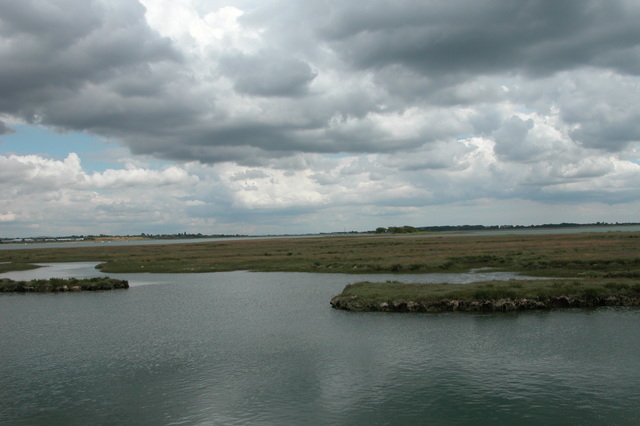
 North Binness Island at high tide in July 2005
North Binness Island is an island in Langstone Harbour[1] It is 900 metres (980 yd) long and up to 250 metres (270 yd) wide but only rises to 2.5 metres (8 ft) above Ordnance Datum[2] The island was originally (along with a large part of Farlington Marshes) part of Binner's Island.[3] The island has been uninhabited in recent times but there is evidence of historical occupation. A 100-metre (110 yd) long earthwork on the island has been suggested to date from the 18th century[2]. There is also archaeological evidence that suggests the island was occupied during the bronze age and the Roman period[2]. Finds from the bronze age include evidence of a salt works.[4] The Island and has also produced finds dating back to the Mesolithic period prior to the formation of Langstone Harbour and the island.[4]
The island was formerly home to a pond which is now filled with mud.[2]Plants on the island consist of salt-water grasses and a few trees.[2]
In 1978 the island along with the other islands in Langstone harbour was acquired by the Royal Society for the Protection of Birds who turned it into a bird sanctuary.[5] Since that time unauthorised landings have been forbidden.[5]
References
- ^ "Havant Borough Townscape, Landscape and Seascape Character Assessment February 2007" (PDF). Havant Borough Council. http://www.havant.gov.uk/PDF/LCASection5Hayling29to34.pdf. Retrieved 15 March 2011.
- ^ a b c d e Adam, Neil J; Momber, Gary (2000). "North Binness Island". In Allen, Michael J; Gardiner, Julie. Our Changing Coast a survey of the intertidal archaeology of Langstone Harbour Hampshire. York: Council for British Archaeology. pp. 91–97. ISBN 1902771141.
- ^ Fontana, Val; Fontana, Dominic (2000). "A brief historical survey". In Allen, Michael J; Gardiner, Julie. Our Changing Coast a survey of the intertidal archaeology of Langstone Harbour Hampshire. York: Council for British Archaeology. p. 82. ISBN 1902771141.
- ^ a b Young, Andrew; Trevarthen, Emma (2008). "The Aggregate Landscape of Hampshire Assessment of the Archaeological Resource" (PDF). Cornwall County Council. pp. 127–128. http://ads.ahds.ac.uk/catalogue/adsdata/arch-880-1/dissemination/pdf/Hampshire_report.pdf. Retrieved 15 March 2011.
- ^ a b Tweed, Ronald (2000). A History of Langstone Harbour and its environs in the County of Hampshire. Dido Publications. pp. 159–160. ISBN 0953331210.
Categories:- Geography of Hampshire
- Islands of England
Wikimedia Foundation. 2010.