- New Brunswick Route 540
-
Route 540 Route information Length: 54.8 km[1] (34.1 mi) Major junctions South end:  Route 122 in Graham Corner
 Route 555 near Richmond Corner
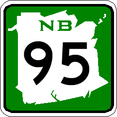
 Route 95 near Richmond Corner
North end:  Route 550 near Lindsay
Location Counties: York, Carleton Highway system Provincial highways in New Brunswick
Former routes← Route 535 Route 550 →Route 540 is a 54.8-kilometre (34.1 mi) long provincial highway located in western New Brunswick, Canada. The highway begins in Graham Corner at a junction with Route 122 and travels north to a terminus at Route 550 in Lindsay.
Route description
Route 540 begins in Graham Corner, near Eel River Lake, and travels north through rural woodlands in northern York County, passing through the community of Maxwell, and by Belle Lake. The highway continues north, into Carleton County and the community of Kirkland, where the woodlands give way to farmland. The highways first junction with another numbered highway occurs south of Richmond Corner, with Route 555, then just north of Richmond Corner with Route 95, which provides access to Maine and to Woodstock and the Trans-Canada Highway. Past Route 95, the highway continues though several small communities and rural farm land, before turning east near Oakville. The highway comes to an end in Lindsay at an intersection with Route 550.[1]
Major intersections
County Location km[1] Destinations Notes York Graham Corner 0.0  Route 122 to US 1 – Orient, Me, Canterbury
Southern terminus Carleton Richmond Corner 36.2 Route 555 – Irish Settlement, Woodstock37.4 
 Route 95 to I-95 / Route 2 (TCH) – Houlton, Me, Woodstock
Interchange Lindsay 54.8 Route 550 – Hartford, Tracey MillsNorthern terminus 1.000 mi = 1.609 km; 1.000 km = 0.621 mi References
- ^ a b c Google, Inc. Google Maps – Route 540 (Map). Cartography by Google, Inc. http://maps.google.com/maps?f=d&source=s_d&saddr=NB-540+S&daddr=NB-540+S&hl=en&geocode=Fcu1wQIdGfb2-w%3BFZZ5uwId6C73-w&gl=us&mra=dme&mrcr=0&mrsp=0&sz=16&sll=46.248799,-67.700243&sspn=0.004422,0.013797&ie=UTF8&ll=46.103709,-67.563171&spn=0.567499,1.766052&z=9. Retrieved December 22, 2010.
Categories:- New Brunswick provincial highways
- Roads in York County, New Brunswick
- Roads in Carleton County, New Brunswick
Wikimedia Foundation. 2010.