- Chastre
-
Chastre 
Flag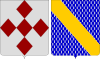
Coat of armsLocation in Belgium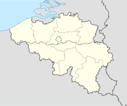
 Chastre
Coordinates: 50°36′N 04°38′E / 50.6°N 4.633°E Country Belgium Region Walloon Region Community French Community Province Walloon Brabant Arrondissement Nivelles Government - Mayor Claude Jossart - Governing party/ies ICR Area - Total 31.27 km2 (12.1 sq mi) Population (1 January 2010)[1] - Total 6,930 - Density 221.6/km2 (574/sq mi) Postal codes 1450 Area codes 010 Website www.chastre.be Map of Chastre
Chastre is a municipality located in the Belgian province of Walloon Brabant. On January 1, 2006 Chastre had a total population of 6,734. The total area is 31.27 km² which gives a population density of 215 inhabitants per km².
References
- ^ Population per municipality on 1 January 2010 (XLS; 221 KB)
External links
Local sites of political parties
- CDH - Centre Démocrate Humaniste - Section de Chastre
- ECOLO - Section de Chastre
- MR - Mouvement Réformateur - Section de Chastre
- PS - Parti Socialiste - Section de Chastre
Nivelles Beauvechain · Braine-l'Alleud · Braine-le-Château · Chastre · Chaumont-Gistoux · Court-Saint-Étienne · Genappe · Grez-Doiceau · Hélécine · Incourt · Ittre · Jodoigne · La Hulpe · Lasne · Mont-Saint-Guibert · Nivelles · Orp-Jauche · Ottignies-Louvain-la-Neuve · Perwez · Ramillies · Rebecq · Rixensart · Tubize · Villers-la-Ville · Walhain · Waterloo · Wavre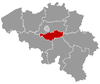 Categories:
- Municipalities of Walloon Brabant
- Belgium geography stubs


Wikimedia Foundation. 2010.