- Nagasaki Expressway
-
Nagasaki Expressway
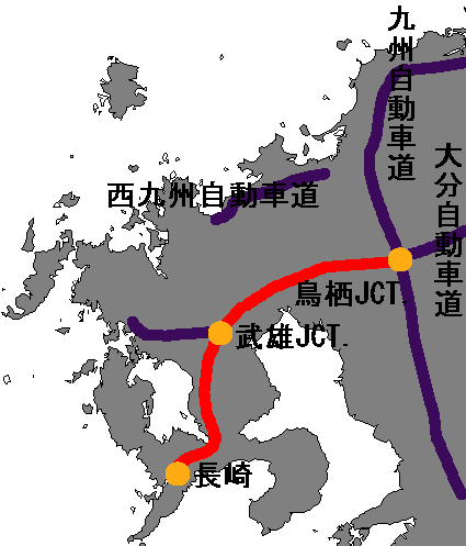
長崎自動車道 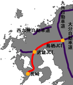
Route information Length: 120.4 km[1] (74.8 mi) Existed: 1973 – present Major junctions From: Tosu Junction in Tosu
 Kyushu Expressway
Ōita ExpresswayTo: Nagasaki Interchange in Nagasaki
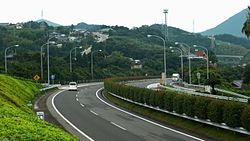
Nagasaki Dejima RoadLocation Major cities: Saga, Takeo, Omura, Isahaya Highway system Nagasaki Expressway (長崎自動車道 Nagasaki Jidōsha-dō) is one of the Expressways of Japan from Tosu to Nagasaki. It runs through the prefecture of Saga, and the southern half of the Nagasaki prefecture. The total length is 120.4 km.
Contents
History
- November 16, 1973, Tosu Interchange and Junction with the Kyushu Expressway to Nankan was open to traffic.
- November 17, 1982, a section from Nagasaki-Tarami to Omura Interchanges was opened to traffic.
- March 28, 1985, a section from Saga-Yamato to Tosu Interchanges was opened to traffic.
- February 5, 1987, the Tosu Junction in the east was opened.
- March 18, 1987, a section from Takeo-Kitagata to Saga-Yamato Interchanges was opened to traffic.
- January 26, 1990, a section from Omura to Takeo-Kitagata was opened to traffic which made the Nagasaki Expressway from Tosu to Nagasaki fully accessible with no gaps.
- January 26, 1990, the Takeo Junction was opened to traffic with another freeway.
- December 18, 1997, the tunnel from Higashisonogi to Ureshino Interchanges which made Nagasaki Expressway with four lanes.
- March 24, 2001, the Sagan Cross Bridge in the Tosu Junction was opened to traffic which made access to the bridge with the Kyushu Expressway.
- March 27, 2004, a section from Nagasaki to Nagasaki-Tarami Interchanges was opened with other freeway.
Interchanges
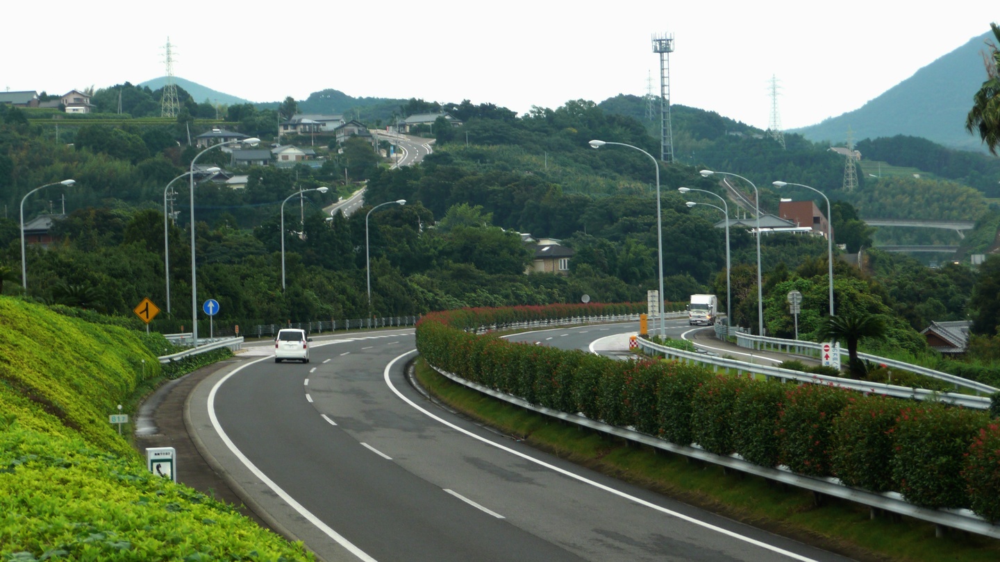
 Higashisonogi, Nagasaki, Japan
- 9 Tosu Junction with the Kyushu Expressway and with the Ōita Expressway
- 1 Tosu Interchange with routes 3 and Route 34
- Yamaura Parking Area
- 2 Higashisefuri Interchange with Route 385
- Kinryu Service Area
- 3 Saga-Yamato Interchange with Route 263
- Ogi Parking Area
- 4 Taku Interchange with Route 203
- Taku-Nishi Parking Area
- 5 Takeo-Kitagata Interchange with Route 34
- Kawanobori Service Area
- 6 Takeo Junction with the Nishi Kyushu Expressway
- 7 Ureshino Interchange
- 8 Higashisonogi Interchange with Route 34 and Route 205
- Omura-wan Parking Area
- 9 Omura Interchange with Route 444
- Koba Parking Area (Only accessible for Nagasaki)
- Imamura Parking Area (Only accessible for Fukuoka, Kumamoto and Oita)
- 10 Isahaya Interchange with Route 34
- 11 Nagasaki-Tarami Interchange with Nagasaki Bypass, a superhighway
- 12 Nagasaki-Susukizuka Interchange (Only entrance for Fukuoka, Kumamoto and Oita)
- 13 Nagasaki Interchange, with Nagasaki Dejima Road, a superhighway
Lanes
- 4-lane, Tosu Junction to Nagasaki-Tarami Interchanges
- 2-lane, Nagasaki-Tarami to Nagasaki Interchanges
References
- ^ Ministry of Land, Infrastructure and Transport, Kyushu Regional Development Bureau. "Road Timetable". http://www.qsr.mlit.go.jp/kyukan/roadtime/kyusyu-do.html. Retrieved 2008-08-31.
Categories:- Expressways in Japan
- Kyūshū region

Wikimedia Foundation. 2010.