- Modrá Hůrka
-
Modrá Hůrka — Municipality — 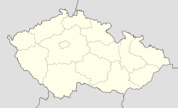
 Modrá Hůrka
Coordinates: 49°10′49″N 14°31′34″E / 49.18028°N 14.52611°ECoordinates: 49°10′49″N 14°31′34″E / 49.18028°N 14.52611°E Country  Czech Republic
Region South Bohemian District České Budějovice Area – Total 3.95 km2 (1.5 sq mi) Elevation 513 m (1,683 ft) Population (2006) – Total 74 – Density 18.7/km2 (48.5/sq mi) Postal code 373 66 Modrá Hůrka is a village and municipality (obec) in České Budějovice District in the South Bohemian Region of the Czech Republic.
The municipality covers an area of 3.95 square kilometres (1.53 sq mi), and has a population of 74 (as at 3 July 2006).
Modrá Hůrka lies approximately 24 kilometres (15 mi) north of České Budějovice and 101 km (63 mi) south of Prague.
References
Towns, městyse and villages of České Budějovice District Adamov · Bečice · Borek · Borovany · Borovnice · Boršov nad Vltavou · Bošilec · Branišov · Břehov · Čakov · Čejkovice · Čenkov u Bechyně · České Budějovice · Chotýčany · Chrášťany · Čížkrajice · Dasný · Dívčice · Dobrá Voda u Českých Budějovic · Dobšice · Dolní Bukovsko · Doubravice · Doudleby · Drahotěšice · Dražíč · Dříteň · Dubičné · Dubné · Dynín · Habří · Hartmanice · Heřmaň · Hlavatce · Hlincová Hora · Hluboká nad Vltavou · Homole · Horní Kněžeklady · Horní Stropnice · Hosín · Hosty · Hradce · Hranice · Hrdějovice · Hůry · Hvozdec · Jankov · Jílovice · Jivno · Kamenná · Kamenný Újezd · Komařice · Kvítkovice · Ledenice · Libín · Libníč · Lipí · Lišov · Litvínovice · Ločenice · Mazelov · Mladošovice · Modrá Hůrka · Mokrý Lom · Mydlovary · Nákří · Nedabyle · Neplachov · Nová Ves · Nové Hrady · Olešnice · Olešník · Ostrolovský Újezd · Petříkov · Pištín · Planá · Plav · Radošovice · Římov · Roudné · Rudolfov · Sedlec · Ševětín · Slavče · Srubec · Staré Hodějovice · Štěpánovice · Strážkovice · Strýčice · Střížov · Svatý Jan nad Malší · Temelín · Trhové Sviny · Týn nad Vltavou · Úsilné · Včelná · Vidov · Vitín · Vlkov · Vrábče · Vráto · Všemyslice · Žabovřesky · Záboří · Zahájí · Žár · Závraty · Žimutice · Zliv · Zvíkov
This South Bohemian Region location article is a stub. You can help Wikipedia by expanding it.
