- Miller Woods
-
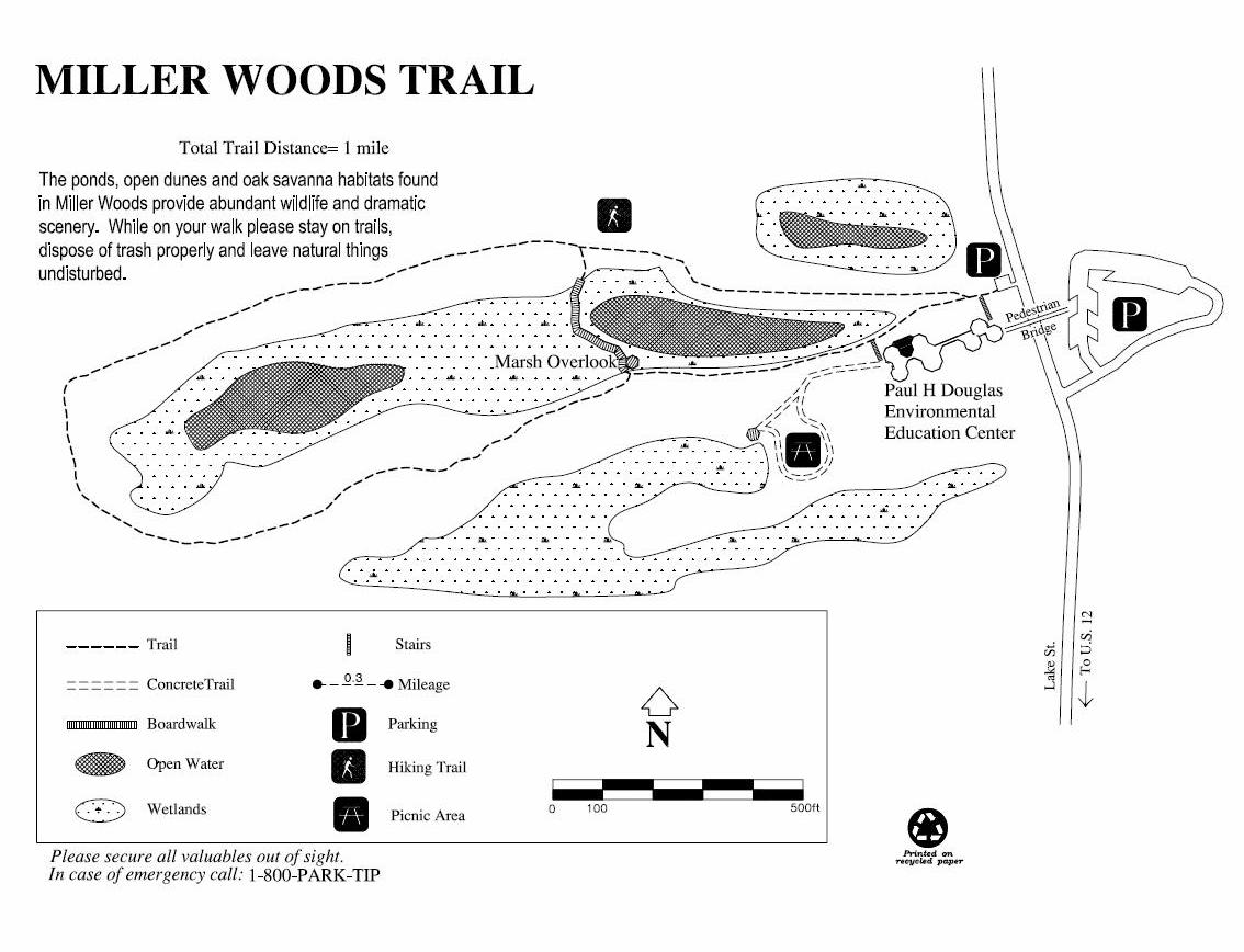
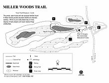 Map of the public trails at Miller Woods
Miller Woods is an area in the far western part of the Indiana Dunes National Lakeshore, in Gary, Indiana, in and near the neighborhood of Miller Beach, and south and west of the Gary Works steel mill. The area is home to the federally endangered Karner Blue butterfly and the federally threatened Pitcher's thistle.[1] Miller Woods is the only part of the National Lakeshore that also adjoins the Grand Calumet River.
The northern part of Miller Woods adjoins Lake Michigan, and includes foredunes and high dunes, as well as blowouts and pannes. The southern and larger part of Miller Woods consists of rolling dune and swale, with dune ridges dominated by oak savanna. This southern part is also traversed by current and former rail lines. The northern and southern parts are divided by the Grand Calumet River, including the westernmost of the three lagoons that mark river's the modern-day headwaters and former mouth.
Contents
History
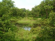 An interdunal swale in the southern part of Miller Woods
Miller Woods was the site of some of Henry Chandler Cowles' earliest observations on ecological succession in the late 19th century.[2] Subsequently, it was acquired by US Steel for industrial use, and a number of railroads and spur lines were laid through the area. This had an unintended beneficial impact for the local oak savanna ecology; the sparks thrown off by passing trains maintained the fire cycle that was suppressed in most other parts of the Indiana Dunes during the 20th century.
The area was acquired by the National Park Service through an expansion bill passed in 1976.[3] The bill was passed in honor of Senator Paul Douglas, who was then on his deathbed, and the Douglas name was applied to the large environmental education center that now stands at the entrance to Miller Woods.
Flora and fauna
Miller Woods is home to at least 287 species of animals and plants.[2] Among them are several species found nowhere else in the National Lakeshore, including the fame flower.[4] The area is known for its brilliant displays of wildflowers such as columbine and trailing arbutus.
- Mammals
- Virginia opossum
- short-tailed shrew
- masked shrew
- eastern mole
- cottontail rabbit
- white-footed mouse
- prairie deer mouse
- meadow vole
- muskrat
- fox squirrel
- gray squirrel
- thirteen-lined ground squirrel
- red squirrel
- raccoon
- long-tailed weasel
- white-tailed deer
- coyote
- beaver
Works cited
- City of Gary (2008). City of Gary, Indiana Comprehensive Plan. http://www.csu.edu/cerc/researchreports/documents/GaryIndianaComprehensivePlanDraft2008.pdf.
- Engel, Ronald (1986). Sacred Sands: The Struggle for Community in the Indiana Dunes. ISBN 0819561290.
- Greenberg, Joel R. (2002). A natural history of the Chicago Region. ISBN 0226306488.
- Whitaker, John O. (1999). "Mammals of the Grand Calumet River region". Proceedings of the Indiana Academy of Science 108/109: 122–144. http://www.indianaacademyofscience.org/Documents/Proceedings/V108-109/PIAS_v108_v109_p122-144.aspx.
References
- ^ City of Gary 2008, p. 74.
- ^ a b Madison, Michael (2000 Fall). "Into the Wild: Miller Woods". Chicago Wilderness. http://www.chicagowildernessmag.org/issues/fall2000/IWmillerwoods.html.
- ^ Engel 1986, p. 283.
- ^ Greenberg 2002, p. 249.
See also
- Indiana Dunes National Lakeshore
- Long Lake (Indiana)
External links
Categories:

Wikimedia Foundation. 2010.