- Mettauertal
-
Mettauertal Country Switzerland 
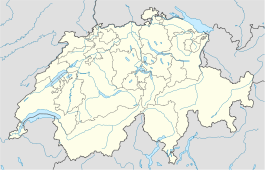
Canton Aargau District Laufenburg 47°34′N 8°9′E / 47.567°N 8.15°ECoordinates: 47°34′N 8°9′E / 47.567°N 8.15°E Population 1,931 (Dec 2010)[1] - Density 90 /km2 (232 /sq mi) Area 21.59 km2 (8.34 sq mi)[2] Elevation 381 m (1,250 ft) Postal code 5276 SFOS number 4184 Surrounded by Gansingen, Hottwil, Leibstadt, Leuggern, Mandach, Mettau, Oberhofen, Schwaderloch Website www.wil-ag.ch
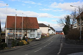
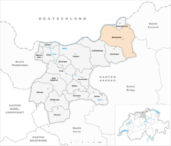
SFSO statisticsMettauertal is a municipality in the district of Laufenburg in the canton of Aargau in Switzerland. On 1 January 2010 the municipalities of Hottwil, Etzgen, Mettau, Oberhofen and Wil merged into the municipality of Mettauertal.[3]
References
- ^ Canton of Aargau Statistical Office, MS Excel document – Bevölkerungsbestand per 31.12.2010 nach Gemeinde, Geschlecht u. Nationalität (German) accessed 11 May 2011
- ^ Arealstatistik Standard - Gemeindedaten nach 4 Hauptbereichen
- ^ Amtliches Gemeindeverzeichnis der Schweiz, Mutationsmeldungen 2009 / Répertoire officiel des communes de Suisse, Mutations 2009 / Elenco ufficiale dei Comuni della Svizzera, Mutazione 2009 (Report). Federal Statistical Office. 2009. 3170. http://www.bfs.admin.ch/bfs/portal/de/index/infothek/nomenklaturen/blank/blank/gem_liste/03.Document.128095.pdf. Retrieved 6 March 2010.
Eiken | Frick | Gansingen | Gipf-Oberfrick | Herznach | Hornussen | Kaisten | Laufenburg | Mettauertal | Münchwilen | Oberhof | Oeschgen | Schwaderloch | Sisseln | Ueken | Wittnau | Wölflinswil | Zeihen
Aargau | Districts of Canton Aargau | Municipalities of the canton of Aargau
 Categories:
- Municipalities of Aargau
- Municipalities of Switzerland
- Switzerland geography stubs
Wikimedia Foundation. 2010.


