- Matemanga
-
Matemanga — Village and ward — Location in Tanzania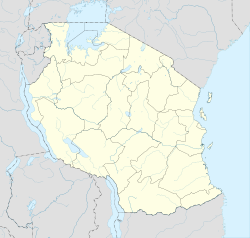
 Matemanga
Coordinates: 10°45′S 37°0′E / 10.75°S 37°E Country  Tanzania
Region Ruvuma Region District Tunduru Time zone EAT (UTC+3) Matemanga is a village and ward in the Ruvuma Region of southern-central Tanzania. It is located along the A19 road, to the northwest of Tabora.[1]
References
- ^ Google. Google Maps (Map).
External links
Categories:- Populated places in the Ruvuma Region
- Wards of Tanzania
- Tanzania geography stubs

Wikimedia Foundation. 2010.