- Marj Al-hamam
-
Marj Al-hamam
الأسم القديم (مرج سكا)
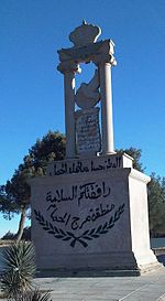
مرج الحمام— District within Greater Amman Municipality (GAM) — The Eastern Entrance of the District 
Flag
SealNickname(s): The Meadow of doves Coordinates: 31°57′N 35°49′E / 31.95°N 35.817°E Country  Jordan
Governorate Amman Governorate Government - Greater Municipalities of Amman's Mayor Omar Mâani Area - Total 53 km2 (20.5 sq mi) Elevation 850-1,070 m (2,952-4,265 ft) Time zone UTC+2 (UTC+2) - Summer (DST) UTC+3 (UTC+3) Area code(s) 06 Website http://www.ammancity.gov.jo/en/gam/index.asp Marj Al-hamam (Arabic: مرج الحمام) Literally "Meadow of Doves" in arabic language, is the District No. (27) of Metropolitan Amman – Greater Amman Municipality (GAM); it is situated to the western part of GAM. It comprises 16 neighborhoods and population gatherings (Circassians neighborhood, Alia Housing, Officers Housing,..); it is 53 Km2 of space; its population counts for 50000 capita. Its zoning borders include Naur, Mqabalein, and Wadi EsSeer.[1] It is situated approximately 15 kilometres (9 mi) south of the country's capital, Amman. Since 2007, it has been part of the Greater Amman Municipality.[2][3]
References
- ^ http://www.ammancity.gov.jo/en/interactive/districts.asp?dist_id=31&sub_id=7
- ^ "4th phase of Amman Master Plan to be announced Wednesday". Zawya.com. Jordan Times. 2007-10-19. http://www.zawya.com/printstory.cfm?storyid=ZAWYA20071019065134&l=065100071019. Retrieved 2009-08-21.
- ^ "Amman International Fair Hall - Marj Al-Hamam". Amman Trade Point. 2004. http://www.atp.jedco.gov.jo/aiehall.html. Retrieved 2009-08-21.
Categories:- Populated places in Jordan
- Jordan geography stubs
Wikimedia Foundation. 2010.

