- Köhlbrandbrücke
The Köhlbrandbrücke is a
cable-stayed bridge in the Wilhelmsburg quarter ofHamburg ,Germany which connects the harbour area between the Norderelbe and Süderelbe branches of theElbe river with motorway 7 (exit Waltershof). It bridges theKöhlbrand , which is part of the Süderelbe branch. It was opened on9 September 1974 .Infobox Bridge
bridge_name = Köhlbrandtbrücke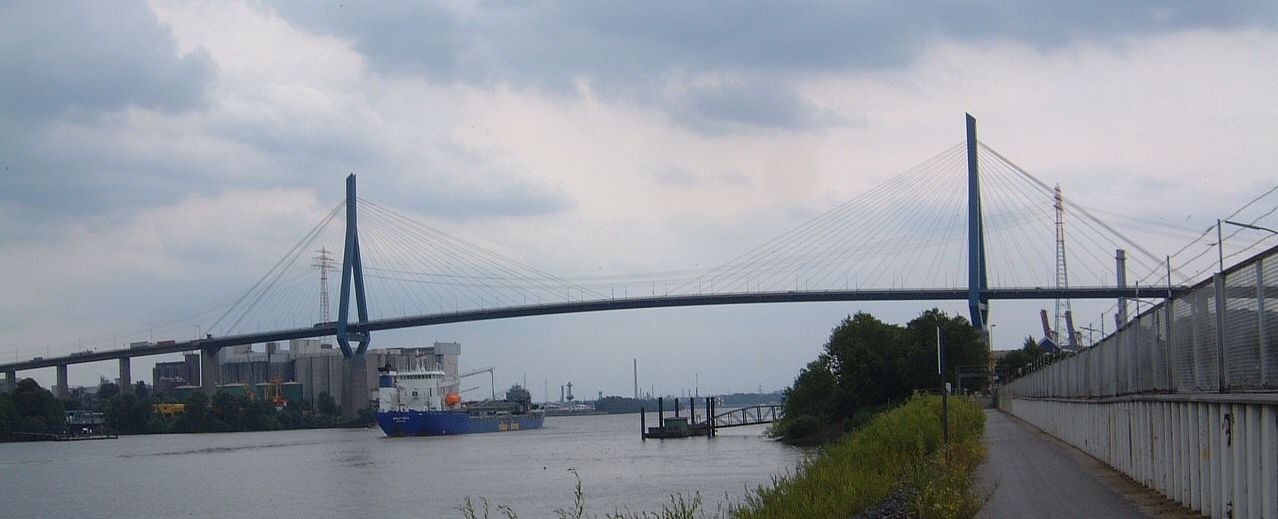
caption = Köhlbrandtbrücke in theport of Hamburg
official_name =
carries = Cars
crosses = Köhlbrandt, part of the river Süderelbe
locale = Hamburg, Germany
maint =
id =
design = Cable-stayed bridge
mainspan = 325 m
length = 3,618 m
width = 17,5 m
height = 135 m
load =
clearance = 53 m
below = 135 m above middle tiede
traffic = 30,000 cars
begin = 1970
complete = 1974
open = September 20, 1974
closed = approx 2028 [ [http://www.welt.de/hamburg/article1531878/Koehlbrandbruecke_wird_in_20_Jahren_abgerissen.html Die Welt vom 8. Januar 2008] (in German)]
toll = free
map_cue =
map_
map_text =
map_width =
coordinates =
lat =
long =History
The bridge was designed by
Hans Wittfoht andEgon Jux . It took 4 years to build it.Since its opening the bridge has only twice been open to pedestrians, on the opening day 1974 and on its 30th birthday in 2004. The magnificent view over the city of Hamburg is however not completely limited to the drivers of cars and trucks. The bridge is on route of Hamburg's yearly
UCI ProTour bicycle raceVattenfall Cyclassics . Quite a number of the amateurs participating in this race make a stop on top of the Köhlbrandbrücke.Several people have committed suicide by jumping from the Köhlbrandbrücke.
Technical data
The bridge is made from about convert|81000|m3|0 of concrete and convert|12700|Mg|0|lk=on of steel. Each day, about 30,000 cars pass over the bridge. Its total cost being 160 million DM.
The bridge is made of 88 steel cables (each of a diameter of convert|10|cm|0). It is convert|3940|m|0 long, the centre piece convert|325|m|0|abbr=on. It is carried by 75 pylons (the highest one of height convert|135|m|0|abbr=on) and reaches a height of convert|55|m|0 to allow ships pass underneath it, even at high tide. The road has an inclination of 4%.
References
External links
*
LongestBridge
type = cable-stayed
start = 1974
end = 1991
previous = Duisburg-Neuenkamp Bridge
current = Köhlbrandbrücke
next = Skarnsund Bridge
Wikimedia Foundation. 2010.