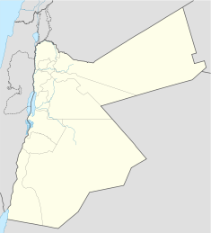
- Al Wahda Dam
-
Al Wahdah Dam Location of Al Wahdah Dam Location Syria/Jordan Coordinates 32°44′02″N 35°52′18″E / 32.73389°N 35.87167°ECoordinates: 32°44′02″N 35°52′18″E / 32.73389°N 35.87167°E Construction began 2004 Opening date 2011 Dam and spillways Type of dam Roller-compacted concrete Height 110 m (360 ft) Length 485 m (1,591 ft) Volume 1,480,000 m3 (52,000,000 cu ft) Impounds Yarmouk River Spillway capacity 8,000 m3/s (280,000 cu ft/s) Reservoir Capacity 115,000,000 m3 (93,000 acre·ft) For the dam in Morocco, see Al Wahda Dam (Morocco).The Al Wahda Dam (سد الوحدة, Sadd al-Waḥda, Unity Dam), formerly known as Maqarin Dam, is a 110 m (360 ft) roller-compacted concrete gravity dam on the Yarmouk River on the border between Syria and Jordan.[1] It can hold up to 115,000,000 m3 (93,000 acre·ft) of water and is designed to provide Jordan with water for both human consumption and agriculture, while boosting power supplies to Syria. Construction has been funded by the Arab Fund for Economic and Social Development (80%), the Abu Dhabi Development Fund (10%) and the Government of Jordan (10%). In February 2004 King Abdullah II of Jordan and Syrian President Bashar al-Assad launched the construction of the dam. Turkey's Ozaltin Company constructed 60 per cent of the dam, while the remaining 40 per cent were carried out by Marwan Alkurdi Company and the National Company for Roads and Bridges.[2]
The sharing of the waters of the Yarmouk River between the two countries is governed by a 1987 treaty that set up a Jordanian-Syrian Yarmouk River Basin Higher Committee.
References
- ^ "Al-Wehdah Dam - Jordan". Özaltın İnşaat. http://www.ozaltin.com.tr/. Retrieved 16 October 2010.
- ^ Two leaders launch Al Wihdeh Dam, Jordan Times, 10 February 2004
Categories:- Dams in Syria
- Jordan River basin
- Dams in Jordan
Wikimedia Foundation. 2010.

