Manafwa

Manafwa
Manafwa
Manafwa is located in Uganda
Manafwa
Map of Uganda showing the location of Manafwa.
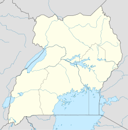
Coordinates: 01°01′19″N 34°22′30″E / 1.02194°N 34.375°E / 1.02194; 34.375
Country  Uganda
District Manafwa District
Elevation 1,370 m (4,495 ft)
Population (2011 Estimate)
 - Total 15,800
Time zone EAT (UTC+3)

Manafwa is a town in Eastern Uganda. It is the largest town in Manafwa District and the district headquarters are located there. The district is named after the town.

Contents

Location

Manafwa is located approximately 26 kilometres (16 mi), by road, southeast of the city of Mbale, the largest metropolitan area in the sub-region.[1] The coordinates of the town are: 01 01 19N, 34 22 30E (Latitude:1.0220; Longitude:34.3750).

Overview

Manafwa is the location of the district headquarters of Manafwa District. The town is a sister city to the town of Åmål, Sweden. Manafwa is located within Mount Elgon National Park. The town is surrounded by tropical mountainous terrain, at an altitude of approximately 1,400 metres (4,600 ft), above sea level.

Population

The Uganda Bureau of Statistics(UBOS), estimated the population of the town at 14,300 in 2008.[2] In 2011, UBOS estimated the mid-year population of Manafwa at approximately 15,800.[3]

Landmarks

The landmarks within the town limits or near the edges of town include:

External links

See also

References

Coordinates: 01°01′19″N 34°22′30″E / 1.02194°N 34.375°E / 1.02194; 34.375


Wikimedia Foundation. 2010.

Игры ⚽ Поможем написать реферат

Look at other dictionaries:

  • Manafwa — Original name in latin Manafwa Name in other language Manafwa State code UG Continent/City Africa/Kampala longitude 0.97842 latitude 34.3743 altitude 1826 Population 0 Date 2012 05 07 …   Cities with a population over 1000 database

  • Manafwa District —   District   District location in Uganda District location in Uganda Coordinates …   Wikipedia

  • Manafwa District — Admin ASC 2 Code Orig. name Manafwa District Country and Admin Code UG.E.D6 UG …   World countries Adminstrative division ASC I-II

  • Distrito de Manafwa — Saltar a navegación, búsqueda El distrito se encuentra en el este de Uganda, sector pintado con naranja El Distrito de Manafwa se localiza al este de Uganda. Es uno de los distritos menos extensos de este país. Como otros distritos ugandeses, su… …   Wikipedia Español

  • Mbale District —   District   District location in Uganda …   Wikipedia

  • Districts of Uganda — Uganda is divided into 111 districts and one city (the capital city of Kampala)[1] across four administrative regions. Most districts are named after their main commercial and administrative towns. Each district is further divided into counties… …   Wikipedia

  • Bamasaba — The Bamasaaba are a Bantu people inhabiting the Eastern Ugandan districts of Sironko, Manafwa, Manjiya and Mbale. Closely related to the Bukusu of Western Kenya, they are a mainly agricultural people, farming millet, bananas and sorghum on small… …   Wikipedia

  • Counties of Uganda — Uganda …   Wikipedia

  • Masaba people — The Masaba people, or Bamasaaba, are a Bantu people inhabiting the Eastern Ugandan districts of Sironko, Manafwa, Bududa, Mbale, Bulambuli, Kapchorwa, Bukwo and Kween (Then Sebei County before Uganda achieved self rule in 1962) under the Bugisu… …   Wikipedia

  • Восточная область (Уганда) — Области (регионы) Уганды: зелёным  Восточная, красным  Центральная, жёлтым  Северная, синим  Западная области Восточная область (Восточный регион, Eastern Region)  административная область (регион) Уганды, состояща …   Википедия

Share the article and excerpts

Direct link
Do a right-click on the link above
and select “Copy Link”