- Mahamadpur, Narayani
-
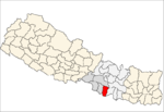
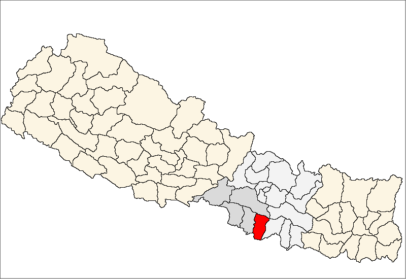
Mahamadpur — Village development committee — Location in Nepal
 Mahamadpur
Coordinates: 26°57′N 85°19′E / 26.95°N 85.31°ECoordinates: 26°57′N 85°19′E / 26.95°N 85.31°E Country  Nepal
NepalZone Narayani Zone District Rautahat District Population (1991) - Total 4,690 Time zone Nepal Time (UTC+5:45) Mahamadpur is a village development committee in Rautahat District in the Narayani Zone of south-eastern Nepal. At the time of the 1991 Nepal census it had a population of 4690 people living in 812 individual households.[1]
References
- ^ "Nepal Census 2001". Nepal's Village Development Committees. Digital Himalaya. http://www.digitalhimalaya.com/collections/nepalcensus/form.php?selection=1. Retrieved 25 November 2008.
Ajagabi · Akolawa · Auraiya · Badharwa · Bagahi · Bahuwa Madanpur · Bairiya · Banjaraha · Bariyarpur · Basantapatti · Basatpur · Basbiti Jingadiya · Bhalohiya · Bhediyahi · Birtipraskota · Bishrampur · Bisunpurwa Manpur · Brahmapuri · Chandranigahapur · Debahi · Dharampur · Dharhari · Dipahi · Dumriya · Dumriyachaur · Fatuha Maheshpur · Fatuwa Harsaha · Gadhi · Gamhariya Birta · Gamhariya Parsa · Gangapipra · Garuda Bairiya · Gedahiguthi · Gunahi · Hajminiya · Hardiya Paltuwa · Harsaha · Hathiyahi · Inarbari Jyutahi · Inaruwa · Jatahare · Jayanagar · Jethrahiya · Jhunkhunma · Jingadawa Belbichhwa · Jingadiya · Jowaha · Judibela · Kakanpur · Karkach Karmaiya · Karuniya · Katahariya · Khesarhiya · Laxminiya · Laxmipur · Laxmipur Belbichhawa · Lokaha · Madanpur · Madhopur · Mahamadpur · Malahi · Maryadpur · Masedawa · Mathiya · Matsari · Mithuawa · Mudwalawa · Narkatiya Guthi · Pacharukhi · Pataura · Pathara Budharampur · Paurai · Pipariya · Pipra Bhagwanpur · Pipra Pokhariya · Pipra Rajbara · Pothiyahi · Pratappur Paltuwa · Prempur Gunahi · Purainawma · Raghunathpur · Rajdevi · Rajpur Farhadawa · Rajpur Tulsi · Ramoli Bairiya · Rampur Khap · Rangapur · Sakhuwa · Sakhuwa Dhamaura · Samanpur · Sangrampur · Santapur · Santpur · Sarmujawa · Saruatha · Saunaraniya · Sawagada · Shitalpur Bairgania · Simara Bhawanipur · Sirsiya · Tejapakar · Tengraha · Tikuliya
 Categories:
- Populated places in Rautahat District
- Narayani Zone geography stubs

Wikimedia Foundation. 2010.