- Dolní Dubňany
-
Dolní Dubňany — Municipality — 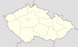
 Dolní Dubňany
Coordinates: 49°3′25″N 16°13′28″E / 49.05694°N 16.22444°ECoordinates: 49°3′25″N 16°13′28″E / 49.05694°N 16.22444°E Country  Czech Republic
Region South Moravian District Znojmo Area – Total 8.12 km2 (3.1 sq mi) Elevation 309 m (1,014 ft) Population (2006) – Total 465 – Density 57.3/km2 (148.3/sq mi) Postal code 671 73 Dolní Dubňany is a village and municipality (obec) in Znojmo District in the South Moravian Region of the Czech Republic.
The municipality covers an area of 8.12 square kilometres (3.14 sq mi), and has a population of 465 (as at 3 July 2006).
Dolní Dubňany lies approximately 27 kilometres (17 mi) north-east of Znojmo, 33 km (21 mi) south-west of Brno, and 174 km (108 mi) south-east of Prague.
References
Towns, městyse and villages of Znojmo District Bantice • Běhařovice • Bezkov • Bítov • Blanné • Blížkovice • Bohutice • Bojanovice • Borotice • Boskovštejn • Božice • Břežany • Čejkovice • Čermákovice • Černín • Chvalatice • Chvalovice • Citonice • Ctidružice • Damnice • Dobelice • Dobřínsko • Dobšice • Dolenice • Dolní Dubňany • Dyjákovice • Dyjákovičky • Dyje • Džbánice • Grešlové Mýto • Havraníky • Hevlín • Hluboké Mašůvky • Hnanice • Hodonice • Horní Břečkov • Horní Dubňany • Horní Dunajovice • Horní Kounice • Hostěradice • Hostim • Hrabětice • Hrádek • Hrušovany nad Jevišovkou • Jamolice • Jaroslavice • Jevišovice • Jezeřany-Maršovice • Jiřice u Miroslavi • Jiřice u Moravských Budějovic • Kadov • Korolupy • Kravsko • Křepice • Krhovice • Křídlůvky • Kubšice • Kuchařovice • Kyjovice • Lančov • Lechovice • Lesná • Lesonice • Litobratřice • Lubnice • Lukov • Mackovice • Mašovice • Medlice • Mikulovice • Milíčovice • Miroslav • Miroslavské Knínice • Morašice • Moravský Krumlov • Našiměřice • Němčičky • Nový Šaldorf-Sedlešovice • Olbramkostel • Olbramovice • Oleksovice • Onšov • Oslnovice • Pavlice • Petrovice • Plaveč • Plenkovice • Podhradí nad Dyjí • Podmolí • Podmyče • Práče • Pravice • Přeskače • Prokopov • Prosiměřice • Rešice • Rozkoš • Rudlice • Rybníky • Šafov • Šanov • Šatov • Skalice • Slatina • Slup • Stálky • Starý Petřín • Štítary • Stošíkovice na Louce • Strachotice • Střelice • Suchohrdly • Suchohrdly u Miroslavi • Šumná • Tasovice • Tavíkovice • Těšetice • Trnové Pole • Trstěnice • Tulešice • Tvořihráz • Uherčice • Újezd • Únanov • Valtrovice • Vedrovice • Velký Karlov • Vémyslice • Vevčice • Višňové • Vítonice • Vracovice • Vranov nad Dyjí • Vranovská Ves • Vratěnín • Vrbovec • Výrovice • Vysočany • Zálesí • Zblovice • Želetice • Žerotice • Žerůtky • Znojmo
This South Moravian Region location article is a stub. You can help Wikipedia by expanding it.
