- Dlouhá Lhota (Tábor District)
-
Dlouhá Lhota — Municipality — 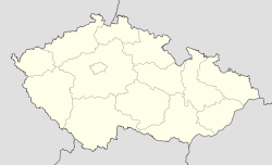
 Dlouhá Lhota
Coordinates: 49°21′6″N 14°47′21″E / 49.35167°N 14.78917°ECoordinates: 49°21′6″N 14°47′21″E / 49.35167°N 14.78917°E Country  Czech Republic
Region South Bohemian District Tábor Area – Total 4.43 km2 (1.7 sq mi) Elevation 455 m (1,493 ft) Population (2006) – Total 177 – Density 40/km2 (103.5/sq mi) Postal code 391 21 Dlouhá Lhota is a village and municipality (obec) in Tábor District in the South Bohemian Region of the Czech Republic.
The municipality covers an area of 4.43 square kilometres (1.71 sq mi), and has a population of 177 (as at 28 August 2006).
Dlouhá Lhota lies approximately 12 kilometres (7 mi) south-east of Tábor, 48 km (30 mi) north-east of České Budějovice, and 86 km (53 mi) south of Prague.
References
Towns, městyse and villages of Tábor District Balkova Lhota • Bechyně • Bečice • Běleč • Borkovice • Borotín • Bradáčov • Březnice • Budislav • Černýšovice • Chotěmice • Chotoviny • Choustník • Chrbonín • Chýnov • Dírná • Dlouhá Lhota • Dobronice u Bechyně • Dolní Hořice • Dolní Hrachovice • Dráchov • Drahov • Dražice • Dražičky • Drhovice • Haškovcova Lhota • Hlasivo • Hlavatce • Hodětín • Hodonice • Jedlany • Jistebnice • Katov • Klenovice • Komárov • Košice • Košín • Krátošice • Krtov • Libějice • Lom • Malšice • Mažice • Meziříčí • Mezná • Mladá Vožice • Mlýny • Myslkovice • Nadějkov • Nasavrky • Nemyšl • Nová Ves u Chýnova • Nová Ves u Mladé Vožice • Oldřichov • Opařany • Planá nad Lužnicí • Pohnánec • Pohnání • Pojbuky • Přehořov • Psárov • Radenín • Radimovice u Tábora • Radimovice u Želče • Radkov • Rataje • Ratibořské Hory • Řemíčov • Řepeč • Řípec • Rodná • Roudná • Šebířov • Sedlečko u Soběslavě • Sezimovo Ústí • Skalice • Skopytce • Skrýchov u Malšic • Slapsko • Slapy • Smilovy Hory • Soběslav • Stádlec • Sudoměřice u Bechyně • Sudoměřice u Tábora • Sviny • Svrabov • Tábor • Třebějice • Tučapy • Turovec • Ústrašice • Val • Vesce • Veselí nad Lužnicí • Vilice • Vlastiboř • Vlčeves • Vlkov • Vodice • Zadní Střítež • Záhoří • Zálší • Želeč • Zhoř u Mladé Vožice • Zhoř u Tábora • Žíšov • Zlukov • Zvěrotice
This South Bohemian Region location article is a stub. You can help Wikipedia by expanding it.
