- Dippen, Argyll and Bute
-
Coordinates: 55°34′16″N 5°29′25″W / 55.57111°N 5.49028°W
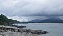 Shoreline at the south of Dippen Bay
Dippen (Scottish Gaelic: Duipinn) is a hamlet on the east coast of the Kintyre Peninsula in Scotland. The community of Dippen is in close proximity to Dippen Bay. Roads on the east coast of Kintyre were greatly improved in the era circa 1776, when the settlement was known as Duppin.[1]
See also
- Torrisdale Bay
Notes
- ^ Taylor and Skinner. 1776
References
- Taylor and Skinner. 1776. Road Map of Kintyre Road - Including Droving and Coach Notes
Categories:- Villages in Argyll and Bute
- Scotland geography stubs

Wikimedia Foundation. 2010.