- Culbin Sands, Forest and Findhorn Bay
-
Culbin Sands, Forest and Findhorn Bay is a huge area of coast and countryside and an SSSI in Moray, Scotland, stretching from just east of the town of Nairn eastwards to the village of Findhorn and its bay. All of the areas are very important for wildlife in general and are strongly protected by law.
Contents
Culbin Forest
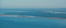 The eastern end of the Culbin Forest from the north west with the Moray Firth in the foreground and Burghead Bay and Findhorn Bay beyond
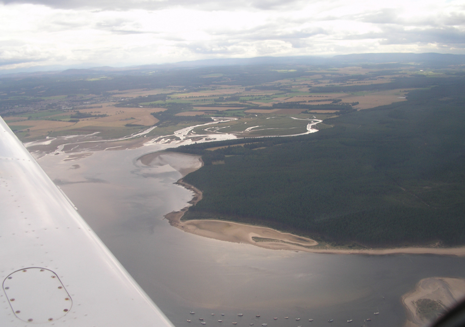
This huge forest is almost completely owned by the Forestry Commission[1], who go to great lengths to maintain a perfect ecosystem. It is split by several large paths and smaller tracks in between. The densely covered areas off these paths are difficult to traverse. Most walks are taken beginning at the south of the forest at Wellhill Car Park[2] and ending at the beach. Among the trees there are several strange monoliths bearing messages, and at one tree there is a small plaque commemorating its planting by Prince Charles. Although mostly made up of tall pines and coarse ground cover, Culbin also has many more open, sandy patches in the forest, where small younger trees have recently been planted. The grassland areas are very suitable for butterflies. There are several ponds which act as oases to the local animals. Hill 99, a towering wooden structure which blends in subtly with the canopy, provides an excellent viewpoint. The wildlife amongst the trees is very discreet although birds can clearly be heard singing everywhere.
Culbin Sands
Nowadays the name "Culbin Sands" means a beach, but formerly the name meant a large area of loose dune sand desert which is now the Culbin Forest.
This long strip of pristine beach is owned by the RSPB[3], due to its excellent bird habitat, home to Eurasian Oystercatchers, Eurasian Curlews, Common Redshanks and other birds. It is made up of a curious mixture of sand and long grass, but gets muddier further westwards. A lot of natural driftwood such as logs and shells ends up on the sands. The bank of dunes separates the forest quite suddenly from the flat beach.
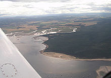
Findhorn Bay
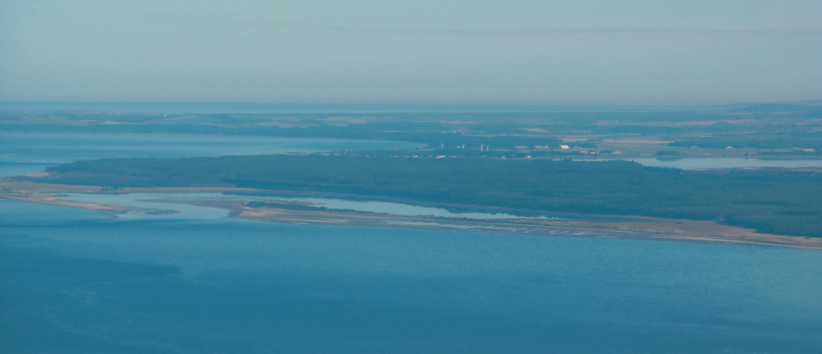
 Aerial photo of Findhorn Bay, with the east end of the Culbin Forest at right and the estuary of the River Findhorn at centre.
The forest meets the bay at a very steep dune and this bay is home on the east side to the village of Findhorn. Findhorn Beach is much stonier right by the coast and further out to sea a strip of sand, often separated from the mainland by the Moray Firth, is home to a colony of grey seals. Common Eiders often come and sit by them and European Herring Gulls fly around the general area.
History
Formerly the area which is now the Culbin Forest was loose blowing sand dunes, called the Culbin Sands. The area had been fertile farmland, but was gradually covered in loose sand, particularly during a windstorm in 1694. The area remained largely dune desert for two centuries, sometimes referred to as "Scotland's Sahara". In the 20th century the Forestry Commission planted the area with forest. [4] [5] [6] [7] [8]
Notes
- ^ http://www.forestry.gov.uk/culbin
- ^ http://www.forestry.gov.uk/website/recreation.nsf/LUWebDocsByKey/ScotlandMorayMorayForestsCulbinWellhillCarPark
- ^ http://www.rspb.org.uk/reserves/guide/c/culbinsands/
- ^ http://www.morayfirth-partnership.org/mfptreasure/infozone/64.htm The Moray First Infozone: 64. CULBIN SANDS
- ^ http://www.kinnaird.net/culsands.htm THE CULBIN SANDS
- ^ http://www.abandonedcommunities.co.uk/shiftingsands5.html Abandoned Communities ..... Shifting Sands, part 5
- ^ http://walking.visitscotland.com/walks/nescotland/culbin_forest Walking Scotland: Culbin Forest
- ^ http://www.bbc.co.uk/programmes/b00w163m BBC Radio Scotland radio feature "Walking Through Landscape", Episode 5, on Culbin Forest and Sands
External links
Categories:- Sites of Special Scientific Interest in Moray and Nairn
- Estuaries of Scotland
Wikimedia Foundation. 2010.